
Cycling in Scottsdale
Discover a map of 402 cycling routes and bike trails near Scottsdale, created by our community.
Region portrait
Get to know Scottsdale
Find the right bike route for you through Scottsdale, where we've got 402 cycle routes to explore. Most people get on their bikes to ride here in the months of April and May.
13,267 km
Tracked distance
402
Cycle routes
217,385
Population
Community
Most active users in Scottsdale


From our community
The best bike routes in and around Scottsdale


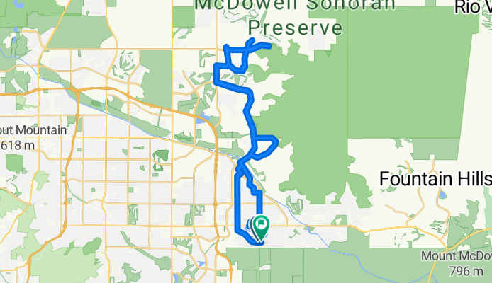
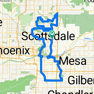
Scottsdale Grayhawk Road Ride
Cycling route in Scottsdale, Arizona, United States
- 67.9 km
- Distance
- 562 m
- Ascent
- 561 m
- Descent

N Granite Reef Rd, Scottsdale to N Granite Reef Rd, Scottsdale
Cycling route in Scottsdale, Arizona, United States
- 77.7 km
- Distance
- 429 m
- Ascent
- 426 m
- Descent
Mountain View to Pinnacle Peak in Scottsdale
Cycling route in Scottsdale, Arizona, United States
- 52.9 km
- Distance
- 470 m
- Ascent
- 467 m
- Descent
Scottsdale Ranch to Mummy Mountain Loop
Cycling route in Scottsdale, Arizona, United States
- 41.9 km
- Distance
- 197 m
- Ascent
- 197 m
- Descent
Discover more routes
 East San Salvador Drive to East San Salvador Drive
- Distance
- 37.8 km
- Ascent
- 151 m
- Descent
- 127 m
- Location
- Scottsdale, Arizona, United States
 N 82nd St, Scottsdale to N Scottsdale Rd, Phoenix
- Distance
- 22.2 km
- Ascent
- 84 m
- Descent
- 22 m
- Location
- Scottsdale, Arizona, United States
 Ultimate Warrior
- Distance
- 97.2 km
- Ascent
- 199 m
- Descent
- 199 m
- Location
- Scottsdale, Arizona, United States
 11796–11798 E Stonegate Cir, Scottsdale to 16300 McDowell Mountain Park Dr, Scottsdale
- Distance
- 28.2 km
- Ascent
- 340 m
- Descent
- 180 m
- Location
- Scottsdale, Arizona, United States
 E Solano Dr, Scottsdale to E Solano Dr, Scottsdale
- Distance
- 27.5 km
- Ascent
- 48 m
- Descent
- 47 m
- Location
- Scottsdale, Arizona, United States
 4419 N Scottsdale Rd, Scottsdale to 7769 E Joshua Tree Ln, Scottsdale
- Distance
- 7.9 km
- Ascent
- 26 m
- Descent
- 22 m
- Location
- Scottsdale, Arizona, United States
 E Solano Dr, Scottsdale to N Ridgeview Dr, Paradise Valley
- Distance
- 19.9 km
- Ascent
- 147 m
- Descent
- 98 m
- Location
- Scottsdale, Arizona, United States
 Tempe Lake-Scottsdale loop
- Distance
- 31.1 km
- Ascent
- 86 m
- Descent
- 88 m
- Location
- Scottsdale, Arizona, United States
Routes from Scottsdale
By bicycle from
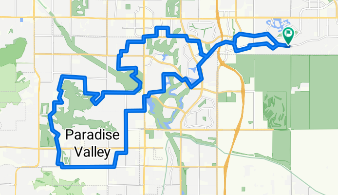
Scottsdale to Paradise Valley
Routes to Scottsdale
By bicycle from
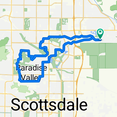
Paradise Valley to Scottsdale