Cycling in Boulder Creek
Discover a map of 13 cycling routes and bike trails near Boulder Creek, created by our community.
Region portrait
Get to know Boulder Creek
Find the right bike route for you through Boulder Creek, where we've got 13 cycle routes to explore.
830 km
Tracked distance
13
Cycle routes
4,923
Population
From our community
The best bike routes in and around Boulder Creek
Low-Key Hillclimb: Boulder Creek to Saratoga Gap
Cycling route in Boulder Creek, California, United States
- 21.9 km
- Distance
- 813 m
- Ascent
- 170 m
- Descent
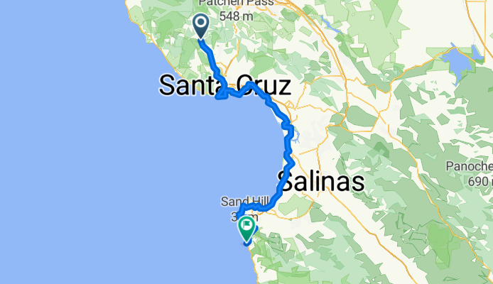
041 panamericana
Cycling route in Boulder Creek, California, United States
- 142.6 km
- Distance
- 573 m
- Ascent
- 702 m
- Descent
Butano Fire Road: 236 to Cloverdale Rd
Cycling route in Boulder Creek, California, United States
- 20 km
- Distance
- 241 m
- Ascent
- 748 m
- Descent
classic gazo a go go
Cycling route in Boulder Creek, California, United States
- 21 km
- Distance
- 536 m
- Ascent
- 587 m
- Descent
Discover more routes
 2022_02_Boulder Creek - Monterey
- Distance
- 95.6 km
- Ascent
- 1,053 m
- Descent
- 1,194 m
- Location
- Boulder Creek, California, United States
 boulder creek big basin skyline
- Distance
- 37.8 km
- Ascent
- 1,006 m
- Descent
- 341 m
- Location
- Boulder Creek, California, United States
 Boulder Big Basin Jamison Alba Empire Loop
- Distance
- 56.6 km
- Ascent
- 1,236 m
- Descent
- 1,242 m
- Location
- Boulder Creek, California, United States
 Boulder Creek loop
- Distance
- 21.6 km
- Ascent
- 793 m
- Descent
- 791 m
- Location
- Boulder Creek, California, United States
 Women's Coast Ride May 2013 - Day 2
- Distance
- 102.7 km
- Ascent
- 475 m
- Descent
- 485 m
- Location
- Boulder Creek, California, United States
 13420 Big Basin Hwy, Boulder Creek nach Monterey Bay Coastal Trail, Monterey
- Distance
- 100.8 km
- Ascent
- 821 m
- Descent
- 968 m
- Location
- Boulder Creek, California, United States
 berry creek falls loop
- Distance
- 14 km
- Ascent
- 576 m
- Descent
- 583 m
- Location
- Boulder Creek, California, United States
 Route 1
- Distance
- 7.8 km
- Ascent
- 25 m
- Descent
- 42 m
- Location
- Boulder Creek, California, United States


