
Cycling in Chico
Discover a map of 570 cycling routes and bike trails near Chico, created by our community.
Region portrait
Get to know Chico
Find the right bike route for you through Chico, where we've got 570 cycle routes to explore. Most people get on their bikes to ride here in the months of May and July.
9,384 km
Tracked distance
570
Cycle routes
86,187
Population
Community
Most active users in Chico


From our community
The best bike routes in and around Chico

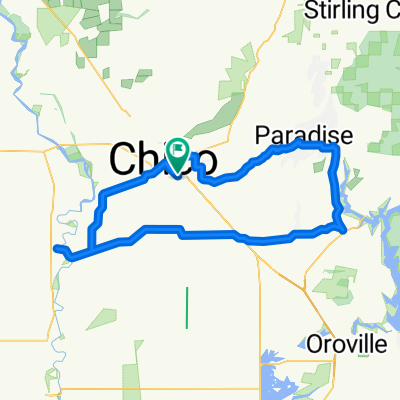
Climb to Paradise
Cycling route in Chico, California, United States
- 21.8 km
- Distance
- 511 m
- Ascent
- 64 m
- Descent

2012 Lassen Trip Final Route
Cycling route in Chico, California, United States
- 506.4 km
- Distance
- 3,923 m
- Ascent
- 3,925 m
- Descent

1- Mile - Butte College - Flag Creek Road
Cycling route in Chico, California, United States
- 33.9 km
- Distance
- 226 m
- Ascent
- 58 m
- Descent
Discover more routes
 Scenic Tour Through Bidwell Park
- Distance
- 11 km
- Ascent
- 87 m
- Descent
- 97 m
- Location
- Chico, California, United States
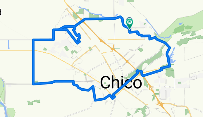
 Chico Mild-Flower
- Distance
- 109.4 km
- Ascent
- 799 m
- Descent
- 809 m
- Location
- Chico, California, United States
 Bicycle Harvest CLONED FROM ROUTE 690504
- Distance
- 35.7 km
- Ascent
- 146 m
- Descent
- 80 m
- Location
- Chico, California, United States
 Trial Route
- Distance
- 7 km
- Ascent
- 21 m
- Descent
- 21 m
- Location
- Chico, California, United States
 Lassen/Eaton/Route
- Distance
- 13.7 km
- Ascent
- 14 m
- Descent
- 14 m
- Location
- Chico, California, United States
 Lassen/Pillsbury/East 1st ave/Esplanade/Bike Trail/Lassens
- Distance
- 11.5 km
- Ascent
- 13 m
- Descent
- 13 m
- Location
- Chico, California, United States
 Dispensary Run
- Distance
- 26.1 km
- Ascent
- 33 m
- Descent
- 33 m
- Location
- Chico, California, United States
 Route to McKinleyville
- Distance
- 382.8 km
- Ascent
- 10,236 m
- Descent
- 10,252 m
- Location
- Chico, California, United States