
Cycling in East San Gabriel
Discover a map of 37 cycling routes and bike trails near East San Gabriel, created by our community.
Region portrait
Get to know East San Gabriel
Find the right bike route for you through East San Gabriel, where we've got 37 cycle routes to explore. Most people get on their bikes to ride here in the month of August.
1,120 km
Tracked distance
37
Cycle routes
14,874
Population
Community
Most active users in East San Gabriel


From our community
The best bike routes in and around East San Gabriel

#GOONSQUAD GOES TO SANTA FE
Cycling route in East San Gabriel, California, United States of America
Ride to Santa Fe Dam. Start at Milk and Honey, go up to Las Tunas via San Gabriel and Walnut Grove. Once the ride hits Live Oak, continue until you hit the dam. Return on the San Gabriel River Trail, exit Ramona Bl, to Valley, back to the Taco Truck/Milk and Honey. Ride should take less than tw
- 28.9 km
- Distance
- 88 m
- Ascent
- 91 m
- Descent

5550 S Walnut Grove Ave, San Gabriel to 5550 S Walnut Grove Ave, San Gabriel
Cycling route in East San Gabriel, California, United States of America
- 3.3 km
- Distance
- 20 m
- Ascent
- 20 m
- Descent

Santa Fe Ave, San Gabriel to Santa Fe Ave, San Gabriel
Cycling route in East San Gabriel, California, United States of America
- 18.6 km
- Distance
- 106 m
- Ascent
- 106 m
- Descent
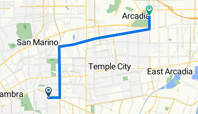
sg to arcadia
Cycling route in East San Gabriel, California, United States of America
sg to arcadia
- 10.3 km
- Distance
- 57 m
- Ascent
- 31 m
- Descent
Discover more routes
 706 Kenmore Dr, San Gabriel to 1327 S San Gabriel Blvd, San Gabriel
- Distance
- 0.5 km
- Ascent
- 0 m
- Descent
- 0 m
- Location
- East San Gabriel, California, United States of America
 Home to Eaton Reservoir & Other Views Loop
- Distance
- 26.3 km
- Ascent
- 245 m
- Descent
- 243 m
- Location
- East San Gabriel, California, United States of America
 Bartlett Ave, San Gabriel to First St, Seal Beach
- Distance
- 53.9 km
- Ascent
- 73 m
- Descent
- 190 m
- Location
- East San Gabriel, California, United States of America
 Bartlett Ave, San Gabriel to N San Gabriel Canyon Rd, Azusa
- Distance
- 28.3 km
- Ascent
- 269 m
- Descent
- 110 m
- Location
- East San Gabriel, California, United States of America
 5552 S Walnut Grove Ave, San Gabriel to 5550 S Walnut Grove Ave, San Gabriel
- Distance
- 2.5 km
- Ascent
- 19 m
- Descent
- 17 m
- Location
- East San Gabriel, California, United States of America
 North Burton Avenue 5561, San Gabriel to Angels Point Road, Los Angeles
- Distance
- 22.3 km
- Ascent
- 221 m
- Descent
- 168 m
- Location
- East San Gabriel, California, United States of America
 261 S California St, San Gabriel to 261 S California St, San Gabriel
- Distance
- 30.1 km
- Ascent
- 94 m
- Descent
- 96 m
- Location
- East San Gabriel, California, United States of America
 601–699 S California St, San Gabriel to 190 W Pennington St, Tucson
- Distance
- 780.1 km
- Ascent
- 3,097 m
- Descent
- 2,493 m
- Location
- East San Gabriel, California, United States of America