
Cycling in Las Flores
Discover a map of 25 cycling routes and bike trails near Las Flores, created by our community.
Region portrait
Get to know Las Flores
Find the right bike route for you through Las Flores, where we've got 25 cycle routes to explore.
605 km
Tracked distance
25
Cycle routes
6,037
Population


From our community
The best bike routes in and around Las Flores

Home to Topanga Lookout
Cycling route in Las Flores, California, United States
- 11.6 km
- Distance
- 677 m
- Ascent
- 49 m
- Descent

beach loop
Cycling route in Las Flores, California, United States
- 72.6 km
- Distance
- 2,540 m
- Ascent
- 2,258 m
- Descent


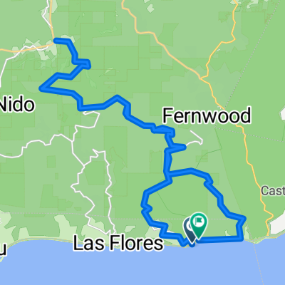
Fernwood-Saddle Peak
Cycling route in Las Flores, California, United States
- 25.1 km
- Distance
- 778 m
- Ascent
- 788 m
- Descent
Discover more routes
 ride from 7/24/17, 6:09 AM
- Distance
- 22.6 km
- Ascent
- 149 m
- Descent
- 161 m
- Location
- Las Flores, California, United States
 Big Rock - Stunt Road - Tuna Canyon Rd - 37 Km
- Distance
- 38.7 km
- Ascent
- 1,238 m
- Descent
- 1,210 m
- Location
- Las Flores, California, United States
 dfffxxdd
- Distance
- 16.8 km
- Ascent
- 306 m
- Descent
- 16 m
- Location
- Las Flores, California, United States
 savage
- Distance
- 7 km
- Ascent
- 8 m
- Descent
- 16 m
- Location
- Las Flores, California, United States
 yeah boi
- Distance
- 39.3 km
- Ascent
- 987 m
- Descent
- 990 m
- Location
- Las Flores, California, United States
 Topanga Canyon to Woodland Hills
- Distance
- 21.3 km
- Ascent
- 491 m
- Descent
- 234 m
- Location
- Las Flores, California, United States
 MALIBU - Downtown
- Distance
- 5.6 km
- Ascent
- 176 m
- Descent
- 120 m
- Location
- Las Flores, California, United States
 19348–19870 Pacific Coast Hwy, Malibu to 1333 Second St, Santa Monica
- Distance
- 11.7 km
- Ascent
- 40 m
- Descent
- 22 m
- Location
- Las Flores, California, United States