
Cycling in Piedmont
Discover a map of 462 cycling routes and bike trails near Piedmont, created by our community.
Region portrait
Get to know Piedmont
Find the right bike route for you through Piedmont, where we've got 462 cycle routes to explore. Most people get on their bikes to ride here in the months of July and September.
11,456 km
Tracked distance
462
Cycle routes
10,667
Population
Community
Most active users in Piedmont


From our community
The best bike routes in and around Piedmont

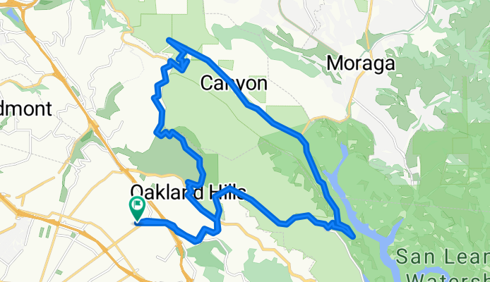
Redwood Heights / Montclair / Tunnel Rd / Skyline /Redwood Heights
Cycling route in Piedmont, California, United States
- 25.2 km
- Distance
- 966 m
- Ascent
- 926 m
- Descent

grizzly to viks
Cycling route in Piedmont, California, United States
- 37.3 km
- Distance
- 628 m
- Ascent
- 626 m
- Descent
Moderately Strenuous Redwood Regional Loop
Cycling route in Piedmont, California, United States
- 27.1 km
- Distance
- 567 m
- Ascent
- 567 m
- Descent

Tunnel Road | Oakland, CA, USA
Cycling route in Piedmont, California, United States
- 4.6 km
- Distance
- 406 m
- Ascent
- 187 m
- Descent
Discover more routes
 Oakland
- Distance
- 78.1 km
- Ascent
- 762 m
- Descent
- 764 m
- Location
- Piedmont, California, United States
 rollin redwood
- Distance
- 46.4 km
- Ascent
- 671 m
- Descent
- 652 m
- Location
- Piedmont, California, United States
 Redwood Regional park 25
- Distance
- 25.5 km
- Ascent
- 594 m
- Descent
- 622 m
- Location
- Piedmont, California, United States
 Rockridge to Inspiration point
- Distance
- 32.5 km
- Ascent
- 718 m
- Descent
- 718 m
- Location
- Piedmont, California, United States
 Park - Snake - Skyline - Redwood - Pinehurst Loop
- Distance
- 38.2 km
- Ascent
- 720 m
- Descent
- 720 m
- Location
- Piedmont, California, United States
 Hill Bomb Redwood to Lake Merritt
- Distance
- 17.8 km
- Ascent
- 152 m
- Descent
- 541 m
- Location
- Piedmont, California, United States
 Around downtown Oakland
- Distance
- 16.6 km
- Ascent
- 67 m
- Descent
- 67 m
- Location
- Piedmont, California, United States
 Over-the-Hills Loop
- Distance
- 44.3 km
- Ascent
- 723 m
- Descent
- 546 m
- Location
- Piedmont, California, United States
Routes from Piedmont
Quick ride by bicycle from
Piedmont to Berkeley
Routes to Piedmont
Quick ride by bicycle from
Berkeley to Piedmont