
Cycling in Poway
Discover a map of 404 cycling routes and bike trails near Poway, created by our community.
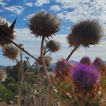
Region portrait
Get to know Poway
Find the right bike route for you through Poway, where we've got 404 cycle routes to explore. Most people get on their bikes to ride here in the months of May and June.
6,587 km
Tracked distance
404
Cycle routes
47,811
Population
Community
Most active users in Poway


Handpicked routes
Discover Poway through these collections
Tour
From our community
The best bike routes in and around Poway

Creekview - around Blue Sky Canyon
Cycling route in Poway, California, United States of America
- 52.6 km
- Distance
- 626 m
- Ascent
- 626 m
- Descent

Domagas Place
Cycling route in Poway, California, United States of America
- 18.6 km
- Distance
- 237 m
- Ascent
- 199 m
- Descent


Scripps Lake Dr, San Diego: Miramar Lake Circle
Cycling route in Poway, California, United States of America
- 8 km
- Distance
- 61 m
- Ascent
- 62 m
- Descent

To Lake Hodges Dam & Back
Cycling route in Poway, California, United States of America
Up dated March 6, 2011. Very Tired! Not a thing left in these legs. Got a major thigh cramp a mile from home.
- 55.5 km
- Distance
- 431 m
- Ascent
- 431 m
- Descent
Discover more routes
 Garden Rd to 67
- Distance
- 26.2 km
- Ascent
- 505 m
- Descent
- 505 m
- Location
- Poway, California, United States of America
 Oak Knoll Road 12223, Poway to Oak Knoll Road 12223, Poway
- Distance
- 15.4 km
- Ascent
- 219 m
- Descent
- 220 m
- Location
- Poway, California, United States of America
 Pow Poway
- Distance
- 82.3 km
- Ascent
- 876 m
- Descent
- 876 m
- Location
- Poway, California, United States of America
 Attempt Up Mt Woodson ~1.7 mi. From Top
- Distance
- 12.2 km
- Ascent
- 431 m
- Descent
- 68 m
- Location
- Poway, California, United States of America
 Poblado Road 10978, San Diego to Del Dios Hwy. & Bing Crosby Bl., Rancho Santa Fe
- Distance
- 11.3 km
- Ascent
- 188 m
- Descent
- 283 m
- Location
- Poway, California, United States of America
 Around Poway
- Distance
- 41.7 km
- Ascent
- 439 m
- Descent
- 439 m
- Location
- Poway, California, United States of America
 Vueltecita
- Distance
- 50.9 km
- Ascent
- 647 m
- Descent
- 647 m
- Location
- Poway, California, United States of America
 looks easy
- Distance
- 13.1 km
- Ascent
- 139 m
- Descent
- 136 m
- Location
- Poway, California, United States of America