
Cycling in San Carlos
Discover a map of 52 cycling routes and bike trails near San Carlos, created by our community.
Region portrait
Get to know San Carlos
Find the right bike route for you through San Carlos, where we've got 52 cycle routes to explore. Most people get on their bikes to ride here in the month of May.
1,596 km
Tracked distance
52
Cycle routes
28,406
Population
Community
Most active users in San Carlos

From our community
The best bike routes in and around San Carlos
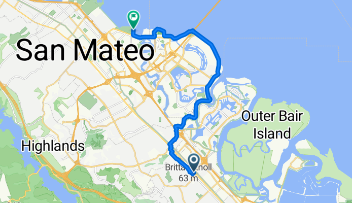
Old County Rd, San Carlos a San Francisco Bay Trail, San Mateo
Cycling route in San Carlos, California, United States
- 15.3 km
- Distance
- 75 m
- Ascent
- 74 m
- Descent

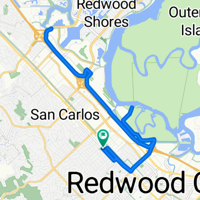
963–995 Skyway Rd, San Carlos to San Francisco Bay Trail, Redwood City
Cycling route in San Carlos, California, United States
- 7.9 km
- Distance
- 5 m
- Ascent
- 5 m
- Descent

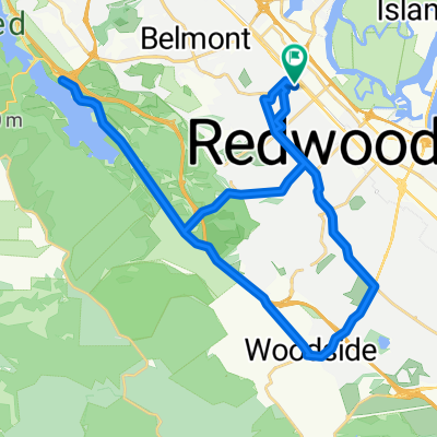
Loop
Cycling route in San Carlos, California, United States
- 64.8 km
- Distance
- 1,058 m
- Ascent
- 1,052 m
- Descent

Neighborhood - Edgewood
Cycling route in San Carlos, California, United States
- 26.3 km
- Distance
- 464 m
- Ascent
- 466 m
- Descent
Discover more routes
 Bay Ride
- Distance
- 29.1 km
- Ascent
- 38 m
- Descent
- 38 m
- Location
- San Carlos, California, United States
 The Out and Back to Arastradero
- Distance
- 39.6 km
- Ascent
- 275 m
- Descent
- 269 m
- Location
- San Carlos, California, United States
 Roundtrip San Carlos, Redwood Shores, San Mateo
- Distance
- 25.9 km
- Ascent
- 21 m
- Descent
- 22 m
- Location
- San Carlos, California, United States
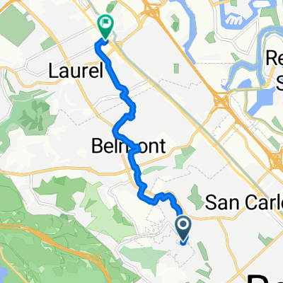
 Laurel Street 1438, San Carlos to Laurel Street 1495, San Carlos
- Distance
- 19.3 km
- Ascent
- 7 m
- Descent
- 8 m
- Location
- San Carlos, California, United States
 Easy ride in San Carlos
- Distance
- 39.5 km
- Ascent
- 495 m
- Descent
- 497 m
- Location
- San Carlos, California, United States
 1348 Laurel St, San Carlos to 1348 Laurel St, San Carlos
- Distance
- 28.4 km
- Ascent
- 10 m
- Descent
- 15 m
- Location
- San Carlos, California, United States
 From San Carlos to San Mateo
- Distance
- 7.6 km
- Ascent
- 144 m
- Descent
- 217 m
- Location
- San Carlos, California, United States
 Mounten View
- Distance
- 46.8 km
- Ascent
- 480 m
- Descent
- 592 m
- Location
- San Carlos, California, United States