
Cycling in Santa Barbara
Discover a map of 350 cycling routes and bike trails near Santa Barbara, created by our community.
Region portrait
Get to know Santa Barbara
Find the right bike route for you through Santa Barbara, where we've got 350 cycle routes to explore. Most people get on their bikes to ride here in the months of May and August.
28,993 km
Tracked distance
350
Cycle routes
88,410
Population
Community
Most active users in Santa Barbara


From our community
The best bike routes in and around Santa Barbara
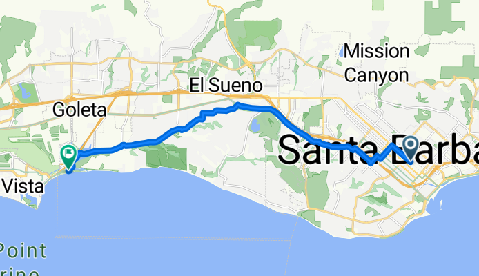
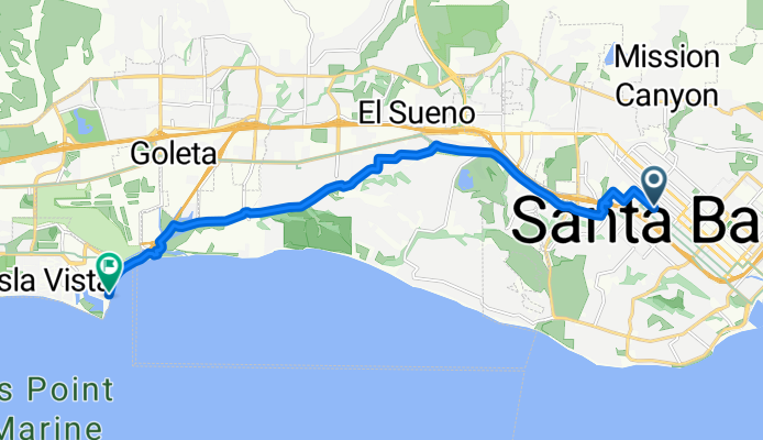
From Santa Barbara to Goleta
Cycling route in Santa Barbara, California, United States
- 15.1 km
- Distance
- 116 m
- Ascent
- 128 m
- Descent

Aufnahme vom 11.05.2016, 18:14
Cycling route in Santa Barbara, California, United States
- 22.8 km
- Distance
- 390 m
- Ascent
- 385 m
- Descent


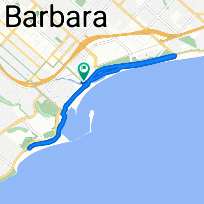
Coronel Place 525, Santa Barbara to Coronel Place 524, Santa Barbara
Cycling route in Santa Barbara, California, United States
- 45.7 km
- Distance
- 1,898 m
- Ascent
- 1,642 m
- Descent
Route in Santa Barbara
Cycling route in Santa Barbara, California, United States
- 15.1 km
- Distance
- 96 m
- Ascent
- 124 m
- Descent
Discover more routes
 Santa Barbara Mountain Drive Ride
- Distance
- 41 km
- Ascent
- 585 m
- Descent
- 585 m
- Location
- Santa Barbara, California, United States
 Santa Barbara to Carpinteira
- Distance
- 34.5 km
- Ascent
- 156 m
- Descent
- 166 m
- Location
- Santa Barbara, California, United States
 Bikes to go trip
- Distance
- 15.8 km
- Ascent
- 90 m
- Descent
- 88 m
- Location
- Santa Barbara, California, United States
 Helena Ave, Santa Barbara to E Mason St, Santa Barbara
- Distance
- 7.3 km
- Ascent
- 58 m
- Descent
- 58 m
- Location
- Santa Barbara, California, United States
 Mission Ridge Los Canoas
- Distance
- 17.3 km
- Ascent
- 295 m
- Descent
- 298 m
- Location
- Santa Barbara, California, United States
 Steady ride in Santa Barbara
- Distance
- 21 km
- Ascent
- 0 m
- Descent
- 11 m
- Location
- Santa Barbara, California, United States
 Gibraltar Santa Barbara 60km loop
- Distance
- 60.1 km
- Ascent
- 1,425 m
- Descent
- 1,421 m
- Location
- Santa Barbara, California, United States
 Amgen Tour of California 2013 - Stage 5. Santa Barbara to Avila Beach
- Distance
- 185 km
- Ascent
- 1,288 m
- Descent
- 1,278 m
- Location
- Santa Barbara, California, United States