
Cycling in Gleneagle
Discover a map of 14 cycling routes and bike trails near Gleneagle, created by our community.
Region portrait
Get to know Gleneagle
Find the right bike route for you through Gleneagle, where we've got 14 cycle routes to explore.
433 km
Tracked distance
14
Cycle routes
6,611
Population


From our community
The best bike routes in and around Gleneagle


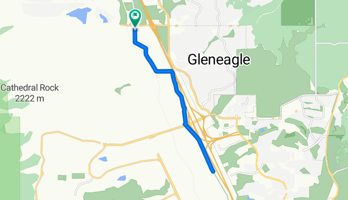
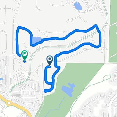
New Santa Fe Regional Trail, Monument to Old Denver Rd, Monument
Cycling route in Gleneagle, Colorado, United States
- 12.8 km
- Distance
- 94 m
- Ascent
- 91 m
- Descent


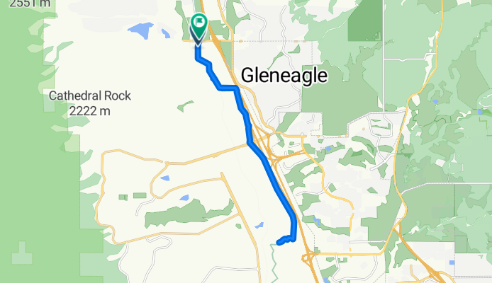
New Santa Fe Regional Trail, Monument to Old Denver Rd, Monument
Cycling route in Gleneagle, Colorado, United States
- 17.7 km
- Distance
- 127 m
- Ascent
- 128 m
- Descent

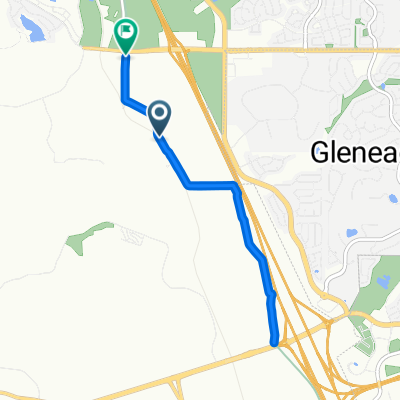
Toscana Heights, Colorado Springs to 2167–2199 Field House Dr, Usaf Academy
Cycling route in Gleneagle, Colorado, United States
- 7.3 km
- Distance
- 148 m
- Ascent
- 71 m
- Descent

baptist to woodmen
Cycling route in Gleneagle, Colorado, United States
- 17.4 km
- Distance
- 14 m
- Ascent
- 175 m
- Descent
Discover more routes
 13482 Bass Pro Dr, Colorado Springs to Struthers Rd, Colorado Springs
- Distance
- 11.4 km
- Ascent
- 140 m
- Descent
- 135 m
- Location
- Gleneagle, Colorado, United States
 Voyager/83 Loop
- Distance
- 15 km
- Ascent
- 142 m
- Descent
- 144 m
- Location
- Gleneagle, Colorado, United States
 TdC 100M
- Distance
- 166.9 km
- Ascent
- 1,304 m
- Descent
- 1,305 m
- Location
- Gleneagle, Colorado, United States
 12654 Rockbridge Cir, Colorado Springs to 1183 Middle Creek Pkwy, Colorado Springs
- Distance
- 42.4 km
- Ascent
- 671 m
- Descent
- 431 m
- Location
- Gleneagle, Colorado, United States
 991–1099 Longspur Ln, Colorado Springs to 4430 E Fountain Blvd, Colorado Springs
- Distance
- 39.1 km
- Ascent
- 250 m
- Descent
- 640 m
- Location
- Gleneagle, Colorado, United States
 New Santa Fe Regional Trail, Monument to Old Denver Rd, Monument
- Distance
- 8 km
- Ascent
- 73 m
- Descent
- 56 m
- Location
- Gleneagle, Colorado, United States
 Doral Way, Colorado Springs to Westchester Dr, Colorado Springs
- Distance
- 3.9 km
- Ascent
- 32 m
- Descent
- 45 m
- Location
- Gleneagle, Colorado, United States
 New Santa Fe Regional Trail, Monument to New Santa Fe Regional Trail, Monument
- Distance
- 7.8 km
- Ascent
- 50 m
- Descent
- 51 m
- Location
- Gleneagle, Colorado, United States