
Cycling in Gypsum
Discover a map of 12 cycling routes and bike trails near Gypsum, created by our community.
Region portrait
Get to know Gypsum
Find the right bike route for you through Gypsum, where we've got 12 cycle routes to explore.
448 km
Tracked distance
12
Cycle routes
6,477
Population
Community
Most active users in Gypsum


From our community
The best bike routes in and around Gypsum


Cooley Mesa Road and Navajo Road W, Gypsum to Hawks Nest Lane 1160, Gypsum
Cycling route in Gypsum, Colorado, United States
- 1.9 km
- Distance
- 46 m
- Ascent
- 0 m
- Descent

Heart Lake Reservoir out and back
Cycling route in Gypsum, Colorado, United States
- 96.6 km
- Distance
- 1,486 m
- Ascent
- 1,486 m
- Descent

Gypsum - Dotsero
Cycling route in Gypsum, Colorado, United States
- 16.3 km
- Distance
- 64 m
- Ascent
- 149 m
- Descent
Discover more routes
 CO 1 - McCoy, CO
- Distance
- 54.2 km
- Ascent
- 472 m
- Descent
- 273 m
- Location
- Gypsum, Colorado, United States
 glenwood canyon and town
- Distance
- 33 km
- Ascent
- 499 m
- Descent
- 627 m
- Location
- Gypsum, Colorado, United States
 glenwood canyon descent
- Distance
- 21.3 km
- Ascent
- 403 m
- Descent
- 514 m
- Location
- Gypsum, Colorado, United States
 Cooley Mesa Road 871, Gypsum to Chambers Avenue 212, Eagle
- Distance
- 8.7 km
- Ascent
- 62 m
- Descent
- 38 m
- Location
- Gypsum, Colorado, United States
 Western Slope RR
- Distance
- 94.5 km
- Ascent
- 343 m
- Descent
- 293 m
- Location
- Gypsum, Colorado, United States
 Glenwood Canyon
- Distance
- 26.1 km
- Ascent
- 232 m
- Descent
- 353 m
- Location
- Gypsum, Colorado, United States
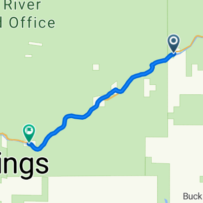
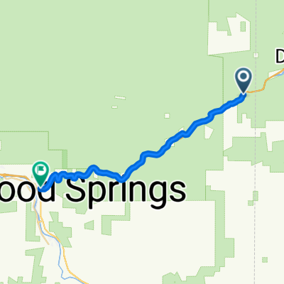 Gypsum - Glenwood Springs
- Distance
- 23.6 km
- Ascent
- 58 m
- Descent
- 184 m
- Location
- Gypsum, Colorado, United States
 I-70 E, Glenwood Springs to I-70 E, Glenwood Springs
- Distance
- 13.6 km
- Ascent
- 819 m
- Descent
- 867 m
- Location
- Gypsum, Colorado, United States