
Cycling in Pendleton
Discover a map of 10 cycling routes and bike trails near Pendleton, created by our community.
Region portrait
Get to know Pendleton
Find the right bike route for you through Pendleton, where we've got 10 cycle routes to explore.
1,199 km
Tracked distance
10
Cycle routes
16,612
Population
Community
Most active users in Pendleton


From our community
The best bike routes in and around Pendleton

Blue, Wallowa Mountain loop from Pendleton airport
Cycling route in Pendleton, Oregon, United States
- 601.9 km
- Distance
- 3,900 m
- Ascent
- 3,874 m
- Descent

McKay West Side A
Cycling route in Pendleton, Oregon, United States
- 4.8 km
- Distance
- 114 m
- Ascent
- 68 m
- Descent

Umatilla to Pendleton
Cycling route in Pendleton, Oregon, United States
- 62 km
- Distance
- 175 m
- Ascent
- 393 m
- Descent

Pendleton Airport Road A
Cycling route in Pendleton, Oregon, United States
- 6.8 km
- Distance
- 50 m
- Ascent
- 19 m
- Descent
Discover more routes
 Live.me route day 1
- Distance
- 8.5 km
- Ascent
- 79 m
- Descent
- 46 m
- Location
- Pendleton, Oregon, United States
 fucked up in the head
- Distance
- 128.1 km
- Ascent
- 6,381 m
- Descent
- 6,372 m
- Location
- Pendleton, Oregon, United States
 Echo plus 2016
- Distance
- 152.8 km
- Ascent
- 676 m
- Descent
- 676 m
- Location
- Pendleton, Oregon, United States
 17 NW Ninth St, Pendleton to 220 SW 12th St, Pendleton
- Distance
- 5.1 km
- Ascent
- 65 m
- Descent
- 74 m
- Location
- Pendleton, Oregon, United States
 clover hill
- Distance
- 127.3 km
- Ascent
- 1,802 m
- Descent
- 1,918 m
- Location
- Pendleton, Oregon, United States
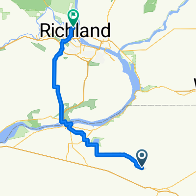 Pendleton - Richland
- Distance
- 101.5 km
- Ascent
- 670 m
- Descent
- 946 m
- Location
- Pendleton, Oregon, United States