
Cycling in Terrebonne
Discover a map of 13 cycling routes and bike trails near Terrebonne, created by our community.
Region portrait
Get to know Terrebonne
Find the right bike route for you through Terrebonne, where we've got 13 cycle routes to explore.
5,367 km
Tracked distance
13
Cycle routes
1,257
Population
Community
Most active users in Terrebonne


From our community
The best bike routes in and around Terrebonne

Cross Country Route
Cycling route in Terrebonne, Oregon, United States
- 4,851 km
- Distance
- 3,173 m
- Ascent
- 3,919 m
- Descent

7th Street pub to Smith Rock State Park
Cycling route in Terrebonne, Oregon, United States
- 18.8 km
- Distance
- 114 m
- Ascent
- 64 m
- Descent

Terrebonne Cycling
Cycling route in Terrebonne, Oregon, United States
- 31.7 km
- Distance
- 232 m
- Ascent
- 231 m
- Descent

Discover more routes
 Northeast 29th Street 4288, Redmond to Northeast 33rd Street 4750, Redmond
- Distance
- 18.6 km
- Ascent
- 145 m
- Descent
- 148 m
- Location
- Terrebonne, Oregon, United States
 SmithRock BanditSprings
- Distance
- 77.6 km
- Ascent
- 611 m
- Descent
- 91 m
- Location
- Terrebonne, Oregon, United States
 10087 NE Crooked River Dr, Terrebonne to 448 NW 24th Pl, Redmond
- Distance
- 19.2 km
- Ascent
- 142 m
- Descent
- 99 m
- Location
- Terrebonne, Oregon, United States
 Terrebonne Cycling
- Distance
- 21.7 km
- Ascent
- 164 m
- Descent
- 153 m
- Location
- Terrebonne, Oregon, United States
 Restful route in Troutdale
- Distance
- 0.2 km
- Ascent
- 0 m
- Descent
- 0 m
- Location
- Terrebonne, Oregon, United States
 Relaxed route in Terrebonne
- Distance
- 4 km
- Ascent
- 108 m
- Descent
- 110 m
- Location
- Terrebonne, Oregon, United States
 sisters2
- Distance
- 90.3 km
- Ascent
- 466 m
- Descent
- 221 m
- Location
- Terrebonne, Oregon, United States
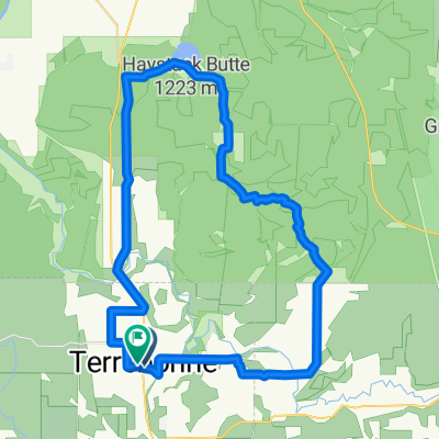 Terrebone, Haystack, Smith Rock
- Distance
- 53.8 km
- Ascent
- 748 m
- Descent
- 747 m
- Location
- Terrebonne, Oregon, United States