


Cycling in Coalville
Discover a map of 22 cycling routes and bike trails near Coalville, created by our community.
Region portrait
Get to know Coalville
Find the right bike route for you through Coalville, where we've got 22 cycle routes to explore.
1,153 km
Tracked distance
22
Cycle routes
1,363
Population
Community
Most active users in Coalville
From our community
The best bike routes in and around Coalville
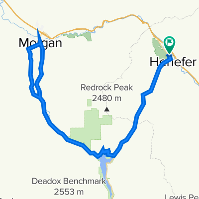
Pioneer Drive to Pioneer Drive
Cycling route in Coalville, Utah, United States
- 34 km
- Distance
- 219 m
- Ascent
- 204 m
- Descent
Pioneer Drive to Pioneer Drive
Cycling route in Coalville, Utah, United States
- 96.6 km
- Distance
- 542 m
- Ascent
- 522 m
- Descent
Coalville - Snyderville
Cycling route in Coalville, Utah, United States
- 21.4 km
- Distance
- 379 m
- Ascent
- 226 m
- Descent
Discover more routes
- All routes in Coalville
- Round trips
- Relaxed
- Gravel
- Road
- MTB
- Trekking


 430 Echo Dam Rd, Coalville to Union Pacific Rail Trail, Coalville0
- 22.4 km
- 199 m
- 196 m
- Coalville, Utah, United States


