
Cycling in Labelle
Discover a map of 65 cycling routes and bike trails near Labelle, created by our community.
Region portrait
Get to know Labelle
Find the right bike route for you through Labelle, where we've got 65 cycle routes to explore. Most people get on their bikes to ride here in the months of August and September.
7,335 km
Tracked distance
65
Cycle routes
1,239
Population

From our community
The best bike routes in and around Labelle


P'tit Train du Nord, Labelle to Rue Labelle 1296, Mont-Tremblant
Cycling route in Labelle, Quebec, Canada
- 23.1 km
- Distance
- 147 m
- Ascent
- 141 m
- Descent


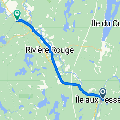
2011 - Laurentides - Jour 3
Cycling route in Labelle, Quebec, Canada
- 108 km
- Distance
- 323 m
- Ascent
- 457 m
- Descent

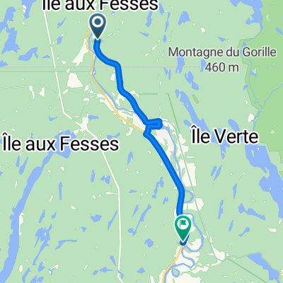
le petit train du nord
Cycling route in Labelle, Quebec, Canada
- 238.9 km
- Distance
- 1,265 m
- Ascent
- 1,247 m
- Descent
Discover more routes
 20250929_4 La Macaza - Marchand
- Distance
- 17.5 km
- Ascent
- 140 m
- Descent
- 73 m
- Location
- Labelle, Quebec, Canada
 Tremblant Le P’tit Train Labelle to Lac Nominingue
- Distance
- 71 km
- Ascent
- 112 m
- Descent
- 112 m
- Location
- Labelle, Quebec, Canada
 Gravel lac caché
- Distance
- 57.4 km
- Ascent
- 934 m
- Descent
- 934 m
- Location
- Labelle, Quebec, Canada
 Ch du Lac-Caché, Labelle à 7601–7687 Boul du Curé-Labelle N, Labelle
- Distance
- 75.6 km
- Ascent
- 675 m
- Descent
- 682 m
- Location
- Labelle, Quebec, Canada
 Labelle à Mont-Laurier, La Macaza to Labelle à Mont-Laurier, La Macaza
- Distance
- 0.5 km
- Ascent
- 0 m
- Descent
- 0 m
- Location
- Labelle, Quebec, Canada
 August 28 Biking
- Distance
- 4,816.8 km
- Ascent
- 33,972 m
- Descent
- 34,198 m
- Location
- Labelle, Quebec, Canada
 Recovered Route
- Distance
- 17.4 km
- Ascent
- 455 m
- Descent
- 472 m
- Location
- Labelle, Quebec, Canada
 2–298 Ch des Sittelles, Labelle to 2–298 Ch des Sittelles, Labelle
- Distance
- 16 km
- Ascent
- 87 m
- Descent
- 90 m
- Location
- Labelle, Quebec, Canada