Cycling in Imer
Discover a map of 30 cycling routes and bike trails near Imer, created by our community.
Region portrait
Get to know Imer
Find the right bike route for you through Imer, where we've got 30 cycle routes to explore.
1,878 km
Tracked distance
30
Cycle routes
1,114
Population
Community
Most active users in Imer
From our community
The best bike routes in and around Imer
Dolomiti 04
Cycling route in Imer, Trentino-Alto Adige, Italy
- 76.9 km
- Distance
- 2,734 m
- Ascent
- 2,041 m
- Descent
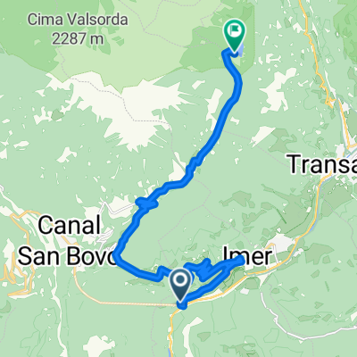
lago Calaita
Cycling route in Imer, Trentino-Alto Adige, Italy
- 15.3 km
- Distance
- 1,018 m
- Ascent
- 58 m
- Descent
Mezzano Sovramonte Mis Cereda
Cycling route in Imer, Trentino-Alto Adige, Italy
- 104.6 km
- Distance
- 1,947 m
- Ascent
- 1,946 m
- Descent
Discover more routes
 Da Località Pontet 6, Monte Croce O Pontet a Strada Statale 50 bis variante, Fonzaso
- Distance
- 38 km
- Ascent
- 843 m
- Descent
- 1,126 m
- Location
- Imer, Trentino-Alto Adige, Italy
 Imer - Imer
- Distance
- 78.6 km
- Ascent
- 1,903 m
- Descent
- 1,885 m
- Location
- Imer, Trentino-Alto Adige, Italy
 vederna malga agnerola
- Distance
- 38.1 km
- Ascent
- 1,147 m
- Descent
- 1,142 m
- Location
- Imer, Trentino-Alto Adige, Italy
 IMER - IMER
- Distance
- 103.5 km
- Ascent
- 2,659 m
- Descent
- 2,659 m
- Location
- Imer, Trentino-Alto Adige, Italy
 Rifugio Vederna + Malga Agnerola
- Distance
- 37.9 km
- Ascent
- 1,118 m
- Descent
- 1,116 m
- Location
- Imer, Trentino-Alto Adige, Italy
 Passo Gobbera
- Distance
- 18.4 km
- Ascent
- 1,086 m
- Descent
- 109 m
- Location
- Imer, Trentino-Alto Adige, Italy
 giro vederna
- Distance
- 42.2 km
- Ascent
- 1,385 m
- Descent
- 1,383 m
- Location
- Imer, Trentino-Alto Adige, Italy
 imer/brocon/bassano 110
- Distance
- 107.8 km
- Ascent
- 1,325 m
- Descent
- 1,842 m
- Location
- Imer, Trentino-Alto Adige, Italy


