
Cycling in Clayton-le-Woods
Discover a map of 162 cycling routes and bike trails near Clayton-le-Woods, created by our community.
Region portrait
Get to know Clayton-le-Woods
Find the right bike route for you through Clayton-le-Woods, where we've got 162 cycle routes to explore. Most people get on their bikes to ride here in the months of April and May.
8,178 km
Tracked distance
162
Cycle routes
14,528
Population
Community
Most active users in Clayton-le-Woods


From our community
The best bike routes in and around Clayton-le-Woods

Collins Road North 3, Bamber Bridge to Collins Road North 7, Bamber Bridge
Cycling route in Clayton-le-Woods, England, United Kingdom
- 26.5 km
- Distance
- 224 m
- Ascent
- 229 m
- Descent


23 Shaw Brow, Chorley to Waterhouse Green, 25 Shaw Brow, Chorley
Cycling route in Clayton-le-Woods, England, United Kingdom
- 24.4 km
- Distance
- 341 m
- Ascent
- 341 m
- Descent

Cuerden Valley Park
Cycling route in Clayton-le-Woods, England, United Kingdom
Safer route to Cuerden Valley Park to try.
- 5.2 km
- Distance
- 24 m
- Ascent
- 33 m
- Descent
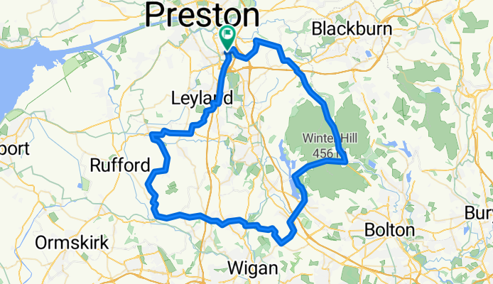
Parbold, Rivington Winter Hill ride.
Cycling route in Clayton-le-Woods, England, United Kingdom
Leyland, Ulnes Walton, Parbold, Rivington Winter Hill
47miles, road bike
- 74.3 km
- Distance
- 521 m
- Ascent
- 521 m
- Descent
Discover more routes
 preston to knott end
- Distance
- 102.7 km
- Ascent
- 151 m
- Descent
- 151 m
- Location
- Clayton-le-Woods, England, United Kingdom
 Whall-ey ?
- Distance
- 55 km
- Ascent
- 579 m
- Descent
- 578 m
- Location
- Clayton-le-Woods, England, United Kingdom
 monster roundtrip
- Distance
- 139.2 km
- Ascent
- 469 m
- Descent
- 469 m
- Location
- Clayton-le-Woods, England, United Kingdom
 Waterhouse Green, 25 Shaw Brow, Chorley to Waterhouse Green, 25 Shaw Brow, Chorley
- Distance
- 29.5 km
- Ascent
- 742 m
- Descent
- 794 m
- Location
- Clayton-le-Woods, England, United Kingdom
 Home To New Work
- Distance
- 42 km
- Ascent
- 100 m
- Descent
- 99 m
- Location
- Clayton-le-Woods, England, United Kingdom
 Leyland Flat Pancake Ride
- Distance
- 65.1 km
- Ascent
- 120 m
- Descent
- 120 m
- Location
- Clayton-le-Woods, England, United Kingdom
 Knott End training Loop
- Distance
- 88 km
- Ascent
- 131 m
- Descent
- 130 m
- Location
- Clayton-le-Woods, England, United Kingdom
 Bridge Street 39, Bamber Bridge to Bridge Street 41, Bamber Bridge
- Distance
- 107.6 km
- Ascent
- 811 m
- Descent
- 863 m
- Location
- Clayton-le-Woods, England, United Kingdom