How cycling in Hungary could look like.

Cycling in Hungary

Discover a map of 174,156 cycling routes and bike trails in Hungary, created by our community.

Region portrait

Get to know Hungary

Find and create the best bike routes in Hungary, a country known for its breathtaking architecture, folk art and thermal baths, thanks to the bike route planner. The country is the home of many world heritage sites, UNESCO biosphere reserves, the world’s second largest thermal lake (lake Héviz) and the biggest lake of Middle Europe, Lake Balaton. Those exploring the country by bike receive an especially lively impression of nature’s beauty and the fascinating cultural monuments. Water lovers should cycle along the  in Hungary’s Southwest, as the trail is scenically beautiful and offers the opportunity to travel to the capital Budapest as well as to other cities.

10,255,346 km

Tracked distance

174,156

Cycle routes

10 million

Population

Community

Most active users in Hungary

Handpicked routes

Discover Hungary through these collections

From our community

The best bike routes in Hungary

4

Route in Badacsonytomaj

Cycling route in Badacsonytomaj, Veszprém megye, Hungary

66.4 km
Distance
131 m
Ascent
133 m
Descent
5

4. Budapest-Szob

Cycling route in Budapest VIII. kerĂĽlet, Budapest, Hungary

Budapest-Szob (kamp), 76 km Na putu iz Budimpešte do Soba prolazimo pored Sentadreje. U Sobu noćimo u kampu “Ipolykapu Kemping”, Park utca 11, Szob.
76.3 km
Distance
299 m
Ascent
311 m
Descent
 Majdnem körtúra képekkel
MTBPavedUnpaved
küldönc
8

Majdnem körtúra képekkel

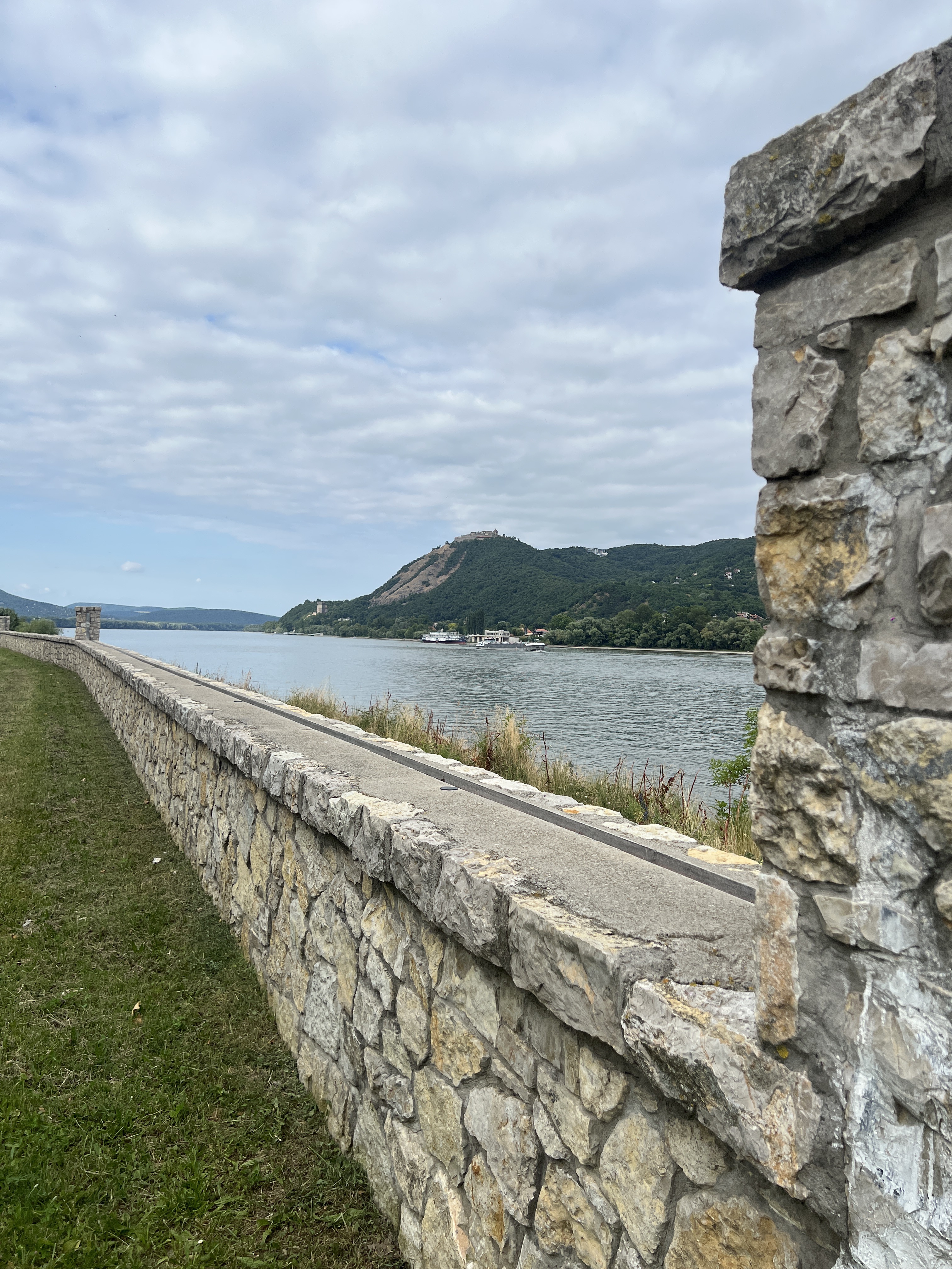
Cycling route in Kismaros, Pest County, Hungary

<span style="font-size: 10pt; font-style: normal; font-family: "Times New Roman";">A túrát a Kóspallagi úttól kezdtük, hogy a végére ne maradjon emelkedő. Feltekerünk a Törökmezei elágazásig, ahol balra fordulunk a műúton. Törökmezőn a tóhoz is érdemes <span style="mso-spacerun: yes;"> </span>lemenni a turista jelzésen. Ezután a forga- lom elől elzárt műúton folytatjuk a túrát. Az első betonos parkolónál kereshető a kis ház, melynél szép a kilátás.(Parkoló végénél be- menni az erdőbe cca : 30m).Visszatérve tekerünk a Köves-mező felé, ahol a <span style="mso-spacerun: yes;"> </span>Visegrádi várra látunk rá tökéletesen.</span> <span style="font-size: 10pt; font-style: normal; font-family: "Times New Roman";">A turista jelzést nem<span style="mso-spacerun: yes;"> </span>figyelve a betonút vé- ge utáni sorompót kikerülve az erdőgazda- sági úton induljunk , mert „barátságosabb felfelé. A Világos-teret elérve mindenképpen a sorompós (Y jobb) haladjunk, sőt vissza- felé is itt jöjjünk majd.Ha követjük a nyom- vonalat felérünk az ürmös rétre a toronyhoz. Jobbra fordulva hamar elérjük a Julianus kilátót. A panoráma lenyűgöző, </span> <span style="font-size: 10pt; font-style: normal; font-family: "Times New Roman";"><span style="text-decoration: underline;">ezért érdemes feljönni.</span></span> <span style="font-size: 10pt; font-style: normal; font-family: "Times New Roman";">Innen már könnyű a túra, nincs komoly emelkedő. Lefelé a Világos-térig hasonlóan</span> <span style="font-size: 10pt; font-style: normal; font-family: "Times New Roman";">ereszkedjünk, onnan viszont a turista út remek választás a Köves-mezőig, ahol az eligazító oszlop is mutatja a Zebegénybe induló utat. Bringa jelzéses földút visz a községbe, ahol felkereshető a Trianoni emlékmű, kilátó /akár a sárga turista jelzésen</span> <span style="font-size: 10pt; font-style: normal; font-family: "Times New Roman";">Sok más látnivaló is van , nagyon szép település.</span> <span style="font-size: 10pt; font-style: normal; font-family: "Times New Roman";">A központban a híd alatt átmegyünk a főút túl oldalára és a kiépített kerékpár úton tekerünk vissza 13 km-t.</span> <span style="font-size: 10pt; font-style: normal; font-family: "Times New Roman";"> </span> <span style="font-size: 12pt; font-style: normal; font-family: "Times New Roman";"> </span> <span style="font-size: 12pt; font-style: normal; font-family: "Times New Roman";"> </span>
33.5 km
Distance
452 m
Ascent
455 m
Descent
4

VELOREGIO_14.

Cycling route in Kőszeg, Vas County, Hungary

HU   A mintegy 35 kilométeres túra Kőszegről felvisz minket az Országos Kéktúra kiindulópontjához, a 884 méter magas Írottkőre az osztrák-magyar határon, ahonnan megtekinthetjük a panorámát, mielőtt az osztrák oldalon keresztül visszatérnénk kiindulópontunkra. Kőszeg számos kulturális, történelmi és gasztronómiai élményt rejt, amelyek jól kombinálhatóak egy néhány napos vagy akár egy hetes bringás kirándulással is. Az útvonal az osztrák oldali aszfaltozott útig jó minőségű, ám aszfaltozatlan erdészeti utakon vezet folyamatosan emelkedve; nem igényel olyan komoly tereptapasztalatot, mint a mountain bike-os túrakínálat útjai, azonban a komolyabb szintemelkedés miatt kisgyermekes családoknak kevésbé ajánlott. A jelzett erdészeti út a Hunyadi János útról, a Jurisich gimnázium után, a Chernel ház mellől érhető el, innen emelkedik folyamatosan, festői tájon keresztül az Írottkőig, ahonnan meredeken ereszkedik le B56-os osztrák útra. Ezen ereszkedünk egészen Lékáig (Lockenhaus), amelynek sokat megélt várát mindenképpen érdemes megcsodálni. Lékától jobbra tartunk a határmenti Rattersdorfig (Rőtfalva), ahonnan már közvetlenül el is érjük a határállomást. Innen már csak le kell gurulni a Csónakázó-tó mellett, Kőszegre a Kéthelyi út-Meskó út útvonalon érünk be a legegyszerűbben.   DE Die 35 Kilometer lange Tour von Kőszeg bringt uns zum Startpunkt der Nationalen Blauen Tour (Orszásgos Kéktúra), dem 884 Meter hohen Írottkő an der österreichisch-ungarischen Grenze, von dem wir das Panorama sehen können, bevor wie über die österreichische Seite zu unserem Ausgangspunkt zurückkehren. Kőszeg hat viele kulturelle, historische und gastronomische Sehenswürdigkeiten/Erlebnisse, die mit ein paar Tagen oder sogar einer einwöchigen Radtour kombiniert werden können. Die Route führt auf unbefestigten, aber hochwertigen Waldwegen zu einer asphaltierten Straße auf der österreichischen Seite. Die Tour erfordert keine ernsthaften Felderfahrungen wie die Routen der Mountainbike-Touren, aber aufgrund einer ernsthafteren Zunahme Höhen, ist diese Tour für Familien mit kleinen Kindern weniger zu empfehlen. Die markierte Waldstraße von Hunyadi János út nach dem Jurisich-Gymnasium ist vom Chernel Haus aus zu erreichen. Von hier aus gibt es Steigerungen, man fährt durch die malerische Landschaft nach Írottkő, ab wo wir steil nach unten zur österreichischer B56 Straße fahren. Wir steigen hinunter nach Léka (Lockenhaus), dessen Festung besuchungswert ist. Von Léka nach rechts erreichen wir bei der Grenzen Rattersdorf (Rőtfalva), von wo aus wir den Grenzen direkt erreichen können. Von hier aus müssen wir neben den See Csónakázó fahren, und der einfachste Weg, um nach Kőszeg zu gelangen, ist die Route: Straße Kéthelyi –Meskó.   EN This almost 35-km trip takes you from Kőszeg to the starting point of the National Blue Rail, the 884-meter-high Írottkő at the Austrian-Hungarian border where you can look at the panorama before returning to the starting point through the Austrian side. Kőszeg has numerous cultural, historical and gastronomical experiences that can be combined with a several-day or even with a several-week long cycle trip. The route goes through ascending good quality forest roads until Austria; unlike the mountain bike tours, it doesn’t need too much experience but given the ascension we don’t recommend it for families with small children. You can reach the signed forest road from Hunyadi János út after the Jurisich gymnasium and next to the Chernel house. From there it ascends continuously with a beautiful landscape until Írottkő where it goes downwards to the Austrian road B56. Follow it to Léka (Lockenhaus) where you can find a castle that is worth visiting. Turn right towards Rattersdorf (Rőtfalva) in the borderlands and reach the border station. Continue near the Csónakázó lake and reach Kőszeg on the Kéthelyi út-Meskó út route.
33.7 km
Distance
636 m
Ascent
635 m
Descent

Discover more routes

Highlights

  • Biking in the Hungarian Puszta: The steppe-like, flat landscape without trees can be easily explored by bike.
  • Empress Elisabeth of Austria, better known as Sisi, is famous for her big love for Hungary. Her castle Gödöllö is a highlight of the Hungarian baroque architecture, only 28 kilometres away from Budapest and is easily accessible by bike.
  • The river Danube runs through Hungary’s capital Budapest and divides the city in two parts, Buda and Pest. There are wide-spanning cycle tracks along the Danube that also pass several sights. When planning a longer tour one can just follow the cycle tracks upstream towards the Danube Bend or downstream towards the Danube FĂĽred.

Tips

  • Since 2007, there cyclists are obligated to wear a safety vest after dusk and during bad visibility.
  • In general, you can also travel Hungary by bike during the summer. In spring and fall, there is less traffic on the streets which can prove to be quite pleasant.
  • The train is the best means of transport for transporting the bike over big distances. There’s usually an area for bikes available, otherwise, it’s allowed to store the bike in the train’s first or last waggon.

See where people are biking in Hungary

Popular cycling regions in Hungary