
Cycling in Gönc
Discover a map of 325 cycling routes and bike trails near Gönc, created by our community.
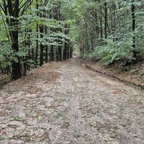
Region portrait
Get to know Gönc
Find the right bike route for you through Gönc, where we've got 325 cycle routes to explore. Most people get on their bikes to ride here in the months of July and August.
16,724 km
Tracked distance
325
Cycle routes
2,217
Population
Community
Most active users in Gönc


Handpicked routes
Discover Gönc through these collections
Tour
From our community
The best bike routes in and around Gönc

Zemplén 2014.
Cycling route in Gönc, Borsod-Abauj Zemplen county, Hungary
z
- 70.8 km
- Distance
- 1,338 m
- Ascent
- 1,338 m
- Descent

STEREO 10.3 Kőkapu - Ördög völgy - Gerendás Rétig
Cycling route in Gönc, Borsod-Abauj Zemplen county, Hungary
Monoton emelkedő, egy részen lehet 100m-t tolni kell, ügyesebbek feltekernek:)
- 10.3 km
- Distance
- 351 m
- Ascent
- 146 m
- Descent

12.31 Zemplén kör 2022
Cycling route in Gönc, Borsod-Abauj Zemplen county, Hungary
szakasz: Füzér-Pálháza
- 20.7 km
- Distance
- 198 m
- Ascent
- 481 m
- Descent

Füzér, Izra-tó, Szalánchuta, Lászlótanya kör
Cycling route in Gönc, Borsod-Abauj Zemplen county, Hungary
- 22.5 km
- Distance
- 636 m
- Ascent
- 636 m
- Descent
Discover more routes
 Telkibánya, Sólyom-kő, Amadé-vár rom, Hejcei emlékpark kör
- Distance
- 31.4 km
- Ascent
- 864 m
- Descent
- 865 m
- Location
- Gönc, Borsod-Abauj Zemplen county, Hungary
 Kőkapu 2
- Distance
- 13 km
- Ascent
- 434 m
- Descent
- 433 m
- Location
- Gönc, Borsod-Abauj Zemplen county, Hungary
 Kő-kapu Kerek-kő- István-kút Kőkapu
- Distance
- 23.9 km
- Ascent
- 434 m
- Descent
- 432 m
- Location
- Gönc, Borsod-Abauj Zemplen county, Hungary
 Dzedo patak völgye. Út keresés.
- Distance
- 23.1 km
- Ascent
- 488 m
- Descent
- 489 m
- Location
- Gönc, Borsod-Abauj Zemplen county, Hungary
 Pálháza 30km körút
- Distance
- 14.2 km
- Ascent
- 80 m
- Descent
- 388 m
- Location
- Gönc, Borsod-Abauj Zemplen county, Hungary
 Füzér-Nagy Milic - Füzér kör
- Distance
- 15.3 km
- Ascent
- 587 m
- Descent
- 596 m
- Location
- Gönc, Borsod-Abauj Zemplen county, Hungary
 Telkibánya 38 km-es kör
- Distance
- 37.8 km
- Ascent
- 559 m
- Descent
- 559 m
- Location
- Gönc, Borsod-Abauj Zemplen county, Hungary
 Múzeum út 8a., Telkibánya to Múzeum út 11., Telkibánya
- Distance
- 37.7 km
- Ascent
- 970 m
- Descent
- 980 m
- Location
- Gönc, Borsod-Abauj Zemplen county, Hungary
Routes from Gönc
Cycling day trip from
Gönc to Sátoraljaújhely
Routes to Gönc
Cycling day trip from
Košice to Gönc
Cycling day trip from
Sátoraljaújhely to Gönc