

Telkibánya, Sólyom-kő, Amadé-vár rom, Hejcei emlékpark kör
A cycling route starting in Gönc, Borsod-Abauj Zemplen county, Hungary.
Overview
About this route
Próbaverzió.
- -:--
- Duration
- 31.4 km
- Distance
- 864 m
- Ascent
- 865 m
- Descent
- ---
- Avg. speed
- ---
- Avg. speed
Route quality
Waytypes & surfaces along the route
Waytypes
Track
26.4 km
(84 %)
Path
2.9 km
(9 %)
Surfaces
Paved
2.6 km
(8 %)
Unpaved
27.5 km
(88 %)
Ground
23.8 km
(76 %)
Gravel
2.6 km
(8 %)
Route highlights
Points of interest along the route
Point of interest after 14.9 km
Sólyom-kő kilátó
Point of interest after 16 km
Téglás-kő kilátó
Point of interest after 17.5 km
Amadé-vár rom 660 km
Point of interest after 20.7 km
Hejcei repülőgép szerencsétlenség emlékpark (2006. január 19). Borsóhegy 755 méter.
Point of interest after 26.4 km
Pálos kolostorrom
Point of interest after 27.3 km
Potácsháza
Continue with Bikemap
Use, edit, or download this cycling route
You would like to ride Telkibánya, Sólyom-kő, Amadé-vár rom, Hejcei emlékpark kör or customize it for your own trip? Here is what you can do with this Bikemap route:
Free features
- Save this route as favorite or in collections
- Copy & plan your own version of this route
- Sync your route with Garmin or Wahoo
Premium features
Free trial for 3 days, or one-time payment. More about Bikemap Premium.
- Navigate this route on iOS & Android
- Export a GPX / KML file of this route
- Create your custom printout (try it for free)
- Download this route for offline navigation
Discover more Premium features.
Get Bikemap PremiumFrom our community
Other popular routes starting in Gönc
 12.31 Zemplén kör 2022
- Distance
- 20.7 km
- Ascent
- 198 m
- Descent
- 481 m
- Location
- Gönc, Borsod-Abauj Zemplen county, Hungary
 STEREO 10.3 Kőkapu - Ördög völgy - Gerendás Rétig
- Distance
- 10.3 km
- Ascent
- 351 m
- Descent
- 146 m
- Location
- Gönc, Borsod-Abauj Zemplen county, Hungary
 Füzér-Nagy Milic - Füzér kör
- Distance
- 15.3 km
- Ascent
- 587 m
- Descent
- 596 m
- Location
- Gönc, Borsod-Abauj Zemplen county, Hungary
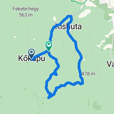 Kőkapu-Kishuta-Nagyhuta (kör)
- Distance
- 19.4 km
- Ascent
- 433 m
- Descent
- 458 m
- Location
- Gönc, Borsod-Abauj Zemplen county, Hungary
 Zemplén 2014.
- Distance
- 70.8 km
- Ascent
- 1,338 m
- Descent
- 1,338 m
- Location
- Gönc, Borsod-Abauj Zemplen county, Hungary
 Kőkapu 2
- Distance
- 13 km
- Ascent
- 434 m
- Descent
- 433 m
- Location
- Gönc, Borsod-Abauj Zemplen county, Hungary
 Dzedo patak völgye. Út keresés.
- Distance
- 23.1 km
- Ascent
- 488 m
- Descent
- 489 m
- Location
- Gönc, Borsod-Abauj Zemplen county, Hungary
 Telkibánya, Sólyom-kő, Amadé-vár rom, Hejcei emlékpark kör
- Distance
- 31.4 km
- Ascent
- 864 m
- Descent
- 865 m
- Location
- Gönc, Borsod-Abauj Zemplen county, Hungary
Open it in the app