
Cycling in View Park-Windsor Hills
Discover a map of 524 cycling routes and bike trails near View Park-Windsor Hills, created by our community.
Region portrait
Get to know View Park-Windsor Hills
Find the right bike route for you through View Park-Windsor Hills, where we've got 524 cycle routes to explore. Most people get on their bikes to ride here in the months of May and July.
10,045 km
Tracked distance
524
Cycle routes
11,075
Population
Community
Most active users in View Park-Windsor Hills
From our community
The best bike routes in and around View Park-Windsor Hills
Kari’s Ln, Los Angeles to Kari’s Ln, Los Angeles
Cycling route in View Park-Windsor Hills, California, United States of America
- 8 km
- Distance
- 232 m
- Ascent
- 233 m
- Descent
12/2/16 Bike Route #1
Cycling route in View Park-Windsor Hills, California, United States of America
Tour De Los Angeles
- 63.8 km
- Distance
- 462 m
- Ascent
- 461 m
- Descent
To Eagle Rock
Cycling route in View Park-Windsor Hills, California, United States of America
i went from the U.S.C area to Eagle Rock. I took Figueroa up north through Down town then got on to Broadway crossed the bridge and connect back on to Fuigeroa at some point. on figueroa i went to Yorkblvd. I went back the same general way.
- 21.4 km
- Distance
- 274 m
- Ascent
- 135 m
- Descent
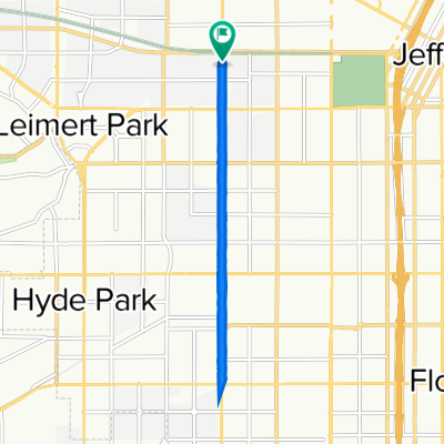
CicLAvia Route (Florence to Exposition via Western) 👨👩👧👦
Cycling route in View Park-Windsor Hills, California, United States of America
- 9.4 km
- Distance
- 7 m
- Ascent
- 7 m
- Descent
Discover more routes
- Steady ride in Santa Monica
- Distance
- 20.9 km
- Ascent
- 190 m
- Descent
- 186 m
- Location
- View Park-Windsor Hills, California, United States of America
- 6011 Buckler Ave, Los Angeles to 1100–1198 Los Palos St, Los Angeles
- Distance
- 17.7 km
- Ascent
- 10 m
- Descent
- 30 m
- Location
- View Park-Windsor Hills, California, United States of America
- Lengthy ride from Los Angeles to Manhattan Beach
- Distance
- 33.5 km
- Ascent
- 123 m
- Descent
- 146 m
- Location
- View Park-Windsor Hills, California, United States of America
- Moderate route in Manhattan Beach
- Distance
- 33.7 km
- Ascent
- 190 m
- Descent
- 228 m
- Location
- View Park-Windsor Hills, California, United States of America
- 1257 W 37th Dr, Los Angeles to 3629 S Vermont Ave, Los Angeles
- Distance
- 44.2 km
- Ascent
- 149 m
- Descent
- 153 m
- Location
- View Park-Windsor Hills, California, United States of America
- 1252 W 37th Dr, Los Angeles to Karis Ln, Los Angeles
- Distance
- 10.7 km
- Ascent
- 125 m
- Descent
- 37 m
- Location
- View Park-Windsor Hills, California, United States of America
- 1247 W 37th Dr, Los Angeles to 928 S Western Ave, Los Angeles
- Distance
- 7.7 km
- Ascent
- 38 m
- Descent
- 33 m
- Location
- View Park-Windsor Hills, California, United States of America
- 1257 W 37th Dr, Los Angeles to 1250 W 37th Dr, Los Angeles
- Distance
- 17 km
- Ascent
- 35 m
- Descent
- 38 m
- Location
- View Park-Windsor Hills, California, United States of America