
Cycling in Mambalan
Discover a map of 20 cycling routes and bike trails near Mambalan, created by our community.
Region portrait
Get to know Mambalan
Find the right bike route for you through Mambalan, where we've got 20 cycle routes to explore.
363 km
Tracked distance
20
Cycle routes
Community
Most active users in Mambalan


From our community
The best bike routes in and around Mambalan


Bukit cacing
Cycling route in Mambalan, West Nusa Tenggara, Indonesia
- 42.5 km
- Distance
- 7 m
- Ascent
- 0 m
- Descent


meninting batu layar
Cycling route in Mambalan, West Nusa Tenggara, Indonesia
- 7.1 km
- Distance
- 70 m
- Ascent
- 75 m
- Descent

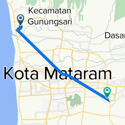
Lombok- Matarm to Gunungsari-Bukit Kedondong-Senggigi
Cycling route in Mambalan, West Nusa Tenggara, Indonesia
- 13.1 km
- Distance
- 476 m
- Ascent
- 497 m
- Descent

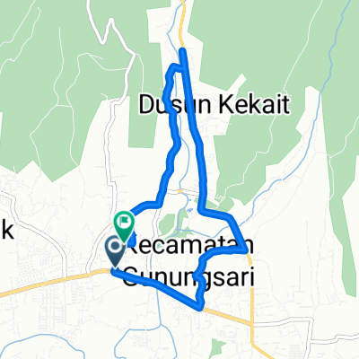
15 + 1 peaks plus a monkey forest
Cycling route in Mambalan, West Nusa Tenggara, Indonesia
- 54 km
- Distance
- 528 m
- Ascent
- 528 m
- Descent
Discover more routes
 15 + 1 peaks plus a monkey forest
- Distance
- 54 km
- Ascent
- 518 m
- Descent
- 518 m
- Location
- Mambalan, West Nusa Tenggara, Indonesia
 Jalan Raya Meninting, Kecamatan Batu Layar to H2JX+3QV, Kecamatan Pemenang
- Distance
- 21.8 km
- Ascent
- 339 m
- Descent
- 340 m
- Location
- Mambalan, West Nusa Tenggara, Indonesia
 Meninting, Batu Layar to Jalan Tulip 91, Kecamatan Sandubaya
- Distance
- 10.9 km
- Ascent
- 29 m
- Descent
- 6 m
- Location
- Mambalan, West Nusa Tenggara, Indonesia
 L-6 to L-6
- Distance
- 8.1 km
- Ascent
- 43 m
- Descent
- 84 m
- Location
- Mambalan, West Nusa Tenggara, Indonesia
 L-6 to L-6
- Distance
- 3.6 km
- Ascent
- 18 m
- Descent
- 58 m
- Location
- Mambalan, West Nusa Tenggara, Indonesia
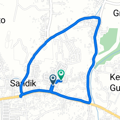
 Jalan Pariwisata 40, Gunung Sari to Jalan Pariwisata 32, Gunung Sari
- Distance
- 9.9 km
- Ascent
- 87 m
- Descent
- 91 m
- Location
- Mambalan, West Nusa Tenggara, Indonesia
 Jalan Pariwisata 32, Gunung Sari to Jalan Pariwisata 32, Gunung Sari
- Distance
- 15.3 km
- Ascent
- 36 m
- Descent
- 47 m
- Location
- Mambalan, West Nusa Tenggara, Indonesia
 Jalan Pariwisata 14x, Batu Layar to Jalan Kembung 8, Kecamatan Ampenan
- Distance
- 6.5 km
- Ascent
- 82 m
- Descent
- 75 m
- Location
- Mambalan, West Nusa Tenggara, Indonesia