
Cycling in Leżajsk
Discover a map of 110 cycling routes and bike trails near Leżajsk, created by our community.
Region portrait
Get to know Leżajsk
Find the right bike route for you through Leżajsk, where we've got 110 cycle routes to explore. Most people get on their bikes to ride here in the months of July and August.
9,832 km
Tracked distance
110
Cycle routes
13,958
Population


From our community
The best bike routes in and around Leżajsk

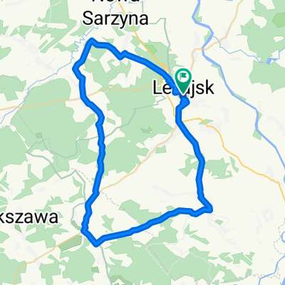
GV-3-Lezajsk-Jarocin
Cycling route in Leżajsk, Subcarpathian Voivodeship, Poland
- 49.7 km
- Distance
- 130 m
- Ascent
- 116 m
- Descent

Leżajsk - Borowe Młyny
Cycling route in Leżajsk, Subcarpathian Voivodeship, Poland
- 55.9 km
- Distance
- 150 m
- Ascent
- 115 m
- Descent

Leżajsk-Przemyśl- Rzeszów-Leżajska
Cycling route in Leżajsk, Subcarpathian Voivodeship, Poland
- 333.1 km
- Distance
- 972 m
- Ascent
- 967 m
- Descent

Leżajsk - Leżajsk szlak arch drewnianej
Cycling route in Leżajsk, Subcarpathian Voivodeship, Poland
- 229.6 km
- Distance
- 408 m
- Ascent
- 403 m
- Descent
Discover more routes
 Leżajsk - Sokołów - Czarna - Grodzisko - Leżajsk
- Distance
- 78.9 km
- Ascent
- 216 m
- Descent
- 216 m
- Location
- Leżajsk, Subcarpathian Voivodeship, Poland
 Pętelka Leżajsk-Jelna-Łukowa-Leżajsk
- Distance
- 25.9 km
- Ascent
- 96 m
- Descent
- 96 m
- Location
- Leżajsk, Subcarpathian Voivodeship, Poland
 Trasa Leżajsk - Elbląg
- Distance
- 1,245.4 km
- Ascent
- 695 m
- Descent
- 879 m
- Location
- Leżajsk, Subcarpathian Voivodeship, Poland
 Leżajsk - Gniewczyna - Tryńcza - Leżajsk
- Distance
- 44.1 km
- Ascent
- 84 m
- Descent
- 83 m
- Location
- Leżajsk, Subcarpathian Voivodeship, Poland
 Subcarpathia
- Distance
- 420.8 km
- Ascent
- 861 m
- Descent
- 861 m
- Location
- Leżajsk, Subcarpathian Voivodeship, Poland
 Leżajsk - Zbiornik Maziarnia
- Distance
- 44.6 km
- Ascent
- 215 m
- Descent
- 211 m
- Location
- Leżajsk, Subcarpathian Voivodeship, Poland
 Leżajsk - Tanogród - Sieniawa - Leżajsk
- Distance
- 79 km
- Ascent
- 223 m
- Descent
- 226 m
- Location
- Leżajsk, Subcarpathian Voivodeship, Poland
 50km po drogach, ścieżkach, lasach
- Distance
- 50.2 km
- Ascent
- 232 m
- Descent
- 232 m
- Location
- Leżajsk, Subcarpathian Voivodeship, Poland