Cycling in Gjirokastër
Discover a map of 57 cycling routes and bike trails near Gjirokastër, created by our community.
Region portrait
Get to know Gjirokastër
Find the right bike route for you through Gjirokastër, where we've got 57 cycle routes to explore.
4,371 km
Tracked distance
57
Cycle routes
23,437
Population
Community
Most active users in Gjirokastër
From our community
The best bike routes in and around Gjirokastër

Gjirokastër - Kakavijë
Cycling route in Gjirokastër, Gjirokastër County, Albania
- 75.4 km
- Distance
- 1,861 m
- Ascent
- 1,651 m
- Descent

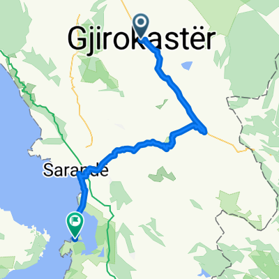
Gjirokastra - Saranda
Cycling route in Gjirokastër, Gjirokastër County, Albania
- 52.8 km
- Distance
- 2,163 m
- Ascent
- 2,453 m
- Descent

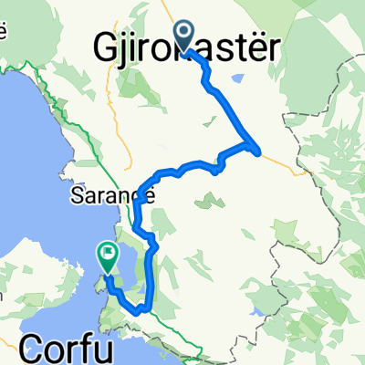
De Gjirokastër à Saranda
Cycling route in Gjirokastër, Gjirokastër County, Albania
- 64.4 km
- Distance
- 1,777 m
- Ascent
- 2,055 m
- Descent

argirocastro - Permet
Cycling route in Gjirokastër, Gjirokastër County, Albania
- 65.7 km
- Distance
- 717 m
- Ascent
- 667 m
- Descent
Discover more routes
- All routes in Gjirokastër
- Round trips
- Relaxed
- Gravel
- Road
- MTB
- Trekking