
Cycling in Natahoyo
Discover a map of 230 cycling routes and bike trails near Natahoyo, created by our community.
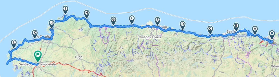
Region portrait
Get to know Natahoyo
Find the right bike route for you through Natahoyo, where we've got 230 cycle routes to explore. Most people get on their bikes to ride here in the months of August and October.
18,313 km
Tracked distance
230
Cycle routes
20,000
Population
Community
Most active users in Natahoyo


Handpicked routes
Discover Natahoyo through these collections
- Tour
From our community
The best bike routes in and around Natahoyo
Avenida José Madre Palacio Álvarez, Gijón a Calle de Corín Tellado, Gijón
Cycling route in Natahoyo, Principality of Asturias, Spain
- 7.3 km
- Distance
- 28 m
- Ascent
- 31 m
- Descent

Barrio Campones Urbano, Gijón a Avenida del Príncipe de Asturias, Gijón
Cycling route in Natahoyo, Principality of Asturias, Spain
- 2.2 km
- Distance
- 25 m
- Ascent
- 30 m
- Descent

Barrio Campones Urbano, Gijón a Calle de Corín Tellado, Gijón
Cycling route in Natahoyo, Principality of Asturias, Spain
- 10.2 km
- Distance
- 55 m
- Ascent
- 65 m
- Descent
Ruta en Gijón
Cycling route in Natahoyo, Principality of Asturias, Spain
- 6.4 km
- Distance
- 145 m
- Ascent
- 77 m
- Descent
Discover more routes
 Calle de la Solidaridad, Gijón a Calle de Corín Tellado, Gijón
- Distance
- 15.2 km
- Ascent
- 111 m
- Descent
- 116 m
- Location
- Natahoyo, Principality of Asturias, Spain
 Calle de la Solidaridad, Gijón a Calle de Corín Tellado, Gijón
- Distance
- 15.2 km
- Ascent
- 111 m
- Descent
- 116 m
- Location
- Natahoyo, Principality of Asturias, Spain
 CN_06_28
- Distance
- 55.8 km
- Ascent
- 1,171 m
- Descent
- 1,172 m
- Location
- Natahoyo, Principality of Asturias, Spain
 CaminoDelNorte_06a
- Distance
- 58.3 km
- Ascent
- 1,059 m
- Descent
- 1,063 m
- Location
- Natahoyo, Principality of Asturias, Spain
 SALIDA PYNOSPERDIUS 24/03/12
- Distance
- 105.7 km
- Ascent
- 2,170 m
- Descent
- 2,177 m
- Location
- Natahoyo, Principality of Asturias, Spain
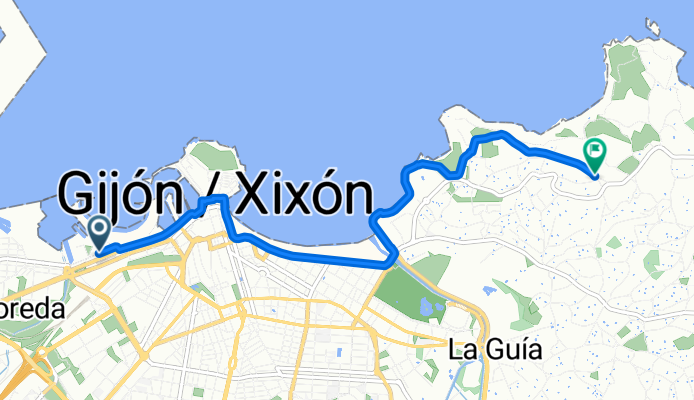
 Playa de Poniente-Playa La Ñora
- Distance
- 12.2 km
- Ascent
- 303 m
- Descent
- 270 m
- Location
- Natahoyo, Principality of Asturias, Spain
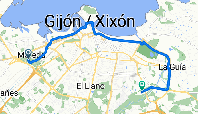
 Gijón/Xixón
- Distance
- 24.4 km
- Ascent
- 151 m
- Descent
- 152 m
- Location
- Natahoyo, Principality of Asturias, Spain
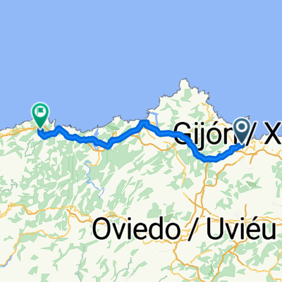
 GIJÓN - LUARCA
- Distance
- 104.5 km
- Ascent
- 1,209 m
- Descent
- 832 m
- Location
- Natahoyo, Principality of Asturias, Spain
Routes from Natahoyo
By bicycle from
Natahoyo to Gijón
Routes to Natahoyo
By bicycle from
Gijón to Natahoyo