
Cycling in Rodsley
Discover a map of 9 cycling routes and bike trails near Rodsley, created by our community.
Region portrait
Get to know Rodsley
Find the right bike route for you through Rodsley, where we've got 9 cycle routes to explore.
199 km
Tracked distance
9
Cycle routes
Community
Most active users in Rodsley


From our community
The best bike routes in and around Rodsley
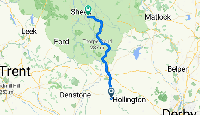
1–6 Rodsley Lane, Ashbourne to B5054, Buxton
Cycling route in Rodsley, England, United Kingdom
- 26.8 km
- Distance
- 374 m
- Ascent
- 291 m
- Descent
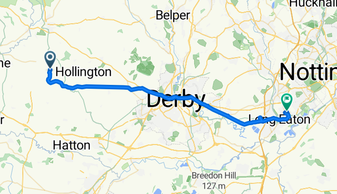
Hellingly House, Leapley Lane, Ashbourne to Swiney Way, Nottingham
Cycling route in Rodsley, England, United Kingdom
- 39.9 km
- Distance
- 168 m
- Ascent
- 288 m
- Descent
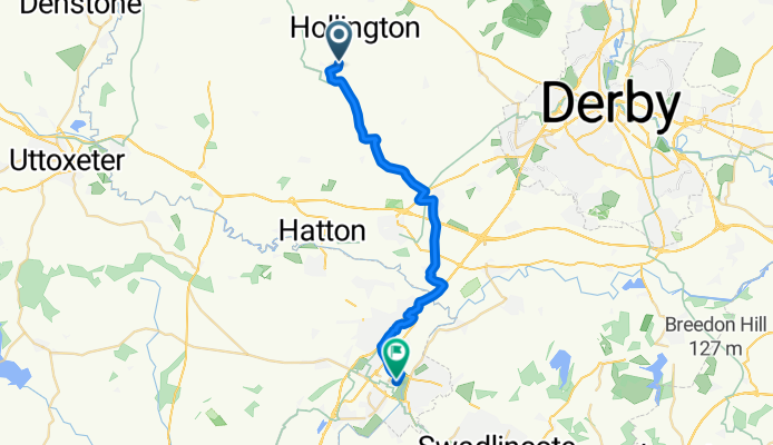
Hoargate Lane, Hollington, Ashbourne to 50 Cosmopolitan, High St, Burton-On-Trent
Cycling route in Rodsley, England, United Kingdom
- 22.2 km
- Distance
- 61 m
- Ascent
- 97 m
- Descent
Discover more routes
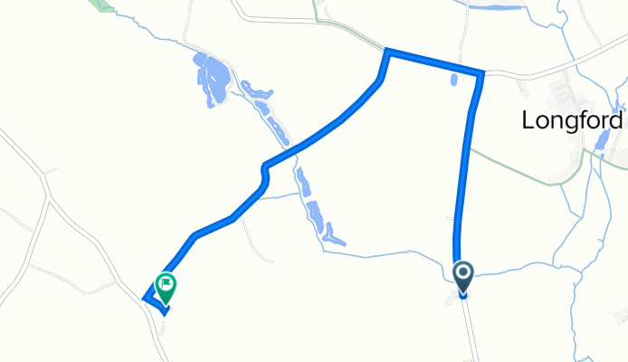
 11 Fearne Close, Derby to Calke, Derby
- Distance
- 28.7 km
- Ascent
- 165 m
- Descent
- 137 m
- Location
- Rodsley, England, United Kingdom
 Rose Cottage, Park Lane, Ashbourne to Visitors Centre, Carsington Water, Ashbourne
- Distance
- 17.4 km
- Ascent
- 238 m
- Descent
- 148 m
- Location
- Rodsley, England, United Kingdom
 Park Lane, Rodsley, Ashbourne to Visitors Centre, Carsington Water, Ashbourne
- Distance
- 16.8 km
- Ascent
- 248 m
- Descent
- 159 m
- Location
- Rodsley, England, United Kingdom
 Route to 6 Fearne Close, Derby
- Distance
- 22 km
- Ascent
- 110 m
- Descent
- 110 m
- Location
- Rodsley, England, United Kingdom
 Steady ride in Ashbourne
- Distance
- 21.5 km
- Ascent
- 240 m
- Descent
- 252 m
- Location
- Rodsley, England, United Kingdom