
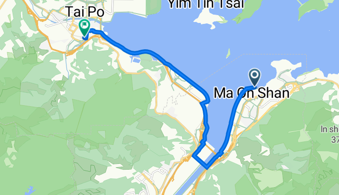
Route template
Sai Kung to Tai Po

- 2 h 9 min
- Duration
- 28.3 km
- Distance
- 591 m
- Ascent
- 636 m
- Descent
- 13.2 km/h
- Avg. speed
- 254 m
- Max. altitude
Kick off your ride from the laid-back, seaside town of Sai Kung—the “back garden of Hong Kong”—famous for its seafood and chilled waterfront vibes. This route takes you on a rolling, nearly 28.3 km journey north to Tai Po, a lively district by the Lam Tsuen River with bustling wet markets and the scenic Tai Po Waterfront Park.
You’ll be cruising mostly on paved surfaces (lots of cycleway and some quiet roads), though keep an eye out for short stretches where the surface or signs might be missing. There’s some climbing involved, so get ready for a decent workout, with about 590m uphill and nearly the same coming down. Max elevation gets you up to about 254m, which means you’ll be rewarded with sweeping views of the hills midway.
Once you reach Tai Po, be sure to reward yourself with some street snacks or a stroll along the Tolo Harbour promenade. It’s a great mix of nature, local flavor, and urban buzz—perfect for a half-day ride!
Community
Top users in this region


From our community
The best bike routes from Sai Kung to Tai Po

大水坑 至 船灣水壩
Cycling route in Sai Kung, Sai Kung District, Hong Kong
- 19.9 km
- Distance
- 86 m
- Ascent
- 84 m
- Descent

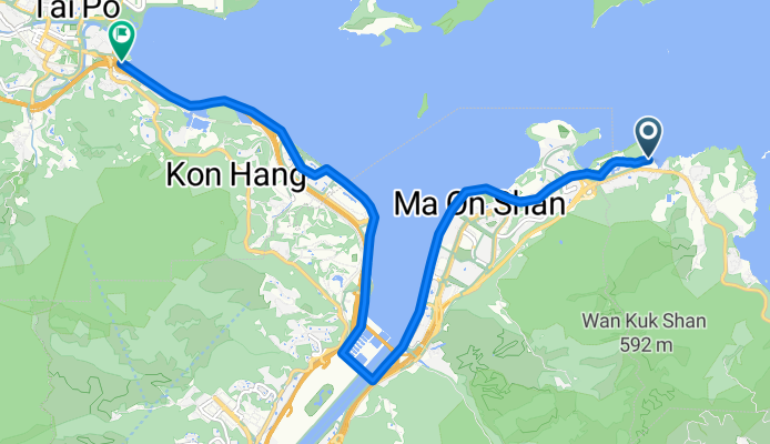
馬鞍山 - 上水大水管
Cycling route in Sai Kung, Sai Kung District, Hong Kong
- 25.9 km
- Distance
- 90 m
- Ascent
- 93 m
- Descent

MUI TSZ LAM & MA ON SHAN
Cycling route in Sai Kung, Sai Kung District, Hong Kong
- 46 km
- Distance
- 479 m
- Ascent
- 492 m
- Descent

馬鞍山海濱長廊 to 科技大道東 12
Cycling route in Sai Kung, Sai Kung District, Hong Kong
- 10.9 km
- Distance
- 6 m
- Ascent
- 7 m
- Descent


補trip第二日
Cycling route in Sai Kung, Sai Kung District, Hong Kong
- 64.9 km
- Distance
- 410 m
- Ascent
- 412 m
- Descent

Route from Sai Sha Road, Ma On Shan
Cycling route in Sai Kung, Sai Kung District, Hong Kong
- 10.6 km
- Distance
- 100 m
- Ascent
- 104 m
- Descent

training 11
Cycling route in Sai Kung, Sai Kung District, Hong Kong
- 13.8 km
- Distance
- 96 m
- Ascent
- 92 m
- Descent

dfdfdfddfdfdfdfsdfsf
Cycling route in Sai Kung, Sai Kung District, Hong Kong
- 47 km
- Distance
- 428 m
- Ascent
- 439 m
- Descent

烏溪沙 - 花都
Cycling route in Sai Kung, Sai Kung District, Hong Kong
- 23.7 km
- Distance
- 129 m
- Ascent
- 97 m
- Descent
Discover more routes
 馬鞍山海濱長廊 to 科技大道東 12
- Distance
- 10.9 km
- Ascent
- 6 m
- Descent
- 7 m
- Location
- Sai Kung, Sai Kung District, Hong Kong
 馬鞍山 - 大埔
- Distance
- 15.3 km
- Ascent
- 84 m
- Descent
- 87 m
- Location
- Sai Kung, Sai Kung District, Hong Kong
 補trip第二日
- Distance
- 64.9 km
- Ascent
- 410 m
- Descent
- 412 m
- Location
- Sai Kung, Sai Kung District, Hong Kong
 Route from Sai Sha Road, Ma On Shan
- Distance
- 10.6 km
- Ascent
- 100 m
- Descent
- 104 m
- Location
- Sai Kung, Sai Kung District, Hong Kong
 2018-4
- Distance
- 19.8 km
- Ascent
- 274 m
- Descent
- 273 m
- Location
- Sai Kung, Sai Kung District, Hong Kong
 training 11
- Distance
- 13.8 km
- Ascent
- 96 m
- Descent
- 92 m
- Location
- Sai Kung, Sai Kung District, Hong Kong
 dfdfdfddfdfdfdfsdfsf
- Distance
- 47 km
- Ascent
- 428 m
- Descent
- 439 m
- Location
- Sai Kung, Sai Kung District, Hong Kong
 烏溪沙 - 花都
- Distance
- 23.7 km
- Ascent
- 129 m
- Descent
- 97 m
- Location
- Sai Kung, Sai Kung District, Hong Kong
Routes from Sai Kung
Cycling day trip from
Sai Kung to Shatin
Cycling day trip from
Sai Kung to Kowloon
Routes to Tai Po
Cycling day trip from
Tuenmen to Tai Po
Cycling day trip from
Yuen Long Kau Hui to Tai Po
Quick ride by bicycle from
Shatin to Tai Po