
Route template
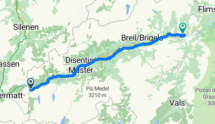
Andermatt to Ilanz

- 5 h 54 min
- Duration
- 77.4 km
- Distance
- 2,977 m
- Ascent
- 3,711 m
- Descent
- 13.1 km/h
- Avg. speed
- 2,047 m
- Max. altitude
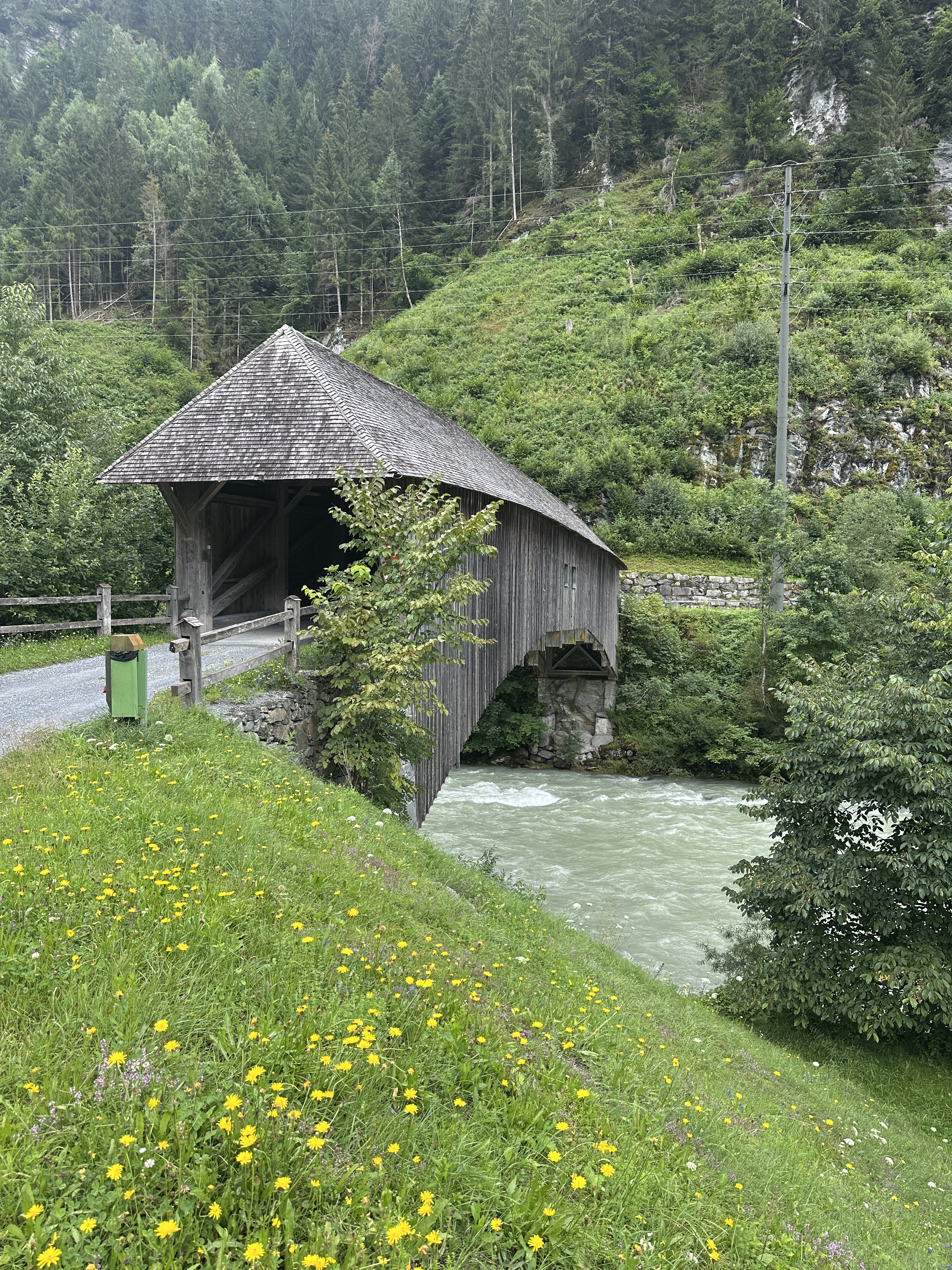
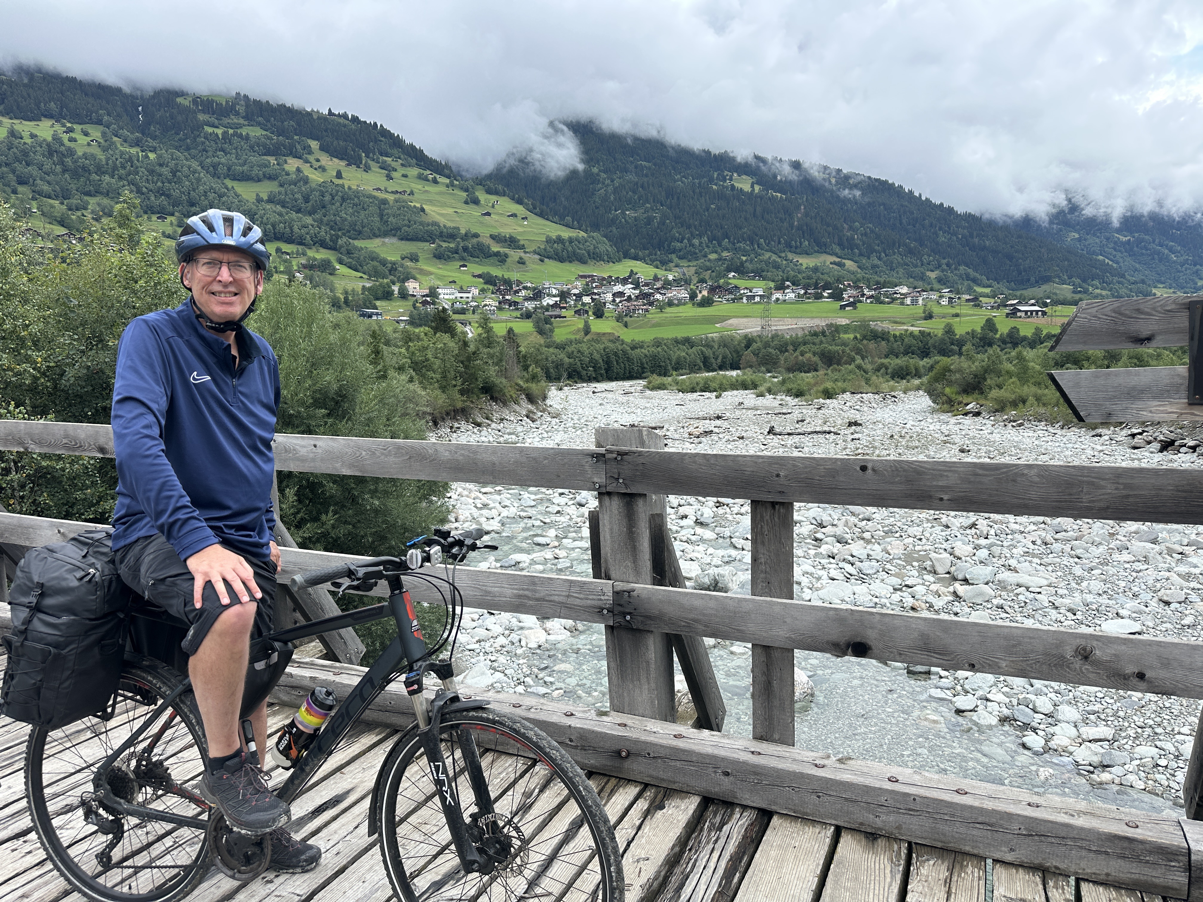
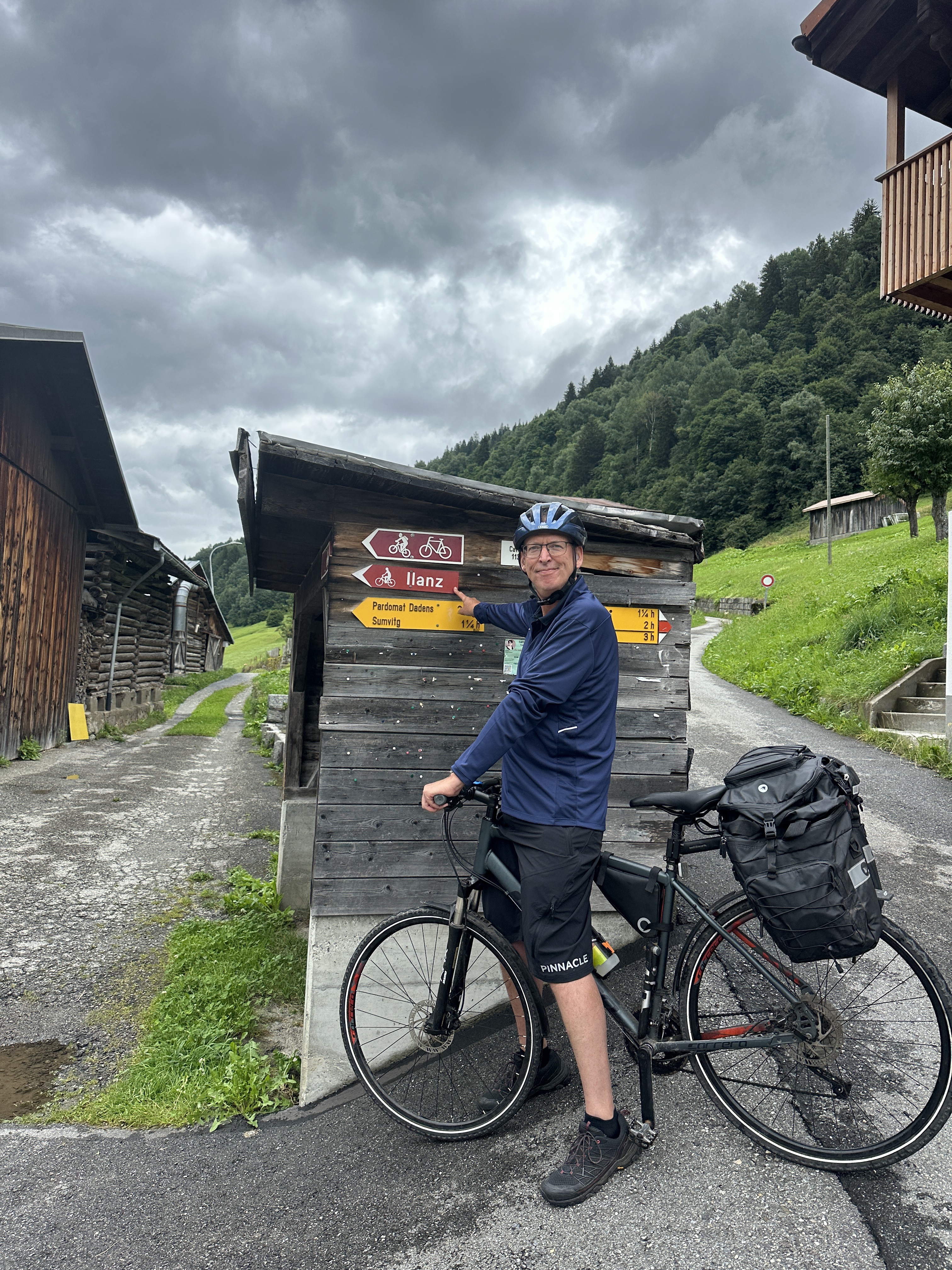
This ride starts in Andermatt, a charming Swiss alpine village famous for its dramatic mountain scenery and role as a crossroads for historic passes. The route to Ilanz is a true alpine challenge—spanning roughly 77 km with nearly 3,000 meters of climbing and over 3,700 meters of descent! You’ll be weaving through high mountain roads (the max elevation exceeds 2,000 meters), so expect epic views and leg-testing ascents, but also thrilling long descents.
About two-thirds of the surfaces are paved or asphalt, but keep your eyes out for gravel and unpaved sections (about 20%), so a sturdy bike is recommended. The journey will have you on plenty of quiet roads and tracks, taking you off the beaten path and deep into the heart of the Alps.
You’ll finish in Ilanz, sometimes called "the first town on the Rhine," with a relaxed vibe and beautiful river views. Make time at both ends: Andermatt is perfect for a pre-ride espresso, and Ilanz is great for a well-earned post-ride meal. This is a spectacular alpine route—perfect for adventurous cyclists!
Community
Top users in this region


From our community
The best bike routes from Andermatt to Ilanz
![[DAY 19] Göschenen - Ilanz](https://media.bikemap.net/routes/8561780/gallery/thumbs/af10c4bc-a85d-4013-8c11-c6c25ccc528a.jpeg.0x384_q80.jpg)
![[DAY 19] Göschenen - Ilanz](https://media.bikemap.net/routes/8561780/gallery/thumbs/e2faa872-fbc3-4c2c-b538-870033855a8f.jpeg.0x384_q80.jpg)
![[DAY 19] Göschenen - Ilanz](https://media.bikemap.net/routes/8561780/gallery/thumbs/eb5987fc-cb3a-4a38-8faf-3218f15fa9b8.jpeg.0x384_q80.jpg)
![[DAY 19] Göschenen - Ilanz](https://media.bikemap.net/routes/8561780/staticmaps/in_2c7d3584-57a1-4372-ac45-1c8dc3e2e5a4_694x400_bikemap-2021-3D-static.png)
[DAY 19] Göschenen - Ilanz
Cycling route in Andermatt, Canton of Uri, Switzerland
- 68.1 km
- Distance
- 984 m
- Ascent
- 1,380 m
- Descent

Rheinradtour Teil1/Etappe1
Cycling route in Andermatt, Canton of Uri, Switzerland
- 51.4 km
- Distance
- 620 m
- Ascent
- 1,924 m
- Descent
Via Alpsu, Rueras to Klosterweg, Ilanz
Cycling route in Andermatt, Canton of Uri, Switzerland
- 53.1 km
- Distance
- 526 m
- Ascent
- 1,579 m
- Descent

RR01 - Oberalppass - Ilanz
Cycling route in Andermatt, Canton of Uri, Switzerland
- 52.9 km
- Distance
- 442 m
- Ascent
- 1,776 m
- Descent

Klassenlager Valata 2014
Cycling route in Andermatt, Canton of Uri, Switzerland
- 46.3 km
- Distance
- 509 m
- Ascent
- 1,346 m
- Descent

RR01 Oberalppass-Ilanz.kml - RR01 Oberalppass-Ilanz.kml_RR01 Oberalppass-Ilanz
Cycling route in Andermatt, Canton of Uri, Switzerland
- 52.7 km
- Distance
- 1,069 m
- Ascent
- 2,401 m
- Descent

Andermatt - Ilanz
Cycling route in Andermatt, Canton of Uri, Switzerland
- 63 km
- Distance
- 1,121 m
- Ascent
- 1,871 m
- Descent

#1 Oberalpass to Castrisch
Cycling route in Andermatt, Canton of Uri, Switzerland
- 53.4 km
- Distance
- 89 m
- Ascent
- 1,395 m
- Descent

RR01 Oberalppass-Ilanz.kml_RR01 Oberalppass-Ilanz
Cycling route in Andermatt, Canton of Uri, Switzerland
- 52.9 km
- Distance
- 0 m
- Ascent
- 0 m
- Descent

day 4 PART 4 ANDERMATT-IIANZ
Cycling route in Andermatt, Canton of Uri, Switzerland
- 62.3 km
- Distance
- 1,061 m
- Ascent
- 1,800 m
- Descent

Day 1 EuroVelo 15 Switzerland
Cycling route in Andermatt, Canton of Uri, Switzerland
- 63.7 km
- Distance
- 661 m
- Ascent
- 1,404 m
- Descent

RR01 Oberalppass-Ilanz.kml - RR01 Oberalppass-Ilanz.kml_RR01 Oberalppass-Ilanz
Cycling route in Andermatt, Canton of Uri, Switzerland
- 52.8 km
- Distance
- 1,075 m
- Ascent
- 2,410 m
- Descent
Discover more routes
 Klassenlager Valata 2014
- Distance
- 46.3 km
- Ascent
- 509 m
- Descent
- 1,346 m
- Location
- Andermatt, Canton of Uri, Switzerland
 RR01 Oberalppass-Ilanz.kml - RR01 Oberalppass-Ilanz.kml_RR01 Oberalppass-Ilanz
- Distance
- 52.7 km
- Ascent
- 1,069 m
- Descent
- 2,401 m
- Location
- Andermatt, Canton of Uri, Switzerland
 Andermatt - Ilanz
- Distance
- 63 km
- Ascent
- 1,121 m
- Descent
- 1,871 m
- Location
- Andermatt, Canton of Uri, Switzerland
 #1 Oberalpass to Castrisch
- Distance
- 53.4 km
- Ascent
- 89 m
- Descent
- 1,395 m
- Location
- Andermatt, Canton of Uri, Switzerland
 RR01 Oberalppass-Ilanz.kml_RR01 Oberalppass-Ilanz
- Distance
- 52.9 km
- Ascent
- 0 m
- Descent
- 0 m
- Location
- Andermatt, Canton of Uri, Switzerland
 day 4 PART 4 ANDERMATT-IIANZ
- Distance
- 62.3 km
- Ascent
- 1,061 m
- Descent
- 1,800 m
- Location
- Andermatt, Canton of Uri, Switzerland
 Day 1 EuroVelo 15 Switzerland
- Distance
- 63.7 km
- Ascent
- 661 m
- Descent
- 1,404 m
- Location
- Andermatt, Canton of Uri, Switzerland
 RR01 Oberalppass-Ilanz.kml - RR01 Oberalppass-Ilanz.kml_RR01 Oberalppass-Ilanz
- Distance
- 52.8 km
- Ascent
- 1,075 m
- Descent
- 2,410 m
- Location
- Andermatt, Canton of Uri, Switzerland
Routes from Andermatt
Bikepacking from
Andermatt to Meiringen
Cycling day trip from
Andermatt to Bellinzona
Cycling day trip from
Andermatt to Airolo