
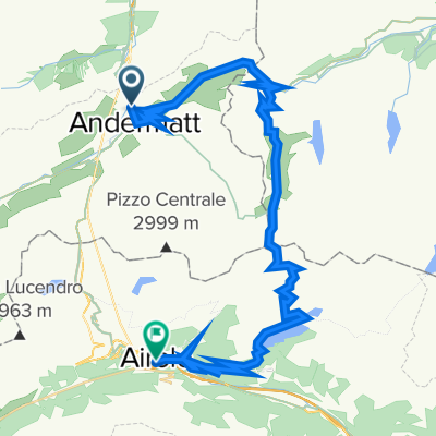
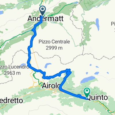
Route template
Andermatt to Airolo

- 2 h 31 min
- Duration
- 26.8 km
- Distance
- 1,052 m
- Ascent
- 1,336 m
- Descent
- 10.6 km/h
- Avg. speed
- 2,190 m
- Max. altitude
Get ready for a stunning Alpine adventure! This cycling route takes you from the high-mountain village of Andermatt to the picturesque town of Airolo, both key stops along the historic Gotthard Pass. The ride is about 27 km long and packs in over 1,000 meters of climbing—so bring your climbing legs and prepare for some epic switchbacks!
You’ll start in Andermatt, a famous Swiss mountain hub at the heart of several alpine passes. Right from the get-go, you’re on iconic territory: most of your route follows paved (and mostly asphalt) roads, with some cool stretches of cobblestones that make you feel like you’re racing the classics. Expect panoramic views and a true sense of history as you crest the pass’s summit—sitting over 2,100 meters above sea level.
Then comes the thrilling descent towards Airolo, where lush forests and mountain streams accompany your speedy arrival. It’s not all smooth sailing—watch out for those sections of gravel and the occasional busy road, but the epic scenery more than makes up for it.
By the time you roll into Airolo, you’ll feel like you’ve conquered the Alps—because, well, you just did!
Community
Top users in this region


From our community
The best bike routes from Andermatt to Airolo

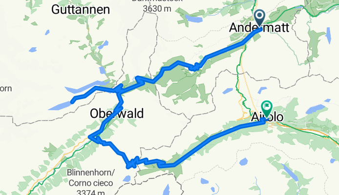
Göschenen Airolo (Susten - Furka - Nufenen)
Cycling route in Andermatt, Canton of Uri, Switzerland
- 130.1 km
- Distance
- 4,591 m
- Ascent
- 4,034 m
- Descent

Andermatt to Airola
Cycling route in Andermatt, Canton of Uri, Switzerland
- 25.2 km
- Distance
- 676 m
- Ascent
- 944 m
- Descent
Giro di Lepontine 2021 - stage 2
Cycling route in Andermatt, Canton of Uri, Switzerland
- 103.7 km
- Distance
- 2,697 m
- Ascent
- 2,979 m
- Descent

Furka/Nufenen
Cycling route in Andermatt, Canton of Uri, Switzerland
- 80.3 km
- Distance
- 2,094 m
- Ascent
- 2,391 m
- Descent

Giro di Lepontine 2021 - stage 3
Cycling route in Andermatt, Canton of Uri, Switzerland
- 131.5 km
- Distance
- 2,312 m
- Ascent
- 2,567 m
- Descent


Schweizer Alpenrundfahrt
Cycling route in Andermatt, Canton of Uri, Switzerland
- 73.9 km
- Distance
- 1,962 m
- Ascent
- 2,132 m
- Descent

Andermatt-Oberalppass-Bornengo-Airolo
Cycling route in Andermatt, Canton of Uri, Switzerland
- 46.6 km
- Distance
- 1,593 m
- Ascent
- 1,884 m
- Descent

over Oberalppass and Furkapass
Cycling route in Andermatt, Canton of Uri, Switzerland
- 54.9 km
- Distance
- 1,394 m
- Ascent
- 1,665 m
- Descent

Andermatt-Oberalp-Bornengo-Airolo
Cycling route in Andermatt, Canton of Uri, Switzerland
- 32.6 km
- Distance
- 1,388 m
- Ascent
- 1,673 m
- Descent
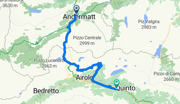
Andermatt - Airolo
Cycling route in Andermatt, Canton of Uri, Switzerland
- 35.2 km
- Distance
- 1,431 m
- Ascent
- 1,871 m
- Descent
Down_Furkapass
Cycling route in Andermatt, Canton of Uri, Switzerland
- 16.6 km
- Distance
- 13 m
- Ascent
- 1,060 m
- Descent
Discover more routes
 Giro di Lepontine 2021 - stage 3
- Distance
- 131.5 km
- Ascent
- 2,312 m
- Descent
- 2,567 m
- Location
- Andermatt, Canton of Uri, Switzerland
 フルカ峠
フルカ峠- Distance
- 29.8 km
- Ascent
- 918 m
- Descent
- 1,063 m
- Location
- Andermatt, Canton of Uri, Switzerland
 Schweizer Alpenrundfahrt
- Distance
- 73.9 km
- Ascent
- 1,962 m
- Descent
- 2,132 m
- Location
- Andermatt, Canton of Uri, Switzerland
 Andermatt-Oberalppass-Bornengo-Airolo
- Distance
- 46.6 km
- Ascent
- 1,593 m
- Descent
- 1,884 m
- Location
- Andermatt, Canton of Uri, Switzerland
 over Oberalppass and Furkapass
- Distance
- 54.9 km
- Ascent
- 1,394 m
- Descent
- 1,665 m
- Location
- Andermatt, Canton of Uri, Switzerland
 Andermatt-Oberalp-Bornengo-Airolo
- Distance
- 32.6 km
- Ascent
- 1,388 m
- Descent
- 1,673 m
- Location
- Andermatt, Canton of Uri, Switzerland
 Andermatt - Airolo
- Distance
- 35.2 km
- Ascent
- 1,431 m
- Descent
- 1,871 m
- Location
- Andermatt, Canton of Uri, Switzerland
 Down_Furkapass
- Distance
- 16.6 km
- Ascent
- 13 m
- Descent
- 1,060 m
- Location
- Andermatt, Canton of Uri, Switzerland
Routes from Andermatt
Bikepacking from
Andermatt to Meiringen
Cycling day trip from
Andermatt to Fiesch
Cycling day trip from
Andermatt to Bellinzona
Routes to Airolo
Cycling day trip from
Fiesch to Airolo