
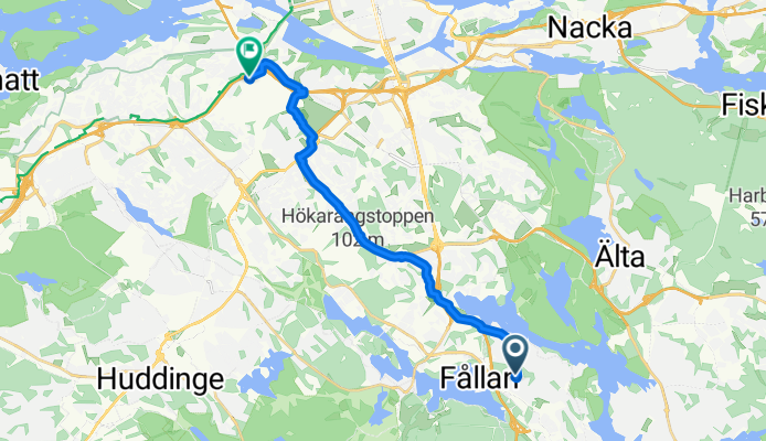
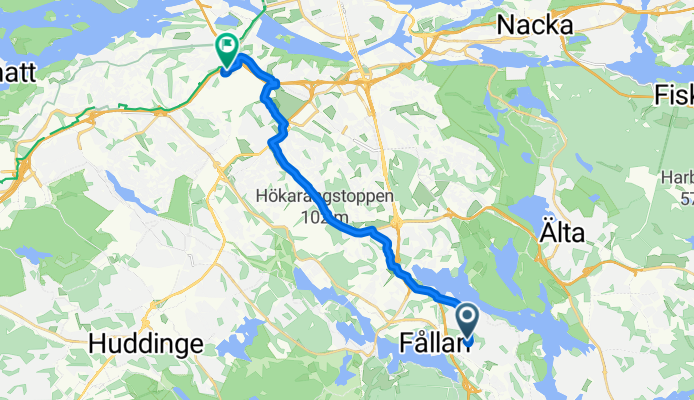
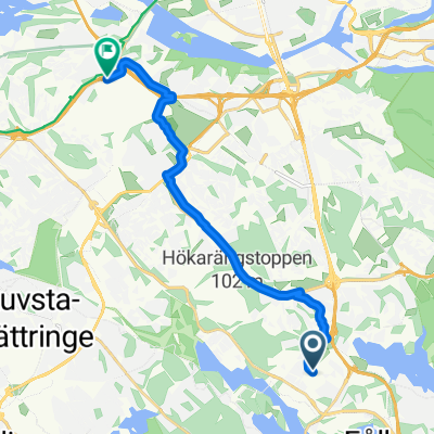
Route template
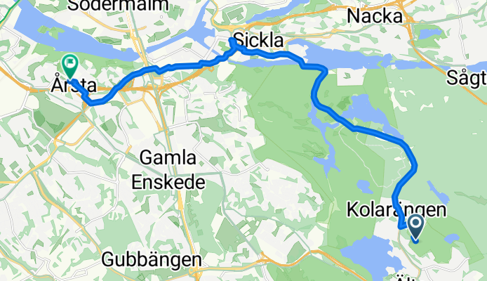
Älta to Årsta
- 49 min
- Duration
- 12.9 km
- Distance
- 144 m
- Ascent
- 163 m
- Descent
- 15.6 km/h
- Avg. speed
- 60 m
- Max. altitude
This pleasant ride takes you from the leafy suburb of Älta to the vibrant district of Årsta, covering just under 13 km—perfect for a leisurely adventure or a scenic commute. You’ll mostly be rolling on smooth asphalt and dedicated cycleways, so it’s a relaxed and safe route almost all the way.
Starting out in Älta, known for its beautiful lakes and proximity to Nacka Nature Reserve, you’ll quickly leave the peaceful residential streets and glide through stretches of greenery. The gentle climbs (with a total ascent of about 144 meters) will give your legs a little workout, but they’re nothing too steep. Enjoy a mix of urban surroundings and nature as you pass through parks and quiet neighborhoods.
Rolling into Årsta, you’ll find a lively community with cozy cafés and a classic Swedish “folkhem” vibe. Årsta is renowned for its functionalist architecture and its strong sense of community. So, park your bike and soak up the local charm—you’ve earned it after a sweet, mostly-paved ride!
Community
Top users in this region


From our community
The best bike routes from Älta to Årsta
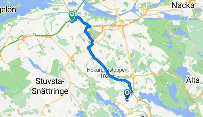
Sköndalsvägen 77 to Harpsundsvägen 81
Cycling route in Älta, Stockholm County, Sweden
- 4.9 km
- Distance
- 36 m
- Ascent
- 37 m
- Descent
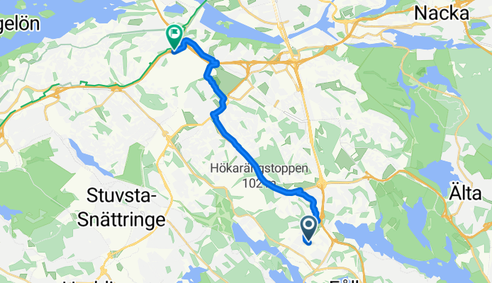
ride from Älta to Stockholm
Cycling route in Älta, Stockholm County, Sweden
- 13 km
- Distance
- 95 m
- Ascent
- 88 m
- Descent
Älta Sköndal Hökis
Cycling route in Älta, Stockholm County, Sweden
- 10.3 km
- Distance
- 94 m
- Ascent
- 90 m
- Descent
Tornslingan, Trångsund to Västberga allé, Hägersten
Cycling route in Älta, Stockholm County, Sweden
- 14 km
- Distance
- 109 m
- Ascent
- 140 m
- Descent

Tornslingan, Trångsund to Vretensborgsvägen, Hägersten
Cycling route in Älta, Stockholm County, Sweden
- 14.4 km
- Distance
- 145 m
- Ascent
- 187 m
- Descent

Tornslingan, Trångsund to Västberga allé, Hägersten
Cycling route in Älta, Stockholm County, Sweden
- 14 km
- Distance
- 116 m
- Ascent
- 149 m
- Descent
Tornslingan, Trångsund to Västberga allé, Hägersten
Cycling route in Älta, Stockholm County, Sweden
- 13.7 km
- Distance
- 85 m
- Ascent
- 115 m
- Descent
Tornslingan, Trångsund to Västberga allé, Hägersten
Cycling route in Älta, Stockholm County, Sweden
- 14 km
- Distance
- 133 m
- Ascent
- 165 m
- Descent

Tornslingan, Trångsund to Västberga allé, Hägersten
Cycling route in Älta, Stockholm County, Sweden
- 13.8 km
- Distance
- 109 m
- Ascent
- 137 m
- Descent
Kroppaplan, Farsta to Vretensborgsvägen, Hägersten
Cycling route in Älta, Stockholm County, Sweden
- 11.2 km
- Distance
- 88 m
- Ascent
- 97 m
- Descent
Tornslingan, Trångsund to Vretensborgsvägen, Hägersten
Cycling route in Älta, Stockholm County, Sweden
- 14.6 km
- Distance
- 117 m
- Ascent
- 139 m
- Descent
Farsta Torg, Farsta to Vretensborgsvägen, Hägersten
Cycling route in Älta, Stockholm County, Sweden
- 11.3 km
- Distance
- 89 m
- Ascent
- 95 m
- Descent
Discover more routes
 Tornslingan, Trångsund to Vretensborgsvägen, Hägersten
- Distance
- 14.4 km
- Ascent
- 145 m
- Descent
- 187 m
- Location
- Älta, Stockholm County, Sweden
 Tornslingan, Trångsund to Västberga allé, Hägersten
- Distance
- 14 km
- Ascent
- 116 m
- Descent
- 149 m
- Location
- Älta, Stockholm County, Sweden
 Tornslingan, Trångsund to Västberga allé, Hägersten
- Distance
- 13.7 km
- Ascent
- 85 m
- Descent
- 115 m
- Location
- Älta, Stockholm County, Sweden
 Tornslingan, Trångsund to Västberga allé, Hägersten
- Distance
- 14 km
- Ascent
- 133 m
- Descent
- 165 m
- Location
- Älta, Stockholm County, Sweden
 Tornslingan, Trångsund to Västberga allé, Hägersten
- Distance
- 13.8 km
- Ascent
- 109 m
- Descent
- 137 m
- Location
- Älta, Stockholm County, Sweden
 Kroppaplan, Farsta to Vretensborgsvägen, Hägersten
- Distance
- 11.2 km
- Ascent
- 88 m
- Descent
- 97 m
- Location
- Älta, Stockholm County, Sweden
 Tornslingan, Trångsund to Vretensborgsvägen, Hägersten
- Distance
- 14.6 km
- Ascent
- 117 m
- Descent
- 139 m
- Location
- Älta, Stockholm County, Sweden
 Farsta Torg, Farsta to Vretensborgsvägen, Hägersten
- Distance
- 11.3 km
- Ascent
- 89 m
- Descent
- 95 m
- Location
- Älta, Stockholm County, Sweden
Routes from Älta
Quick ride by bicycle from
Älta to Stockholm
Routes to Årsta
Quick ride by bicycle from
Bromma to Årsta
Quick ride by bicycle from
Stockholm to Årsta