
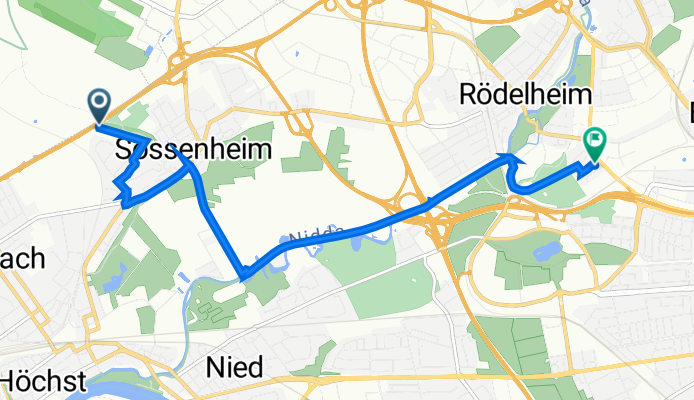
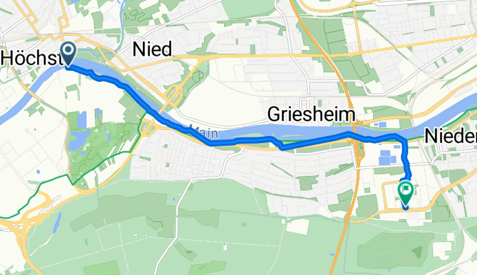
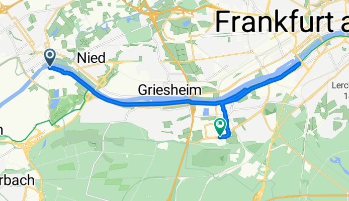
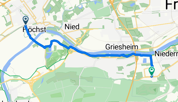
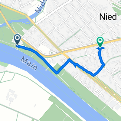
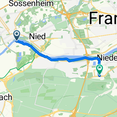
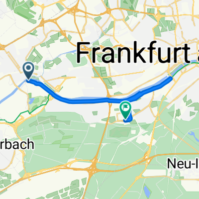
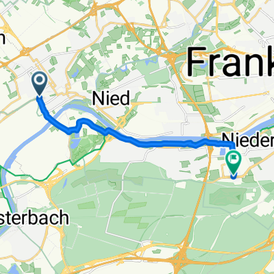
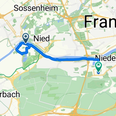
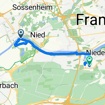
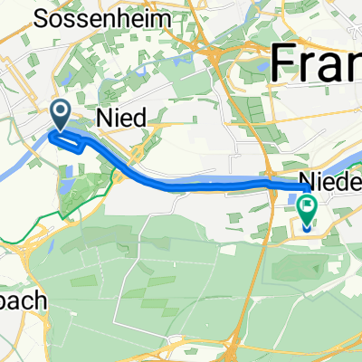
Route template
Sulzbach to Niederrad

- 55 min
- Duration
- 15.7 km
- Distance
- 41 m
- Ascent
- 71 m
- Descent
- 17.2 km/h
- Avg. speed
- 153 m
- Max. altitude
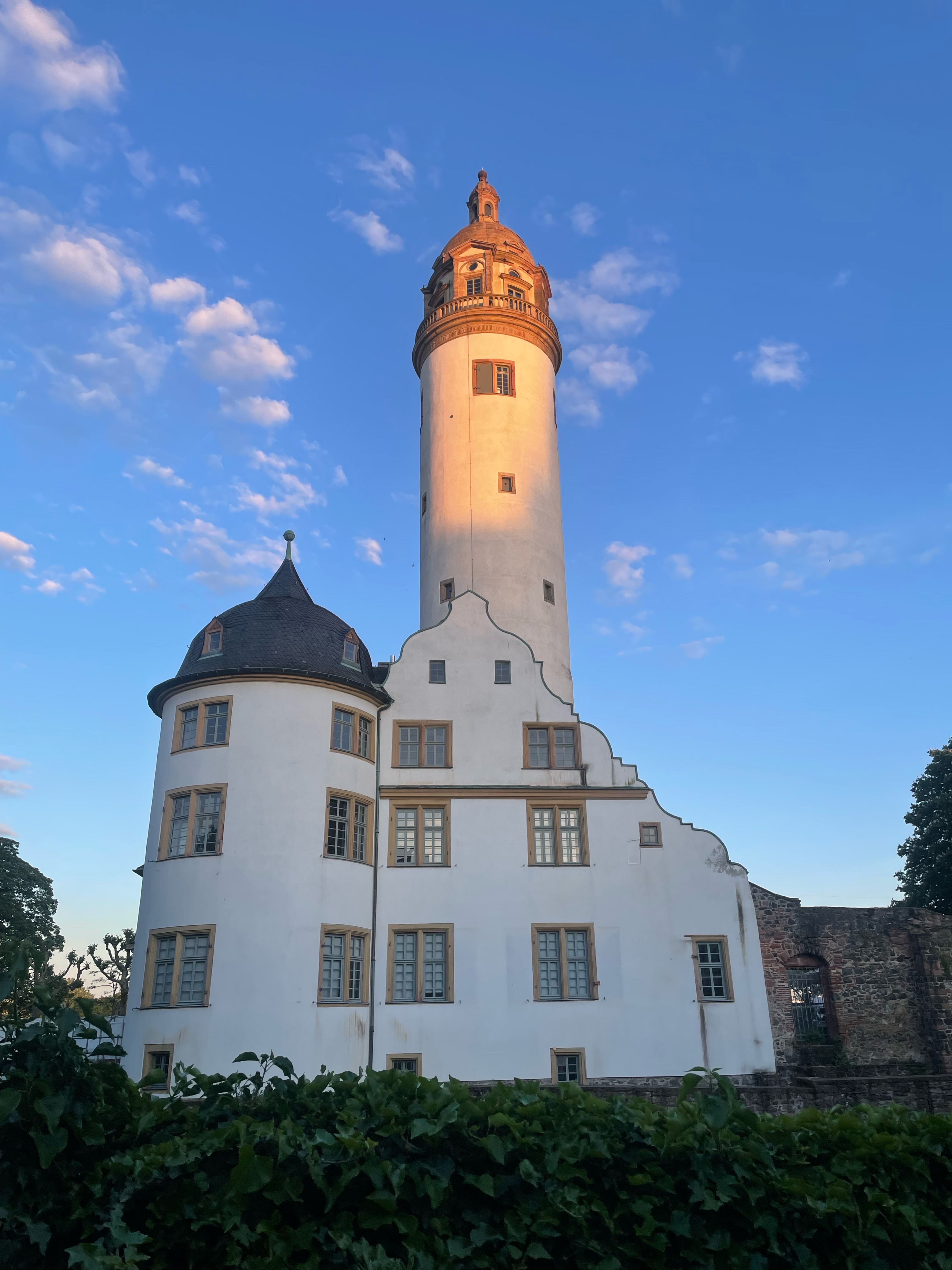
This relaxed cycling route takes you from Sulzbach, a charming small town just west of Frankfurt, into the urban greenery of Frankfurt-Niederrad. Starting at Sulzbach’s historic center (home to the scenic Arboretum Main-Taunus), you’ll wind your way southeast for a little over 15.5 km—most of it gently downhill with only 41 meters of ascent, so it’s easy on the legs!
The route is super rider-friendly, with a whopping 98% of the way paved and plenty of stretches on smooth asphalt and cycle paths. You’ll glide past quiet roads, a few paved tracks, and even some quaint sections with paving stones.
As you pedal into Niederrad, you’ll catch a more metropolitan vibe and maybe even spot some of the impressive modernist buildings that dot this district. It’s the perfect ride if you want a taste of both peaceful countryside and buzzing city life—all in less than an hour’s ride. Don’t forget to grab some coffee and cake at one of Niederrad’s local bakeries when you finish!
Community
Top users in this region


From our community
The best bike routes from Sulzbach to Niederrad

Burggraben, Frankfurt am Main nach Lyoner Straße 52G, Frankfurt am Main
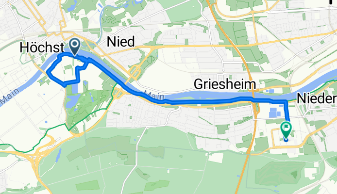
Cycling route in Sulzbach, Hesse, Germany
- 8.8 km
- Distance
- 397 m
- Ascent
- 390 m
- Descent

Nordtour Ffm Grüngürtel
Cycling route in Sulzbach, Hesse, Germany
- 30.2 km
- Distance
- 102 m
- Ascent
- 74 m
- Descent

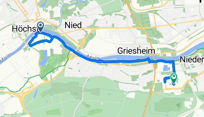
Frankfurt am Main - Ffm Höchst
Cycling route in Sulzbach, Hesse, Germany
- 6.9 km
- Distance
- 26 m
- Ascent
- 23 m
- Descent
Route nach Kohlrauschweg 10, Frankfurt am Main
Cycling route in Sulzbach, Hesse, Germany
- 7.6 km
- Distance
- 7 m
- Ascent
- 63 m
- Descent

Mainzer Landstraße 793, Frankfurt am Main nach Am Mainplacken 4, Frankfurt am Main
Cycling route in Sulzbach, Hesse, Germany
- 1.1 km
- Distance
- 7 m
- Ascent
- 40 m
- Descent

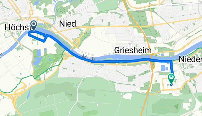
Höchster Weg, Frankfurt am Main nach Lyoner Straße, Frankfurt am Main
Cycling route in Sulzbach, Hesse, Germany
- 7.6 km
- Distance
- 489 m
- Ascent
- 472 m
- Descent
Höchster Weg, Frankfurt am Main nach Lyoner Straße, Frankfurt am Main
Cycling route in Sulzbach, Hesse, Germany
- 15.4 km
- Distance
- 910 m
- Ascent
- 892 m
- Descent
Liederbacher Straße, Frankfurt am Main nach Lyoner Straße, Frankfurt am Main
Cycling route in Sulzbach, Hesse, Germany
- 9.6 km
- Distance
- 321 m
- Ascent
- 328 m
- Descent
West, Frankfurt am Main nach Lyoner Straße, Frankfurt am Main
Cycling route in Sulzbach, Hesse, Germany
- 10.5 km
- Distance
- 325 m
- Ascent
- 326 m
- Descent
Höchster Weg, Frankfurt am Main nach Lyoner Straße, Frankfurt am Main
Cycling route in Sulzbach, Hesse, Germany
- 11.3 km
- Distance
- 439 m
- Ascent
- 436 m
- Descent
Höchster Weg, Frankfurt am Main nach Lyoner Straße, Frankfurt am Main
Cycling route in Sulzbach, Hesse, Germany
- 9 km
- Distance
- 408 m
- Ascent
- 397 m
- Descent
Discover more routes
 Mainzer Landstraße 793, Frankfurt am Main nach Am Mainplacken 4, Frankfurt am Main
- Distance
- 1.1 km
- Ascent
- 7 m
- Descent
- 40 m
- Location
- Sulzbach, Hesse, Germany
 NiJaMo Flachetappe
- Distance
- 45.4 km
- Ascent
- 125 m
- Descent
- 124 m
- Location
- Sulzbach, Hesse, Germany
 Höchster Weg, Frankfurt am Main nach Lyoner Straße, Frankfurt am Main
- Distance
- 7.6 km
- Ascent
- 489 m
- Descent
- 472 m
- Location
- Sulzbach, Hesse, Germany
 Höchster Weg, Frankfurt am Main nach Lyoner Straße, Frankfurt am Main
- Distance
- 15.4 km
- Ascent
- 910 m
- Descent
- 892 m
- Location
- Sulzbach, Hesse, Germany
 Liederbacher Straße, Frankfurt am Main nach Lyoner Straße, Frankfurt am Main
- Distance
- 9.6 km
- Ascent
- 321 m
- Descent
- 328 m
- Location
- Sulzbach, Hesse, Germany
 West, Frankfurt am Main nach Lyoner Straße, Frankfurt am Main
- Distance
- 10.5 km
- Ascent
- 325 m
- Descent
- 326 m
- Location
- Sulzbach, Hesse, Germany
 Höchster Weg, Frankfurt am Main nach Lyoner Straße, Frankfurt am Main
- Distance
- 11.3 km
- Ascent
- 439 m
- Descent
- 436 m
- Location
- Sulzbach, Hesse, Germany
 Höchster Weg, Frankfurt am Main nach Lyoner Straße, Frankfurt am Main
- Distance
- 9 km
- Ascent
- 408 m
- Descent
- 397 m
- Location
- Sulzbach, Hesse, Germany
Routes from Sulzbach
Cycling day trip from
Sulzbach to Frankfurt am Main
Quick ride by bicycle from
Sulzbach to Hattersheim
Quick ride by bicycle from
Sulzbach to Eschborn
Routes to Niederrad
Cycling day trip from
Mörfelden-Walldorf to Niederrad
Quick ride by bicycle from
Eschborn to Niederrad
Quick ride by bicycle from
Frankfurt am Main to Niederrad