
By bicycle from Hattingen to Sprockhövel
Customize your own route based on our template or discover how our community prefers to cycle from Hattingen to Sprockhövel.
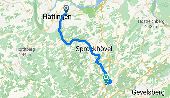
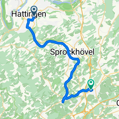
Route template
Hattingen to Sprockhövel

- 54 min
- Duration
- 11.3 km
- Distance
- 231 m
- Ascent
- 101 m
- Descent
- 12.6 km/h
- Avg. speed
- 228 m
- Max. altitude
Get ready for a scenic off-road adventure from Hattingen to Sprockhövel! This roughly 11 km ride takes you through the peaceful hills of the Ruhr region, packed with gravel paths (about 71%) and just enough paved stretches to give your tires a break. You’ll climb around 230 meters total, gently winding up wooded trails and quiet countryside roads. Bring your camera—Hattingen’s half-timbered old town is a gem, with charming medieval flair.
About halfway through, the urban bustle fades away, and you’ll find yourself surrounded by fields and forests typical for this part of North Rhine-Westphalia. Sprockhövel, your destination, has deep roots in coal mining history, but today it’s a tranquil spot beloved by cyclists and hikers.
It’s mostly path and gravel, so a hybrid or mountain bike works best. Plan for some steady climbs and some rewarding descents—plus plenty of fresh air the whole way!
Community
Top users in this region


From our community
The best bike routes from Hattingen to Sprockhövel

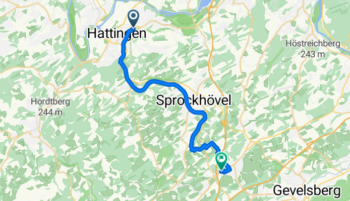
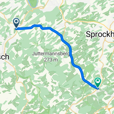
Ulmenstraße, Hattingen nach Mittelstraße, Sprockhövel
Cycling route in Hattingen, North Rhine-Westphalia, Germany
- 14.4 km
- Distance
- 335 m
- Ascent
- 172 m
- Descent
Ulmenstraße, Hattingen nach Mittelstraße, Sprockhövel
Cycling route in Hattingen, North Rhine-Westphalia, Germany
- 14.4 km
- Distance
- 335 m
- Ascent
- 172 m
- Descent
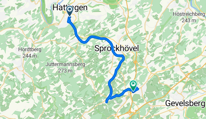
Ulmenstraße, Hattingen nach Mittelstraße, Sprockhövel
Cycling route in Hattingen, North Rhine-Westphalia, Germany
- 15.9 km
- Distance
- 316 m
- Ascent
- 154 m
- Descent
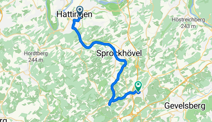
Friedrichstraße, Hattingen nach Mittelstraße, Sprockhövel
Cycling route in Hattingen, North Rhine-Westphalia, Germany
- 18.1 km
- Distance
- 261 m
- Ascent
- 85 m
- Descent

Wodantal (Hattingen)
Cycling route in Hattingen, North Rhine-Westphalia, Germany
- 10 km
- Distance
- 215 m
- Ascent
- 51 m
- Descent

Kleine Trainingsstrecke Hattingen Körnerstr. - Aldi Sprockhövel
Cycling route in Hattingen, North Rhine-Westphalia, Germany
- 6.3 km
- Distance
- 209 m
- Ascent
- 145 m
- Descent

Everesting Strecke
Cycling route in Hattingen, North Rhine-Westphalia, Germany
- 7.8 km
- Distance
- 235 m
- Ascent
- 62 m
- Descent

Henrichsteich-ElfringhauserStr-Bergerhof-Sprockhövel
Cycling route in Hattingen, North Rhine-Westphalia, Germany
- 13.1 km
- Distance
- 284 m
- Ascent
- 192 m
- Descent

Hackstückstraße 64
Cycling route in Hattingen, North Rhine-Westphalia, Germany
- 6.8 km
- Distance
- 178 m
- Ascent
- 93 m
- Descent
Nordstraße, Hattingen nach Mittelstraße, Sprockhövel
Cycling route in Hattingen, North Rhine-Westphalia, Germany
- 18.5 km
- Distance
- 268 m
- Ascent
- 110 m
- Descent

Hattingen-Sprockhövel
Cycling route in Hattingen, North Rhine-Westphalia, Germany
- 7.6 km
- Distance
- 201 m
- Ascent
- 105 m
- Descent

Bo Linden Spr
Cycling route in Hattingen, North Rhine-Westphalia, Germany
- 11.8 km
- Distance
- 191 m
- Ascent
- 132 m
- Descent
Discover more routes
 Wodantal (Hattingen)
- Distance
- 10 km
- Ascent
- 215 m
- Descent
- 51 m
- Location
- Hattingen, North Rhine-Westphalia, Germany
 Kleine Trainingsstrecke Hattingen Körnerstr. - Aldi Sprockhövel
- Distance
- 6.3 km
- Ascent
- 209 m
- Descent
- 145 m
- Location
- Hattingen, North Rhine-Westphalia, Germany
 Everesting Strecke
- Distance
- 7.8 km
- Ascent
- 235 m
- Descent
- 62 m
- Location
- Hattingen, North Rhine-Westphalia, Germany
 Henrichsteich-ElfringhauserStr-Bergerhof-Sprockhövel
- Distance
- 13.1 km
- Ascent
- 284 m
- Descent
- 192 m
- Location
- Hattingen, North Rhine-Westphalia, Germany
 Hackstückstraße 64
- Distance
- 6.8 km
- Ascent
- 178 m
- Descent
- 93 m
- Location
- Hattingen, North Rhine-Westphalia, Germany
 Nordstraße, Hattingen nach Mittelstraße, Sprockhövel
- Distance
- 18.5 km
- Ascent
- 268 m
- Descent
- 110 m
- Location
- Hattingen, North Rhine-Westphalia, Germany
 Hattingen-Sprockhövel
- Distance
- 7.6 km
- Ascent
- 201 m
- Descent
- 105 m
- Location
- Hattingen, North Rhine-Westphalia, Germany
 Bo Linden Spr
- Distance
- 11.8 km
- Ascent
- 191 m
- Descent
- 132 m
- Location
- Hattingen, North Rhine-Westphalia, Germany
Routes from Hattingen
Cycling day trip from
Hattingen to Essen
Cycling day trip from
Hattingen to Witten
By bicycle from
Hattingen to Bochum