
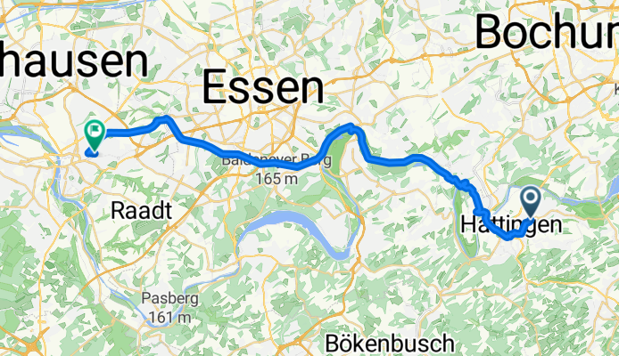
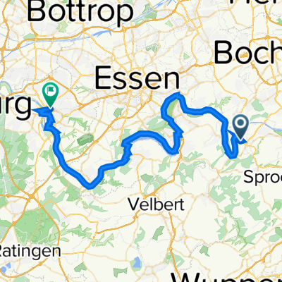
Route template
Hattingen to Mülheim

- 1 h 46 min
- Duration
- 29 km
- Distance
- 205 m
- Ascent
- 263 m
- Descent
- 16.5 km/h
- Avg. speed
- 119 m
- Max. altitude
This cycling route takes you from the charming half-timbered old town of Hattingen all the way to vibrant Mülheim an der Ruhr. It’s about 29 km, so it’s perfect if you’re looking for a good ride but not ready to go all ultra-distance just yet.
Most of the path is wonderfully smooth – you’ll be rolling mainly on asphalt and well-paved routes (over 85% paved), with a nice mix of bike paths and quiet roads. There’s a bit of climbing (you’ll gain around 200 meters), but it’s nothing too steep – more just enough to get your heart going before rewarding you with some gentle descents.
The scenery is classic Ruhrgebiet: expect leafy green stretches along old railway lines, riverside chills, and a sprinkle of historic industry on the horizon. Once you reach Mülheim, the city’s riverfront promenades and cozy cafés are a sweet payoff – perfect for a coffee break before you head back or hop on a train. It’s a great ride for anyone who loves a blend of nature, history, and easy cruising!
Community
Top users in this region


From our community
The best bike routes from Hattingen to Mülheim
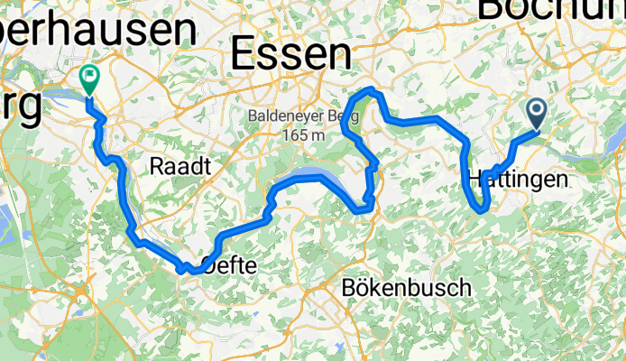
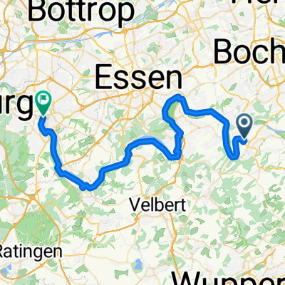
Ulmenstraße, Hattingen nach Hingbergstraße, Mülheim an der Ruhr
Cycling route in Hattingen, North Rhine-Westphalia, Germany
- 29 km
- Distance
- 239 m
- Ascent
- 254 m
- Descent

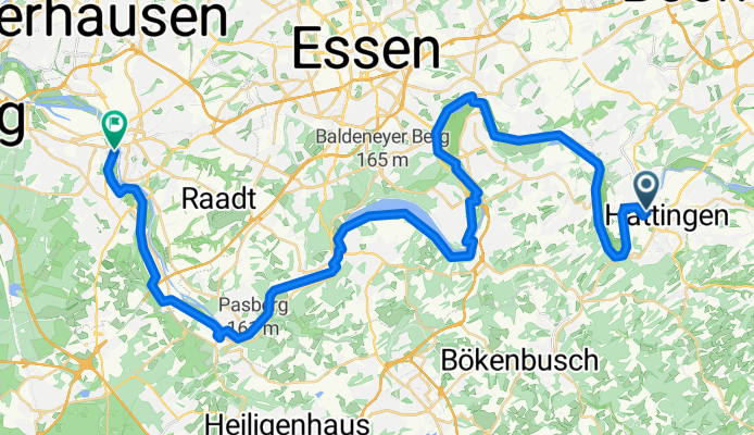
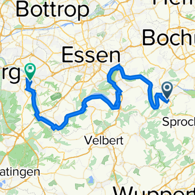
8# Hattingen - Mühlheim an der Ruhr ; auf dem Ruhrtalradweg :)... 50km (Grob gezeichnet)
Cycling route in Hattingen, North Rhine-Westphalia, Germany
- 46.3 km
- Distance
- 101 m
- Ascent
- 187 m
- Descent

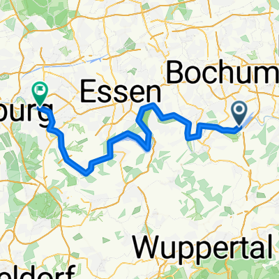
Ruhr-Rhein-Maas-Radweg 31.05.2011
Cycling route in Hattingen, North Rhine-Westphalia, Germany
- 52.1 km
- Distance
- 155 m
- Ascent
- 191 m
- Descent
Hattingen - Mülheim (Ruhr)
Cycling route in Hattingen, North Rhine-Westphalia, Germany
- 53.2 km
- Distance
- 15 m
- Ascent
- 71 m
- Descent

Ruhrtalweg Hattingen-Mülheim
Cycling route in Hattingen, North Rhine-Westphalia, Germany
- 50.6 km
- Distance
- 164 m
- Ascent
- 195 m
- Descent

Ruhr1
Cycling route in Hattingen, North Rhine-Westphalia, Germany
- 49.5 km
- Distance
- 377 m
- Ascent
- 399 m
- Descent

Welperstraße 49A, Hattingen nach Trooststraße 2, Mülheim an der Ruhr
Cycling route in Hattingen, North Rhine-Westphalia, Germany
- 69.1 km
- Distance
- 368 m
- Ascent
- 416 m
- Descent
Etappe 5 Van Hattingen naar Mülheim an der Ruhr - Ruhrdal Fietsroute
Cycling route in Hattingen, North Rhine-Westphalia, Germany
- 48.7 km
- Distance
- 355 m
- Ascent
- 384 m
- Descent

Ruhrtalradweg 5
Cycling route in Hattingen, North Rhine-Westphalia, Germany
- 49.2 km
- Distance
- 312 m
- Ascent
- 361 m
- Descent
Hattingen - Mülheim (Ruhr)
Cycling route in Hattingen, North Rhine-Westphalia, Germany
- 49.8 km
- Distance
- 346 m
- Ascent
- 397 m
- Descent

Eickener Straße 39, Hattingen nach Auf'm Bögel 8, Essen
Cycling route in Hattingen, North Rhine-Westphalia, Germany
- 43 km
- Distance
- 389 m
- Ascent
- 348 m
- Descent

Ruhrradweg Tag 5
Cycling route in Hattingen, North Rhine-Westphalia, Germany
- 53.4 km
- Distance
- 141 m
- Ascent
- 178 m
- Descent
Discover more routes
 Ruhrtalweg Hattingen-Mülheim
- Distance
- 50.6 km
- Ascent
- 164 m
- Descent
- 195 m
- Location
- Hattingen, North Rhine-Westphalia, Germany
 Ruhr1
Ruhr1- Distance
- 49.5 km
- Ascent
- 377 m
- Descent
- 399 m
- Location
- Hattingen, North Rhine-Westphalia, Germany
 Welperstraße 49A, Hattingen nach Trooststraße 2, Mülheim an der Ruhr
- Distance
- 69.1 km
- Ascent
- 368 m
- Descent
- 416 m
- Location
- Hattingen, North Rhine-Westphalia, Germany
 Etappe 5 Van Hattingen naar Mülheim an der Ruhr - Ruhrdal Fietsroute
- Distance
- 48.7 km
- Ascent
- 355 m
- Descent
- 384 m
- Location
- Hattingen, North Rhine-Westphalia, Germany
 Ruhrtalradweg 5
- Distance
- 49.2 km
- Ascent
- 312 m
- Descent
- 361 m
- Location
- Hattingen, North Rhine-Westphalia, Germany
 Hattingen - Mülheim (Ruhr)
- Distance
- 49.8 km
- Ascent
- 346 m
- Descent
- 397 m
- Location
- Hattingen, North Rhine-Westphalia, Germany
 Eickener Straße 39, Hattingen nach Auf'm Bögel 8, Essen
- Distance
- 43 km
- Ascent
- 389 m
- Descent
- 348 m
- Location
- Hattingen, North Rhine-Westphalia, Germany
 Ruhrradweg Tag 5
- Distance
- 53.4 km
- Ascent
- 141 m
- Descent
- 178 m
- Location
- Hattingen, North Rhine-Westphalia, Germany
Routes from Hattingen
Cycling day trip from
Hattingen to Essen
Cycling day trip from
Hattingen to Witten
By bicycle from
Hattingen to Sprockhövel
By bicycle from
Hattingen to Bochum
Routes to Mülheim
Cycling day trip from
Bottrop to Mülheim
Cycling day trip from
Heiligenhaus to Mülheim
By bicycle from
Duisburg to Mülheim
By bicycle from
Oberhausen to Mülheim