
Cycling day trip from Bad Vilbel to Sulzbach
Customize your own route based on our template or discover how our community prefers to cycle from Bad Vilbel to Sulzbach.
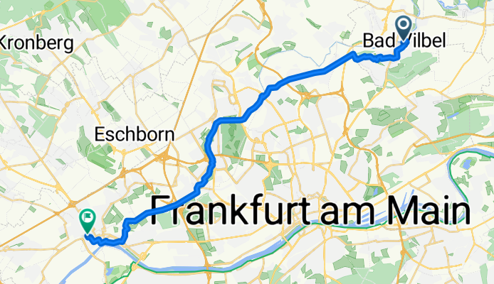
Route template
Bad Vilbel to Sulzbach

- 1 h 20 min
- Duration
- 23.3 km
- Distance
- 183 m
- Ascent
- 166 m
- Descent
- 17.4 km/h
- Avg. speed
- 163 m
- Max. altitude
This scenic cycling route takes you from the spa town of Bad Vilbel to Sulzbach, just outside Frankfurt. Starting in Bad Vilbel—famous for its mineral springs and historic old town—you'll cruise mostly along quiet roads and well-paved paths. The ride covers about 23 km, with gentle ups and downs (about 180 meters total ascent), so it’s a nice workout without being too tough.
Along the way, you’ll weave through a mix of lush countryside and quaint Hessian villages. Over 70% of the route is smooth asphalt, so you can really enjoy the ride. There are a few brief stretches on concrete or paving stones, and only tiny bits of gravel or unpaved sections—nothing a sturdy city or trekking bike can’t handle.
Roll into Sulzbach, a cozy community known for its friendly vibe and half-timbered buildings. It’s a great spot to grab a coffee at a local café or explore the charming center before heading back. This route is perfect if you want a relaxing day out on the bike and a taste of both nature and local culture.
Community
Top users in this region

From our community
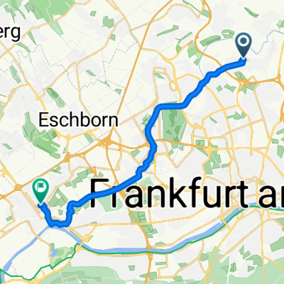
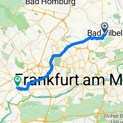
The best bike routes from Bad Vilbel to Sulzbach

MTZ_JBS_T_via Nidda Mündung Höchst
Cycling route in Bad Vilbel, Hesse, Germany
- 18.5 km
- Distance
- 47 m
- Ascent
- 51 m
- Descent

Estrada Balkan_ImM_T_via NIDDA, Höchst.
Cycling route in Bad Vilbel, Hesse, Germany
- 13.6 km
- Distance
- 19 m
- Ascent
- 26 m
- Descent

Goca Jaksic_ImM_N_via alle Straßen Richtung Sossenheim
Cycling route in Bad Vilbel, Hesse, Germany
- 11.7 km
- Distance
- 46 m
- Ascent
- 48 m
- Descent

SRH Höchst_N_ImM via alle Straßen Richtung Höchst
Cycling route in Bad Vilbel, Hesse, Germany
- 12.8 km
- Distance
- 29 m
- Ascent
- 40 m
- Descent

Höchst Psy_JBS_T_via Nidda Höchst
Cycling route in Bad Vilbel, Hesse, Germany
- 15.5 km
- Distance
- 36 m
- Ascent
- 58 m
- Descent

MTZ Sulzbach_ImM_T_via Nidda, Praun, Eschb, Sulzb...
Cycling route in Bad Vilbel, Hesse, Germany
- 14.5 km
- Distance
- 79 m
- Ascent
- 62 m
- Descent

Entlang der Nidda von Bad Vilbel nach Höchst
Cycling route in Bad Vilbel, Hesse, Germany
- 20.2 km
- Distance
- 4 m
- Ascent
- 16 m
- Descent

Kasseler Straße, Bad Vilbel nach Starkeradweg 13, Sulzbach (Taunus)
Cycling route in Bad Vilbel, Hesse, Germany
- 24.9 km
- Distance
- 261 m
- Ascent
- 235 m
- Descent

Goca Jaksic_T_ImM via NIDDA, Bach Sulzbach
Cycling route in Bad Vilbel, Hesse, Germany
- 13 km
- Distance
- 34 m
- Ascent
- 35 m
- Descent

MTZ_ImM_T_via Nidda-Sosenh-Krhs.Höchst.
Cycling route in Bad Vilbel, Hesse, Germany
- 16.6 km
- Distance
- 55 m
- Ascent
- 42 m
- Descent

22km BV zu Niddamündung/Höchst
Cycling route in Bad Vilbel, Hesse, Germany
- 22.2 km
- Distance
- 20 m
- Ascent
- 67 m
- Descent
Discover more routes
 Höchst Psy_JBS_T_via Nidda Höchst
- Distance
- 15.5 km
- Ascent
- 36 m
- Descent
- 58 m
- Location
- Bad Vilbel, Hesse, Germany
 MTZ Sulzbach_ImM_T_via Nidda, Praun, Eschb, Sulzb...
- Distance
- 14.5 km
- Ascent
- 79 m
- Descent
- 62 m
- Location
- Bad Vilbel, Hesse, Germany
 Entlang der Nidda von Bad Vilbel nach Höchst
- Distance
- 20.2 km
- Ascent
- 4 m
- Descent
- 16 m
- Location
- Bad Vilbel, Hesse, Germany
 Kasseler Straße, Bad Vilbel nach Starkeradweg 13, Sulzbach (Taunus)
- Distance
- 24.9 km
- Ascent
- 261 m
- Descent
- 235 m
- Location
- Bad Vilbel, Hesse, Germany
 Goca Jaksic_T_ImM via NIDDA, Bach Sulzbach
- Distance
- 13 km
- Ascent
- 34 m
- Descent
- 35 m
- Location
- Bad Vilbel, Hesse, Germany
 MTZ_ImM_T_via Nidda-Sosenh-Krhs.Höchst.
- Distance
- 16.6 km
- Ascent
- 55 m
- Descent
- 42 m
- Location
- Bad Vilbel, Hesse, Germany
 22km BV zu Niddamündung/Höchst
- Distance
- 22.2 km
- Ascent
- 20 m
- Descent
- 67 m
- Location
- Bad Vilbel, Hesse, Germany
 An der Nidda entlang
- Distance
- 21.4 km
- Ascent
- 72 m
- Descent
- 80 m
- Location
- Bad Vilbel, Hesse, Germany
Routes from Bad Vilbel
By bicycle from
Bad Vilbel to Bad Homburg
By bicycle from
Bad Vilbel to Steinbach am Taunus
Routes to Sulzbach
By bicycle from
Frankfurt am Main to Sulzbach
By bicycle from
Hattersheim to Sulzbach