
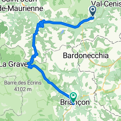
Route template
Modane to Briançon
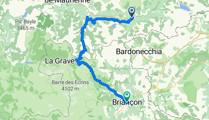
- 8 h 53 min
- Duration
- 93.2 km
- Distance
- 3,959 m
- Ascent
- 3,718 m
- Descent
- 10.5 km/h
- Avg. speed
- 2,634 m
- Max. altitude
Ready for an epic ride between two icons of the French Alps? This route takes you from Modane, a historic town nestled in the Maurienne Valley, all the way to Briançon, famed for its Vauban fortifications and claim as the highest city in France.
You'll climb high—really high. Expect a total ascent nearing 4,000 meters as you traverse some legendary alpine passes. The highest point clocks in just over 2,630 meters, so pack for mountain weather and be prepared for jaw-dropping vistas. About 37% of the route is on paved roads, but nearly 44% is on surfaces that could vary—some gravel, some tracks—so wider tires and a sense of adventure will serve you well.
While some stretches are on busy roads, much of your ride will find you spinning peacefully on quieter roads and alpine tracks. This is not a route for speed; instead, soak in the scenery, pause for plenty of photos, and enjoy cycling from historic Modane to dramatic Briançon, where a cold drink or hot coffee awaits at journey’s end. Happy climbing!
Community
Top users in this region


From our community
The best bike routes from Modane to Briançon

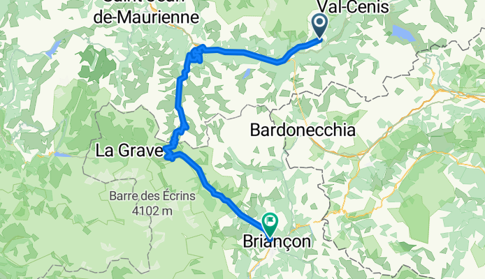
RDGA - Etape 3
Cycling route in Modane, Auvergne-Rhône-Alpes, France
- 89 km
- Distance
- 2,068 m
- Ascent
- 1,923 m
- Descent

BRUTAL-2017-Tag3-Lanslebourg-Briancon
Cycling route in Modane, Auvergne-Rhône-Alpes, France
- 119.1 km
- Distance
- 3,349 m
- Ascent
- 3,544 m
- Descent

BRUTAL-2017-Tag3-Lanslebourg-TOP-Briancon
Cycling route in Modane, Auvergne-Rhône-Alpes, France
- 126.4 km
- Distance
- 3,627 m
- Ascent
- 3,822 m
- Descent

RDGA 4
Cycling route in Modane, Auvergne-Rhône-Alpes, France
- 113.5 km
- Distance
- 2,091 m
- Ascent
- 2,270 m
- Descent

Col du galibier part 2
Cycling route in Modane, Auvergne-Rhône-Alpes, France
- 80.7 km
- Distance
- 2,026 m
- Ascent
- 1,877 m
- Descent

secondo giorno briancon
Cycling route in Modane, Auvergne-Rhône-Alpes, France
- 90.8 km
- Distance
- 2,019 m
- Ascent
- 1,861 m
- Descent

Galibier mit Romontschia
Cycling route in Modane, Auvergne-Rhône-Alpes, France
- 115.5 km
- Distance
- 2,291 m
- Ascent
- 2,358 m
- Descent

5. Aussoins - Saint Michel de Maurienne - Col du Telegraph - Col du Galabier - Briancon (90km, 2000 hm)
Cycling route in Modane, Auvergne-Rhône-Alpes, France
- 93.3 km
- Distance
- 1,939 m
- Ascent
- 2,185 m
- Descent

Transalp Day 4
Cycling route in Modane, Auvergne-Rhône-Alpes, France
- 51 km
- Distance
- 1,577 m
- Ascent
- 1,325 m
- Descent
4.Et. Grandes rooutes
Cycling route in Modane, Auvergne-Rhône-Alpes, France
- 94.9 km
- Distance
- 2,024 m
- Ascent
- 2,247 m
- Descent

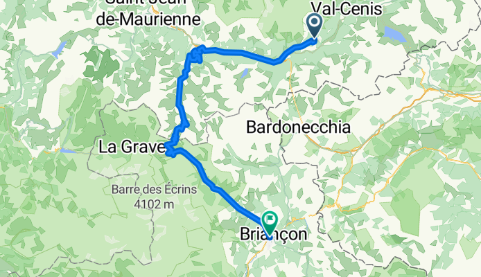
Modane-Briancon (Col du Telegraph/Col de Galibier)
Cycling route in Modane, Auvergne-Rhône-Alpes, France
- 90.7 km
- Distance
- 2,071 m
- Ascent
- 1,869 m
- Descent
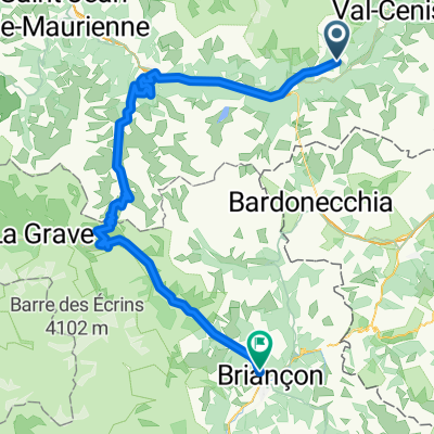
dag 4 Aussois - Briancon 95km
Cycling route in Modane, Auvergne-Rhône-Alpes, France
- 95.2 km
- Distance
- 2,042 m
- Ascent
- 2,314 m
- Descent
Discover more routes
 Col du galibier part 2
- Distance
- 80.7 km
- Ascent
- 2,026 m
- Descent
- 1,877 m
- Location
- Modane, Auvergne-Rhône-Alpes, France
 secondo giorno briancon
- Distance
- 90.8 km
- Ascent
- 2,019 m
- Descent
- 1,861 m
- Location
- Modane, Auvergne-Rhône-Alpes, France
 Galibier mit Romontschia
- Distance
- 115.5 km
- Ascent
- 2,291 m
- Descent
- 2,358 m
- Location
- Modane, Auvergne-Rhône-Alpes, France
 5. Aussoins - Saint Michel de Maurienne - Col du Telegraph - Col du Galabier - Briancon (90km, 2000 hm)
- Distance
- 93.3 km
- Ascent
- 1,939 m
- Descent
- 2,185 m
- Location
- Modane, Auvergne-Rhône-Alpes, France
 Transalp Day 4
- Distance
- 51 km
- Ascent
- 1,577 m
- Descent
- 1,325 m
- Location
- Modane, Auvergne-Rhône-Alpes, France
 4.Et. Grandes rooutes
- Distance
- 94.9 km
- Ascent
- 2,024 m
- Descent
- 2,247 m
- Location
- Modane, Auvergne-Rhône-Alpes, France
 Modane-Briancon (Col du Telegraph/Col de Galibier)
- Distance
- 90.7 km
- Ascent
- 2,071 m
- Descent
- 1,869 m
- Location
- Modane, Auvergne-Rhône-Alpes, France
 dag 4 Aussois - Briancon 95km
- Distance
- 95.2 km
- Ascent
- 2,042 m
- Descent
- 2,314 m
- Location
- Modane, Auvergne-Rhône-Alpes, France
Routes from Modane
Bikepacking from
Modane to Val d'Isère
Cycling day trip from
Modane to Huez
Routes to Briançon
Bikepacking from
Val d'Isère to Briançon
Cycling day trip from
Saint-Jean-de-Maurienne to Briançon
Cycling day trip from
Jausiers to Briançon