
By bicycle from Sant'Antonio to Bormio
Customize your own route based on our template or discover how our community prefers to cycle from Sant'Antonio to Bormio.
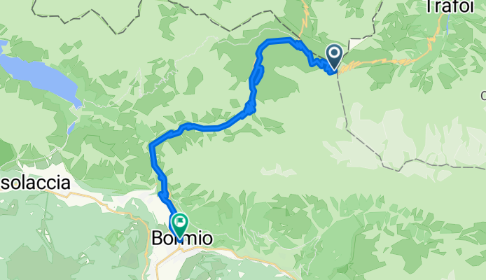
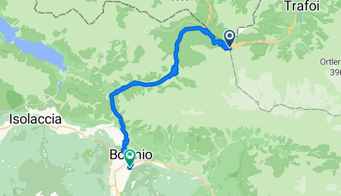
Route template
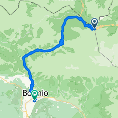
Sant'Antonio to Bormio

- 18 min
- Duration
- 4.4 km
- Distance
- 65 m
- Ascent
- 195 m
- Descent
- 14.3 km/h
- Avg. speed
- 1,337 m
- Max. altitude
This short but sweet cycling route takes you from Sant’Antonio to the beautiful alpine town of Bormio—covering just over 4.3 km, it’s ideal for a quick ride with a scenic punch. Starting from Sant’Antonio, perched in the heart of the Valtellina valley, you’ll enjoy mostly paved surfaces, gliding along quiet roads and a few stretches of classic cobblestones thrown in for local flavor.
The route trends mostly downhill, making your descent into Bormio (famous for its thermal baths and as a gateway to the legendary Stelvio Pass) both easy on the legs and big on views. You’ll lose nearly 200 meters of elevation, so get ready for some breezy fun and alpine panoramas. Whether you’re into history, food, or just want to soak up the mountain atmosphere at the end, Bormio’s charming old town and vibrant piazza make a perfect finish line. Bring a camera and treat yourself to a gelato when you arrive!
Community
Top users in this region


From our community
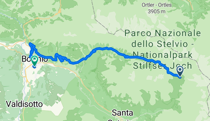
The best bike routes from Sant'Antonio to Bormio
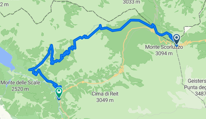
Route von Bormio
Cycling route in Sant'Antonio, Lombardy, Italy
- 24 km
- Distance
- 339 m
- Ascent
- 1,888 m
- Descent

4 Star MTB Tour - terza tappa
Cycling route in Sant'Antonio, Lombardy, Italy
- 32.8 km
- Distance
- 1,560 m
- Ascent
- 2,093 m
- Descent
ste 3
Cycling route in Sant'Antonio, Lombardy, Italy
- 24 km
- Distance
- 402 m
- Ascent
- 1,672 m
- Descent

MTB: Dreisprachen Spitze - P. Umbrail - Bocchette di Forcola - Pedenollo - Bormio
Cycling route in Sant'Antonio, Lombardy, Italy
- 30.1 km
- Distance
- 387 m
- Ascent
- 2,010 m
- Descent

ste 4
Cycling route in Sant'Antonio, Lombardy, Italy
- 48.7 km
- Distance
- 1,261 m
- Ascent
- 2,533 m
- Descent

Bormio day 4 mtb schuttle
Cycling route in Sant'Antonio, Lombardy, Italy
- 36.1 km
- Distance
- 1,294 m
- Ascent
- 1,869 m
- Descent

discesa Stelvio
Cycling route in Sant'Antonio, Lombardy, Italy
- 19.8 km
- Distance
- 14 m
- Ascent
- 1,464 m
- Descent

Val di Rezzalo
Cycling route in Sant'Antonio, Lombardy, Italy
- 39.3 km
- Distance
- 1,061 m
- Ascent
- 1,605 m
- Descent

Podróż do Valdidentro - Dzień 1
Cycling route in Sant'Antonio, Lombardy, Italy
- 27.7 km
- Distance
- 4,695 m
- Ascent
- 6,193 m
- Descent

S. Catarina - Bormio
Cycling route in Sant'Antonio, Lombardy, Italy
- 12.4 km
- Distance
- 42 m
- Ascent
- 585 m
- Descent
Day 2 - A
Cycling route in Sant'Antonio, Lombardy, Italy
- 27.3 km
- Distance
- 478 m
- Ascent
- 1,974 m
- Descent
Discover more routes
 ste 4
ste 4- Distance
- 48.7 km
- Ascent
- 1,261 m
- Descent
- 2,533 m
- Location
- Sant'Antonio, Lombardy, Italy
 into bormio
- Distance
- 22.4 km
- Ascent
- 9 m
- Descent
- 1,607 m
- Location
- Sant'Antonio, Lombardy, Italy
 Bormio day 4 mtb schuttle
- Distance
- 36.1 km
- Ascent
- 1,294 m
- Descent
- 1,869 m
- Location
- Sant'Antonio, Lombardy, Italy
 discesa Stelvio
- Distance
- 19.8 km
- Ascent
- 14 m
- Descent
- 1,464 m
- Location
- Sant'Antonio, Lombardy, Italy
 Val di Rezzalo
- Distance
- 39.3 km
- Ascent
- 1,061 m
- Descent
- 1,605 m
- Location
- Sant'Antonio, Lombardy, Italy
 Podróż do Valdidentro - Dzień 1
- Distance
- 27.7 km
- Ascent
- 4,695 m
- Descent
- 6,193 m
- Location
- Sant'Antonio, Lombardy, Italy
 S. Catarina - Bormio
- Distance
- 12.4 km
- Ascent
- 42 m
- Descent
- 585 m
- Location
- Sant'Antonio, Lombardy, Italy
 Day 2 - A
- Distance
- 27.3 km
- Ascent
- 478 m
- Descent
- 1,974 m
- Location
- Sant'Antonio, Lombardy, Italy
Routes from Sant'Antonio
Cycling day trip from
Sant'Antonio to Livigno
Routes to Bormio
Bikepacking from
Merano to Bormio
Cycling day trip from
Prad am Stilfser Joch to Bormio
Cycling day trip from
Tirano to Bormio