
Cycling day trip from Prad am Stilfser Joch to Bormio
Customize your own route based on our template or discover how our community prefers to cycle from Prad am Stilfser Joch to Bormio.
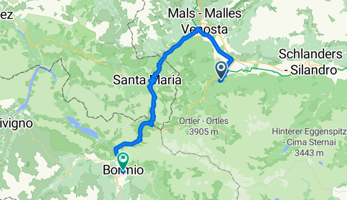
Route template
Prad am Stilfser Joch to Bormio

- 9 h 29 min
- Duration
- 65.4 km
- Distance
- 4,025 m
- Ascent
- 3,736 m
- Descent
- 6.9 km/h
- Avg. speed
- 2,625 m
- Max. altitude
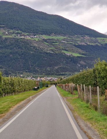
Ready for a serious adventure? This epic route takes you from Prad am Stilfser Joch in Italy's South Tyrol all the way to the spa town of Bormio, deep in the Lombardy Alps. You’ll tackle about 65 km—and a whopping 4,000 meters of climbing! The legendary Stelvio Pass awaits, standing among the highest paved mountain passes in Europe (2,757 meters), with its dizzying hairpins and unforgettable alpine panoramas.
You'll find that about 40% of the ride is missing surface data, but expect a good mix—everything from smooth asphalt sections to gravel and rougher ground. Be sure to pack for changing conditions and possibly variable bike handling if you’re venturing onto all those tracks and paths (that’s where the best views come in!).
Starting in Prad, a quaint mountain village, you’ll ascend, descend, and wind through breathtaking mountain scenery before rolling down into Bormio—a favorite destination for cyclists and home to famous thermal baths. It’s a demanding ride, but an absolute bucket-lister for any passionate cyclist. Don’t forget extra snacks and layers—this route’s not short on adventure!
Community
Top users in this region


From our community
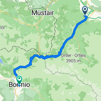
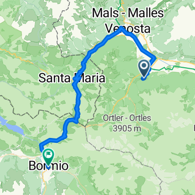
The best bike routes from Prad am Stilfser Joch to Bormio

Stelvio vanuit Prato naar Bormio
Cycling route in Prad am Stilfser Joch, Trentino-Alto Adige, Italy
- 45.9 km
- Distance
- 1,819 m
- Ascent
- 1,517 m
- Descent

Dolomiti tour day 6
Cycling route in Prad am Stilfser Joch, Trentino-Alto Adige, Italy
- 46 km
- Distance
- 1,802 m
- Ascent
- 1,524 m
- Descent

Über den Wolken....
Cycling route in Prad am Stilfser Joch, Trentino-Alto Adige, Italy
- 47.9 km
- Distance
- 1,872 m
- Ascent
- 1,561 m
- Descent

stelvio
Cycling route in Prad am Stilfser Joch, Trentino-Alto Adige, Italy
- 46.9 km
- Distance
- 1,842 m
- Ascent
- 1,553 m
- Descent

Prato allo Stelvio - Bormio
Cycling route in Prad am Stilfser Joch, Trentino-Alto Adige, Italy
- 156.1 km
- Distance
- 4,976 m
- Ascent
- 4,687 m
- Descent

RoDa.2019.7
Cycling route in Prad am Stilfser Joch, Trentino-Alto Adige, Italy
- 45.8 km
- Distance
- 1,858 m
- Ascent
- 1,546 m
- Descent

Stage 5
Cycling route in Prad am Stilfser Joch, Trentino-Alto Adige, Italy
- 50 km
- Distance
- 1,859 m
- Ascent
- 1,607 m
- Descent

5) Passo dello Stelvio – 2757 m.
Cycling route in Prad am Stilfser Joch, Trentino-Alto Adige, Italy
- 46.2 km
- Distance
- 1,818 m
- Ascent
- 1,521 m
- Descent

Prato - Bormio (e15 Giro)
Cycling route in Prad am Stilfser Joch, Trentino-Alto Adige, Italy
- 189.5 km
- Distance
- 3,652 m
- Ascent
- 3,377 m
- Descent
Stelvio to Bormio
Cycling route in Prad am Stilfser Joch, Trentino-Alto Adige, Italy
- 57.8 km
- Distance
- 1,614 m
- Ascent
- 1,680 m
- Descent

prato allo stelvio,passo stelvio bormio
Cycling route in Prad am Stilfser Joch, Trentino-Alto Adige, Italy
- 46.4 km
- Distance
- 1,824 m
- Ascent
- 1,540 m
- Descent

Passo Stelvio
Cycling route in Prad am Stilfser Joch, Trentino-Alto Adige, Italy
- 49.3 km
- Distance
- 1,846 m
- Ascent
- 1,536 m
- Descent
Discover more routes
 Prato allo Stelvio - Bormio
- Distance
- 156.1 km
- Ascent
- 4,976 m
- Descent
- 4,687 m
- Location
- Prad am Stilfser Joch, Trentino-Alto Adige, Italy
 RoDa.2019.7
- Distance
- 45.8 km
- Ascent
- 1,858 m
- Descent
- 1,546 m
- Location
- Prad am Stilfser Joch, Trentino-Alto Adige, Italy
 Stage 5
- Distance
- 50 km
- Ascent
- 1,859 m
- Descent
- 1,607 m
- Location
- Prad am Stilfser Joch, Trentino-Alto Adige, Italy
 5) Passo dello Stelvio – 2757 m.
- Distance
- 46.2 km
- Ascent
- 1,818 m
- Descent
- 1,521 m
- Location
- Prad am Stilfser Joch, Trentino-Alto Adige, Italy
 Prato - Bormio (e15 Giro)
- Distance
- 189.5 km
- Ascent
- 3,652 m
- Descent
- 3,377 m
- Location
- Prad am Stilfser Joch, Trentino-Alto Adige, Italy
 Stelvio to Bormio
- Distance
- 57.8 km
- Ascent
- 1,614 m
- Descent
- 1,680 m
- Location
- Prad am Stilfser Joch, Trentino-Alto Adige, Italy
 prato allo stelvio,passo stelvio bormio
- Distance
- 46.4 km
- Ascent
- 1,824 m
- Descent
- 1,540 m
- Location
- Prad am Stilfser Joch, Trentino-Alto Adige, Italy
 Passo Stelvio
- Distance
- 49.3 km
- Ascent
- 1,846 m
- Descent
- 1,536 m
- Location
- Prad am Stilfser Joch, Trentino-Alto Adige, Italy
Routes from Prad am Stilfser Joch
Cycling day trip from
Prad am Stilfser Joch to Merano
Cycling day trip from
Prad am Stilfser Joch to Sant'Antonio
Routes to Bormio
Bikepacking from
Merano to Bormio
Cycling day trip from
Tirano to Bormio
Cycling day trip from
Livigno to Bormio
By bicycle from
Sant'Antonio to Bormio