
Cycling day trip from Malcesine to Torbole sul Garda
Customize your own route based on our template or discover how our community prefers to cycle from Malcesine to Torbole sul Garda.
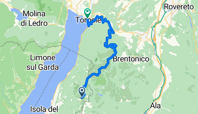
Route template
Malcesine to Torbole sul Garda

- 6 h 32 min
- Duration
- 97.8 km
- Distance
- 1,751 m
- Ascent
- 1,774 m
- Descent
- 15 km/h
- Avg. speed
- 729 m
- Max. altitude
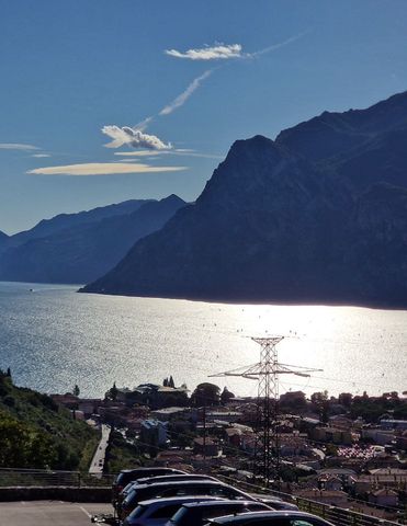
Set off from the picturesque town of Malcesine, nestled on the eastern shore of Lake Garda beneath the imposing Monte Baldo. The route to Torbole sul Garda offers a full day of cycling—you’ll cover about 98 km and climb over 1,700 meters, so it’s an adventure for those who love longer, scenic rides.
You’ll mostly stick to paved roads (about 80%), including an impressive chunk on dedicated cycleways (roughly half the journey!), giving you plenty of chances to soak up the lake views and mountain backdrops. Expect a mix of serene lakeside roads and gradual climbs, with rewarding descents to keep things lively.
As you roll north towards Torbole, you’ll pass through olive groves and charming Italian villages. Don’t forget to look back now and then—the views over Lake Garda are absolutely spectacular.
Your destination, Torbole, is known for its vibrant windsurfing scene and laid-back vibe. Celebrate your ride with a cold drink at one of the lakeside cafés and take in the bustling waterfront before relaxing by the lake. Buon viaggio!
Bikepacking tours
Already sliced up into perfect stages by our community
Community
Top users in this region


From our community
The best bike routes from Malcesine to Torbole sul Garda

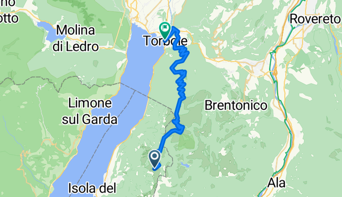
Monte Baldo_Loppio
Cycling route in Malcesine, Veneto, Italy
- 31.4 km
- Distance
- 448 m
- Ascent
- 2,122 m
- Descent
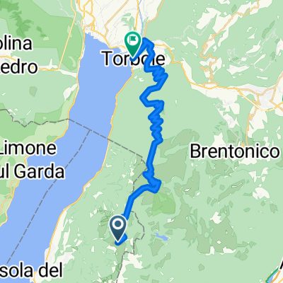
Monte Baldo
Cycling route in Malcesine, Veneto, Italy
- 31.4 km
- Distance
- 616 m
- Ascent
- 2,288 m
- Descent

Monte Baldo
Cycling route in Malcesine, Veneto, Italy
- 31.4 km
- Distance
- 616 m
- Ascent
- 2,288 m
- Descent


6.Tag Gardasee
Cycling route in Malcesine, Veneto, Italy
- 13.7 km
- Distance
- 201 m
- Ascent
- 212 m
- Descent


Monte Baldo 31. augusta, 10:18
Cycling route in Malcesine, Veneto, Italy
- 35.7 km
- Distance
- 295 m
- Ascent
- 1,977 m
- Descent

Malcesine Mount Baldo Aerial tramway - Mount Baldo terminal do Via Giacomo Matteotti 48, Nago-Torbole
Cycling route in Malcesine, Veneto, Italy
- 53.9 km
- Distance
- 1,483 m
- Ascent
- 3,152 m
- Descent


Monte Baldo-Monte Altissimo-Torbole
Cycling route in Malcesine, Veneto, Italy
- 28.9 km
- Distance
- 621 m
- Ascent
- 2,290 m
- Descent
Discover more routes
 Monte Baldo
- Distance
- 28.1 km
- Ascent
- 362 m
- Descent
- 1,984 m
- Location
- Malcesine, Veneto, Italy
 6.Tag Gardasee
- Distance
- 13.7 km
- Ascent
- 201 m
- Descent
- 212 m
- Location
- Malcesine, Veneto, Italy
 Monte Baldo
- Distance
- 33.4 km
- Ascent
- 304 m
- Descent
- 1,973 m
- Location
- Malcesine, Veneto, Italy
 Monte Baldo 31. augusta, 10:18
- Distance
- 35.7 km
- Ascent
- 295 m
- Descent
- 1,977 m
- Location
- Malcesine, Veneto, Italy
 Malcesine Mount Baldo Aerial tramway - Mount Baldo terminal do Via Giacomo Matteotti 48, Nago-Torbole
- Distance
- 53.9 km
- Ascent
- 1,483 m
- Descent
- 3,152 m
- Location
- Malcesine, Veneto, Italy
 Mt Baldo - Torbole
- Distance
- 36 km
- Ascent
- 328 m
- Descent
- 2,004 m
- Location
- Malcesine, Veneto, Italy
 baldo 26km
- Distance
- 26.9 km
- Ascent
- 628 m
- Descent
- 2,309 m
- Location
- Malcesine, Veneto, Italy
 Monte Baldo-Monte Altissimo-Torbole
- Distance
- 28.9 km
- Ascent
- 621 m
- Descent
- 2,290 m
- Location
- Malcesine, Veneto, Italy
Routes from Malcesine
Cycling day trip from
Malcesine to Riva del Garda
By bicycle from
Malcesine to Limone sul Garda
Routes to Torbole sul Garda
Cycling day trip from
Bolzano to Torbole sul Garda
Cycling day trip from
Trento to Torbole sul Garda
By bicycle from
Riva del Garda to Torbole sul Garda