
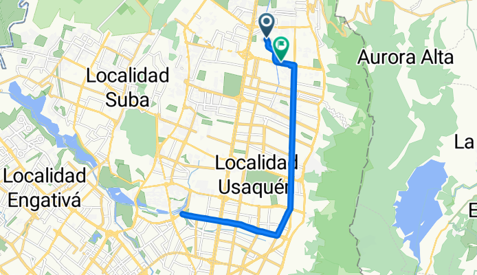
Route template
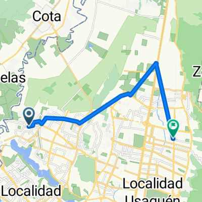
Cota to La Calera

- 2 h 37 min
- Duration
- 39 km
- Distance
- 762 m
- Ascent
- 629 m
- Descent
- 14.9 km/h
- Avg. speed
- 3,066 m
- Max. altitude
Get ready for a solid ride as you pedal from Cota to La Calera, two favorite spots for cyclists near Bogotá! This 39 km route offers a great mix of adventure and challenge. You’ll climb more than 760 meters as you leave the plains of Cota—a calm town known for its dairy farms—heading into the quieter, greener hills northeast of Bogotá.
The highlight? You’ll hit a max elevation over 3,000 meters, so expect some alpine vibes and incredible views. Surfaces are varied: it’s mostly a mix of paved roads and cycleways, but do keep your eyes open for some rougher unpaved sections, perfect for testing your bike-handling skills.
La Calera awaits at the end—a cool, breezy mountain town popular for its restaurants and scenic outlooks over Bogotá. Take it at your own pace, hydrate well (the altitude is real!), and enjoy both the tranquility and exhilaration along the way.
Community
Top users in this region


From our community
The best bike routes from Cota to La Calera

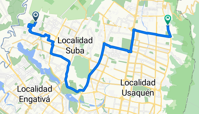
Entrenamiento norte
Cycling route in Cota, Cundinamarca, Colombia
- 91.5 km
- Distance
- 332 m
- Ascent
- 164 m
- Descent

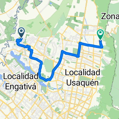
De Carrera 105c 143-11, Bogotá a Calle 160 15-44, Bogotá
Cycling route in Cota, Cundinamarca, Colombia
- 9.3 km
- Distance
- 104 m
- Ascent
- 104 m
- Descent

De Carrera 105c 143, Bogotá a Calle 160 15-44, Bogotá
Cycling route in Cota, Cundinamarca, Colombia
- 12.3 km
- Distance
- 90 m
- Ascent
- 113 m
- Descent

De Calle 167 167-61, Bogotá a Calle 159a Bis 90a98, Bogotá
Cycling route in Cota, Cundinamarca, Colombia
- 6.4 km
- Distance
- 4 m
- Ascent
- 8 m
- Descent

Carrera 74 152B-35–152B-50, Bogotá a La Granja Norte, Bogotá
Cycling route in Cota, Cundinamarca, Colombia
- 7.2 km
- Distance
- 11 m
- Ascent
- 25 m
- Descent
Calle 181, Bogotá a Avenida Calle 170, Bogotá
Cycling route in Cota, Cundinamarca, Colombia
- 21.3 km
- Distance
- 54 m
- Ascent
- 61 m
- Descent
De Avenida Calle a Calle 6-64
Cycling route in Cota, Cundinamarca, Colombia
- 20.9 km
- Distance
- 113 m
- Ascent
- 85 m
- Descent

De Carrera 97b 153-50, Bogotá a AK 7 - Cl 165, Bogotá
Cycling route in Cota, Cundinamarca, Colombia
- 9.2 km
- Distance
- 102 m
- Ascent
- 74 m
- Descent

Autopista Norte 205, Bogotá to Calle 165 9-1, Bogotá
Cycling route in Cota, Cundinamarca, Colombia
- 6.1 km
- Distance
- 42 m
- Ascent
- 58 m
- Descent
De Calle 138C-22 a Avenida Carrera # 164-51
Cycling route in Cota, Cundinamarca, Colombia
- 14.9 km
- Distance
- 16 m
- Ascent
- 55 m
- Descent


bike tour through Bogotá
Cycling route in Cota, Cundinamarca, Colombia
- 26.8 km
- Distance
- 108 m
- Ascent
- 96 m
- Descent
Discover more routes
 Carrera 74 152B-35–152B-50, Bogotá a La Granja Norte, Bogotá
- Distance
- 7.2 km
- Ascent
- 11 m
- Descent
- 25 m
- Location
- Cota, Cundinamarca, Colombia
 Calle 181, Bogotá a Avenida Calle 170, Bogotá
- Distance
- 21.3 km
- Ascent
- 54 m
- Descent
- 61 m
- Location
- Cota, Cundinamarca, Colombia
 De Avenida Calle a Calle 6-64
- Distance
- 20.9 km
- Ascent
- 113 m
- Descent
- 85 m
- Location
- Cota, Cundinamarca, Colombia
 De Carrera 97b 153-50, Bogotá a AK 7 - Cl 165, Bogotá
- Distance
- 9.2 km
- Ascent
- 102 m
- Descent
- 74 m
- Location
- Cota, Cundinamarca, Colombia
 Autopista Norte 205, Bogotá to Calle 165 9-1, Bogotá
- Distance
- 6.1 km
- Ascent
- 42 m
- Descent
- 58 m
- Location
- Cota, Cundinamarca, Colombia
 De Calle 138C-22 a Avenida Carrera # 164-51
- Distance
- 14.9 km
- Ascent
- 16 m
- Descent
- 55 m
- Location
- Cota, Cundinamarca, Colombia
 Paseo lento
- Distance
- 34.6 km
- Ascent
- 434 m
- Descent
- 304 m
- Location
- Cota, Cundinamarca, Colombia
 bike tour through Bogotá
- Distance
- 26.8 km
- Ascent
- 108 m
- Descent
- 96 m
- Location
- Cota, Cundinamarca, Colombia
Routes from Cota
Cycling day trip from
Cota to Bogotá
Cycling day trip from
Cota to Chía
Routes to La Calera
Cycling day trip from
Barrio San Luis to La Calera
Cycling day trip from
Bogotá to La Calera