
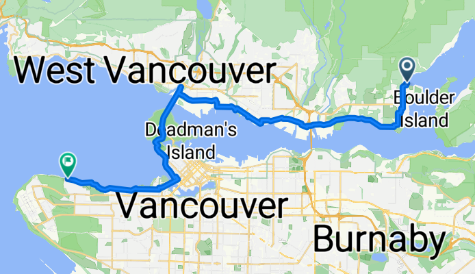
Route template
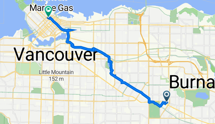
Burnaby to West End

- 54 min
- Duration
- 15.8 km
- Distance
- 119 m
- Ascent
- 157 m
- Descent
- 17.7 km/h
- Avg. speed
- 118 m
- Max. altitude
Ready for a delightful ride from Burnaby to Vancouver’s vibrant West End? This 15.8 km route is perfect for those who enjoy urban cycling with a mix of scenery. You’ll start in Burnaby, a city just east of Vancouver known for its lush parks and bustling Metrotown area. From there, you'll weave through mostly quiet roads and dedicated cycleways (over 70% are peaceful backstreets!), so the ride is easy-going and safe.
The path is almost entirely on pavement and smooth asphalt, so leave the mountain bike at home—any city bike will do the trick. There’s a bit of climbing at the start (just under 120 meters ascent), but you’ll be rewarded with a gentle descent towards your destination. As you roll into the West End, you’ll find yourself in one of Vancouver’s most eclectic and picturesque neighborhoods, a stone’s throw from English Bay and Stanley Park.
If you have some time, grab a coffee or stroll along the seawall at the end of your ride—you’ve earned it!
Community
Top users in this region


From our community
The best bike routes from Burnaby to West End

Capitol Hill (N. BBY) to Science world
Cycling route in Burnaby, British Columbia, Canada
- 16.3 km
- Distance
- 60 m
- Ascent
- 210 m
- Descent

BCIT to Vancouver Public Library
Cycling route in Burnaby, British Columbia, Canada
- 11.9 km
- Distance
- 110 m
- Ascent
- 110 m
- Descent
Deep Cove to UBC Grind
Cycling route in Burnaby, British Columbia, Canada
- 32.4 km
- Distance
- 364 m
- Ascent
- 343 m
- Descent

131a St 11038, Vancouver to Burrard Street 666, Vancouver
Cycling route in Burnaby, British Columbia, Canada
- 14.5 km
- Distance
- 106 m
- Ascent
- 185 m
- Descent
Grange Street 4390, Burnaby to West Georgia Street 1055, Vancouver
Cycling route in Burnaby, British Columbia, Canada
- 13.1 km
- Distance
- 83 m
- Ascent
- 144 m
- Descent

Banbury Rd, North Vancouver to Chilco St, Vancouver
Cycling route in Burnaby, British Columbia, Canada
- 22.3 km
- Distance
- 368 m
- Ascent
- 354 m
- Descent


Madison Avenue, Burnaby to Granville Street 200, Vancouver
Cycling route in Burnaby, British Columbia, Canada
- 11.7 km
- Distance
- 154 m
- Ascent
- 121 m
- Descent

2625 Rupert St, Vancouver to 1190 Homer St, Vancouver
Cycling route in Burnaby, British Columbia, Canada
- 8.3 km
- Distance
- 46 m
- Ascent
- 59 m
- Descent

hot dawg ride
Cycling route in Burnaby, British Columbia, Canada
- 40.6 km
- Distance
- 242 m
- Ascent
- 275 m
- Descent

Discover more routes
 Grange Street 4390, Burnaby to West Georgia Street 1055, Vancouver
- Distance
- 13.1 km
- Ascent
- 83 m
- Descent
- 144 m
- Location
- Burnaby, British Columbia, Canada
 Banbury Rd, North Vancouver to Chilco St, Vancouver
- Distance
- 22.3 km
- Ascent
- 368 m
- Descent
- 354 m
- Location
- Burnaby, British Columbia, Canada
 Kingsway試鏡
- Distance
- 14.1 km
- Ascent
- 87 m
- Descent
- 209 m
- Location
- Burnaby, British Columbia, Canada
 Day off
- Distance
- 20 km
- Ascent
- 171 m
- Descent
- 245 m
- Location
- Burnaby, British Columbia, Canada
 Madison Avenue, Burnaby to Granville Street 200, Vancouver
- Distance
- 11.7 km
- Ascent
- 154 m
- Descent
- 121 m
- Location
- Burnaby, British Columbia, Canada
 2625 Rupert St, Vancouver to 1190 Homer St, Vancouver
- Distance
- 8.3 km
- Ascent
- 46 m
- Descent
- 59 m
- Location
- Burnaby, British Columbia, Canada
 hot dawg ride
- Distance
- 40.6 km
- Ascent
- 242 m
- Descent
- 275 m
- Location
- Burnaby, British Columbia, Canada
 Vancouver
- Distance
- 58 km
- Ascent
- 312 m
- Descent
- 623 m
- Location
- Burnaby, British Columbia, Canada
Routes from Burnaby
By bicycle from
Burnaby to New Westminster
By bicycle from
Burnaby to North Vancouver
Routes to West End
Cycling day trip from
New Westminster to West End
Cycling day trip from
Port Moody to West End
By bicycle from
Vancouver to West End
By bicycle from
Richmond to West End