
Cycling day trip from Miskolc to Szilvásvárad
Customize your own route based on our template or discover how our community prefers to cycle from Miskolc to Szilvásvárad.
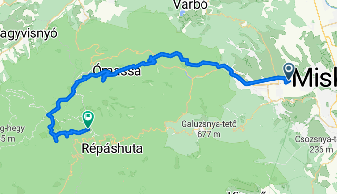
Route template
Miskolc to Szilvásvárad

- 5 h 27 min
- Duration
- 73.2 km
- Distance
- 1,527 m
- Ascent
- 1,209 m
- Descent
- 13.4 km/h
- Avg. speed
- 480 m
- Max. altitude
Set off from Miskolc, a lively city nestled at the foot of the Bükk Mountains—fun fact, it’s one of Hungary’s largest urban centers and a gateway to loads of natural beauty. The ride to Szilvásvárad is about 73 km and packs in plenty of adventure, with a generous serving of climbs (over 1,500 meters ascent!), so get ready for some legwork and amazing panoramic views.
The route is a proper mix: mostly along forest tracks and cycleways, with just enough paved roads to give you a break from the rough stuff. You’ll roll through shady woods, past rural villages, and steadily gain altitude as you come closer to Szilvásvárad—a popular little town famous for its beautiful Szalajka Valley and Lipizzaner horses.
It’s mostly quiet and peaceful, giving you a real chance to soak in the scenery (and catch your breath on those climbs!). Szilvásvárad is the perfect spot to relax at the end—don’t miss the waterfall in the valley. Take some snacks, check your brakes, and enjoy a real taste of northern Hungary’s outdoors!
Community
Top users in this region


From our community
The best bike routes from Miskolc to Szilvásvárad
48.103, 20.738 - 48.067, 20.500
Cycling route in Miskolc, Borsod-Abauj Zemplen county, Hungary
- 43.3 km
- Distance
- 2,059 m
- Ascent
- 1,357 m
- Descent

Tapolca-Bánkút
Cycling route in Miskolc, Borsod-Abauj Zemplen county, Hungary
- 32 km
- Distance
- 863 m
- Ascent
- 111 m
- Descent

Erdészkert utca 2, Bükkszentkereszt - Rákóczi út 13, Répáshuta
Cycling route in Miskolc, Borsod-Abauj Zemplen county, Hungary
- 19.6 km
- Distance
- 460 m
- Ascent
- 506 m
- Descent

Miskolc - Bánkút 2.
Cycling route in Miskolc, Borsod-Abauj Zemplen county, Hungary
- 33.5 km
- Distance
- 787 m
- Ascent
- 121 m
- Descent

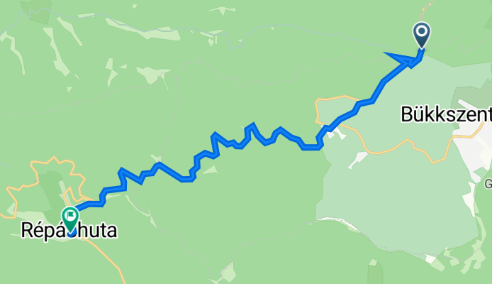
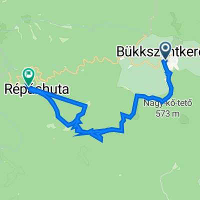
Zrínyi utca 7., Bükkszentkereszt to Répáshuta
Cycling route in Miskolc, Borsod-Abauj Zemplen county, Hungary
- 34 km
- Distance
- 2,345 m
- Ascent
- 2,411 m
- Descent

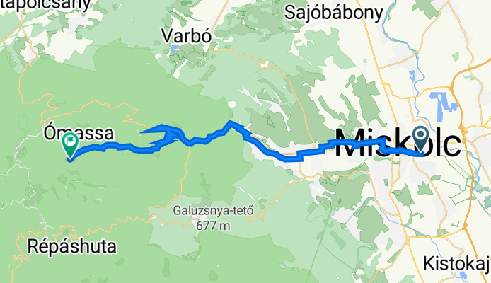
Könyves Kálmán utca 31, Miskolc - Ómassa utca 1, Miskolc
Cycling route in Miskolc, Borsod-Abauj Zemplen county, Hungary
- 12.5 km
- Distance
- 0 m
- Ascent
- 0 m
- Descent
Baross Gábor út 24, Miskolc - Jávorkúti út, Miskolc
Cycling route in Miskolc, Borsod-Abauj Zemplen county, Hungary
- 29.6 km
- Distance
- 781 m
- Ascent
- 202 m
- Descent
Magyarország, Miskolc - Répáshuta, községháza
Cycling route in Miskolc, Borsod-Abauj Zemplen county, Hungary
- 11.2 km
- Distance
- 411 m
- Ascent
- 311 m
- Descent
Pozsonyi-Jávorkút
Cycling route in Miskolc, Borsod-Abauj Zemplen county, Hungary
- 27.6 km
- Distance
- 600 m
- Ascent
- 27 m
- Descent

Hadirokkantak útja, Miskolc - Ómassa utca 27., Miskolc
Cycling route in Miskolc, Borsod-Abauj Zemplen county, Hungary
- 22.7 km
- Distance
- 570 m
- Ascent
- 203 m
- Descent

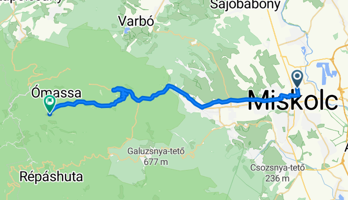
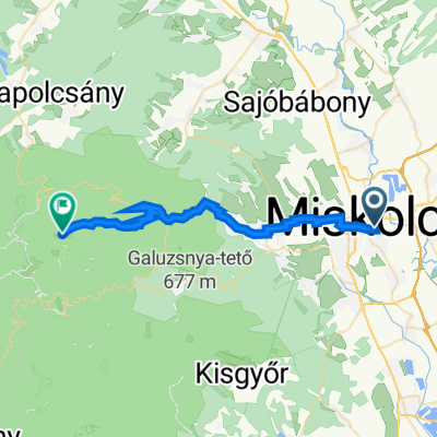
Miskolc-Szilvásvárad
Cycling route in Miskolc, Borsod-Abauj Zemplen county, Hungary
- 49.7 km
- Distance
- 784 m
- Ascent
- 545 m
- Descent

Frater TT
Cycling route in Miskolc, Borsod-Abauj Zemplen county, Hungary
- 84.2 km
- Distance
- 1,565 m
- Ascent
- 811 m
- Descent
Discover more routes
 Zrínyi utca 7., Bükkszentkereszt to Répáshuta
- Distance
- 34 km
- Ascent
- 2,345 m
- Descent
- 2,411 m
- Location
- Miskolc, Borsod-Abauj Zemplen county, Hungary
 Könyves Kálmán utca 31, Miskolc - Ómassa utca 1, Miskolc
- Distance
- 12.5 km
- Ascent
- 0 m
- Descent
- 0 m
- Location
- Miskolc, Borsod-Abauj Zemplen county, Hungary
 Baross Gábor út 24, Miskolc - Jávorkúti út, Miskolc
- Distance
- 29.6 km
- Ascent
- 781 m
- Descent
- 202 m
- Location
- Miskolc, Borsod-Abauj Zemplen county, Hungary
 Magyarország, Miskolc - Répáshuta, községháza
- Distance
- 11.2 km
- Ascent
- 411 m
- Descent
- 311 m
- Location
- Miskolc, Borsod-Abauj Zemplen county, Hungary
 Pozsonyi-Jávorkút
- Distance
- 27.6 km
- Ascent
- 600 m
- Descent
- 27 m
- Location
- Miskolc, Borsod-Abauj Zemplen county, Hungary
 Hadirokkantak útja, Miskolc - Ómassa utca 27., Miskolc
- Distance
- 22.7 km
- Ascent
- 570 m
- Descent
- 203 m
- Location
- Miskolc, Borsod-Abauj Zemplen county, Hungary
 Miskolc-Szilvásvárad
- Distance
- 49.7 km
- Ascent
- 784 m
- Descent
- 545 m
- Location
- Miskolc, Borsod-Abauj Zemplen county, Hungary
 Frater TT
- Distance
- 84.2 km
- Ascent
- 1,565 m
- Descent
- 811 m
- Location
- Miskolc, Borsod-Abauj Zemplen county, Hungary
Routes from Miskolc
Cycling day trip from
Miskolc to Eger
By bicycle from
Miskolc to Sajóbábony
Routes to Szilvásvárad
Cycling day trip from
Eger to Szilvásvárad
Cycling day trip from
Sajóbábony to Szilvásvárad