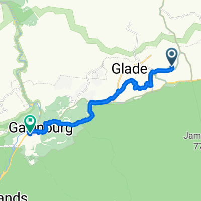
Gatlinburg - Cherohala Skyway - Tellico Plains 171 km
A cycling route starting in Gatlinburg, Tennessee, United States.
Overview
About this route
- -:--
- Duration
- 171.2 km
- Distance
- 2,206 m
- Ascent
- 2,342 m
- Descent
- ---
- Avg. speed
- ---
- Max. altitude
Route quality
Waytypes & surfaces along the route
Waytypes
Busy road
106.2 km
(62 %)
Quiet road
31.7 km
(18 %)
Surfaces
Paved
147.7 km
(86 %)
Unpaved
10.9 km
(6 %)
Asphalt
100 km
(58 %)
Paved (undefined)
47.6 km
(28 %)
Continue with Bikemap
Use, edit, or download this cycling route
You would like to ride Gatlinburg - Cherohala Skyway - Tellico Plains 171 km or customize it for your own trip? Here is what you can do with this Bikemap route:
Free features
- Save this route as favorite or in collections
- Copy & plan your own version of this route
- Split it into stages to create a multi-day tour
- Sync your route with Garmin or Wahoo
Premium features
Free trial for 3 days, or one-time payment. More about Bikemap Premium.
- Navigate this route on iOS & Android
- Export a GPX / KML file of this route
- Create your custom printout (try it for free)
- Download this route for offline navigation
Discover more Premium features.
Get Bikemap PremiumFrom our community
Other popular routes starting in Gatlinburg
- Gatlinburg - Cherohala Skyway - Tellico Plains 171 km
- Distance
- 171.2 km
- Ascent
- 2,206 m
- Descent
- 2,342 m
- Location
- Gatlinburg, Tennessee, United States
- Townsend-Cades Cove
- Distance
- 45.6 km
- Ascent
- 780 m
- Descent
- 777 m
- Location
- Gatlinburg, Tennessee, United States
- Newfound Gap from West
- Distance
- 21.2 km
- Ascent
- 1,186 m
- Descent
- 89 m
- Location
- Gatlinburg, Tennessee, United States
- Newfound Gap from West
- Distance
- 21.2 km
- Ascent
- 1,174 m
- Descent
- 89 m
- Location
- Gatlinburg, Tennessee, United States
- Clingman’s Dome
- Distance
- 37.7 km
- Ascent
- 2,147 m
- Descent
- 647 m
- Location
- Gatlinburg, Tennessee, United States
- Clingmans Dome
- Distance
- 11.3 km
- Ascent
- 666 m
- Descent
- 293 m
- Location
- Gatlinburg, Tennessee, United States
- CLIMBING
- Distance
- 81.7 km
- Ascent
- 1,711 m
- Descent
- 1,695 m
- Location
- Gatlinburg, Tennessee, United States
- 94 River Rd, Gatlinburg to 2903 Barnes Dr, Sevierville
- Distance
- 77.7 km
- Ascent
- 646 m
- Descent
- 706 m
- Location
- Gatlinburg, Tennessee, United States
Open it in the app