

CYCLING THE RHINE: Route 04A
A cycling route starting in Rhenen, Utrecht, The Netherlands.
Overview
About this route
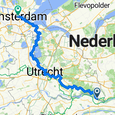
Rhenen railway station to Arnhem railway station, following the Nederrijn River.
- -:--
- Duration
- 26.6 km
- Distance
- 64 m
- Ascent
- 59 m
- Descent
- ---
- Avg. speed
- ---
- Max. altitude
Route quality
Waytypes & surfaces along the route
Waytypes
Road
11.7 km
(44 %)
Quiet road
7.5 km
(28 %)
Surfaces
Paved
18.6 km
(70 %)
Unpaved
1.6 km
(6 %)
Asphalt
18.6 km
(70 %)
Loose gravel
1.6 km
(6 %)
Undefined
6.4 km
(24 %)
Route highlights
Points of interest along the route
Accommodation after 0 km
CAMPSITE
Accommodation after 0.1 km
YOUTH HOSTEL: Stayokay Elst closed for good in September 2011.
Accommodation after 24.8 km
Camping Warnsborn. I have camped here on a number of occasions and found the service and facilities to be outstanding.
Accommodation after 26.6 km
YOUTH HOSTEL: Stayokay Arnhem. I have stayed here a number of times and found the facilities and service to be outstanding.
Continue with Bikemap
Use, edit, or download this cycling route
You would like to ride CYCLING THE RHINE: Route 04A or customize it for your own trip? Here is what you can do with this Bikemap route:
Free features
- Save this route as favorite or in collections
- Copy & plan your own version of this route
- Sync your route with Garmin or Wahoo
Premium features
Free trial for 3 days, or one-time payment. More about Bikemap Premium.
- Navigate this route on iOS & Android
- Export a GPX / KML file of this route
- Create your custom printout (try it for free)
- Download this route for offline navigation
Discover more Premium features.
Get Bikemap PremiumFrom our community
Other popular routes starting in Rhenen
 Rondje Utrechtse Heuvelrug vanuit Rhenen
- Distance
- 35.2 km
- Ascent
- 223 m
- Descent
- 213 m
- Location
- Rhenen, Utrecht, The Netherlands
 CYCLING THE RHINE: Route 04A
- Distance
- 26.6 km
- Ascent
- 64 m
- Descent
- 59 m
- Location
- Rhenen, Utrecht, The Netherlands
 't Pad terug onderlangs+dijk
- Distance
- 13.8 km
- Ascent
- 50 m
- Descent
- 52 m
- Location
- Rhenen, Utrecht, The Netherlands
 MTBroute-Rhenen 609 (c) MTBroutes.nl
- Distance
- 6.4 km
- Ascent
- 86 m
- Descent
- 84 m
- Location
- Rhenen, Utrecht, The Netherlands
 CYCLING THE RHINE: Route R17A
- Distance
- 39.7 km
- Ascent
- 14 m
- Descent
- 30 m
- Location
- Rhenen, Utrecht, The Netherlands
 Rhenen - N'Gein - Rhenen 2 bruggentocht
- Distance
- 95.2 km
- Ascent
- 57 m
- Descent
- 66 m
- Location
- Rhenen, Utrecht, The Netherlands
 14 Rhenen - Amsterdam
- Distance
- 112.6 km
- Ascent
- 201 m
- Descent
- 212 m
- Location
- Rhenen, Utrecht, The Netherlands
 Vanuit Rhenen over de Utrechtse Heuvelrug
- Distance
- 37.4 km
- Ascent
- 147 m
- Descent
- 150 m
- Location
- Rhenen, Utrecht, The Netherlands
Open it in the app