

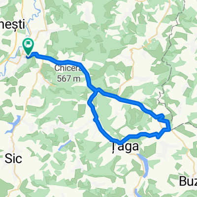
kis tura
A cycling route starting in Gherla, Cluj County, Romania.
Overview
About this route
- -:--
- Duration
- 19.3 km
- Distance
- 0 m
- Ascent
- 0 m
- Descent
- ---
- Avg. speed
- ---
- Max. altitude

Continue with Bikemap
Use, edit, or download this cycling route
You would like to ride kis tura or customize it for your own trip? Here is what you can do with this Bikemap route:
Free features
- Save this route as favorite or in collections
- Copy & plan your own version of this route
- Sync your route with Garmin or Wahoo
Premium features
Free trial for 3 days, or one-time payment. More about Bikemap Premium.
- Navigate this route on iOS & Android
- Export a GPX / KML file of this route
- Create your custom printout (try it for free)
- Download this route for offline navigation
Discover more Premium features.
Get Bikemap PremiumFrom our community
Other popular routes starting in Gherla
 Tura Uphill extreme
- Distance
- 11.2 km
- Ascent
- 258 m
- Descent
- 257 m
- Location
- Gherla, Cluj County, Romania
 medium range tour - Szek, Visa, Bonchida
- Distance
- 63.8 km
- Ascent
- 288 m
- Descent
- 288 m
- Location
- Gherla, Cluj County, Romania
 kis tura
- Distance
- 19.3 km
- Ascent
- 0 m
- Descent
- 0 m
- Location
- Gherla, Cluj County, Romania
 MTB Fizes-Padureni-Gherla(don't try this if your not sure about route)
- Distance
- 21 km
- Ascent
- 307 m
- Descent
- 306 m
- Location
- Gherla, Cluj County, Romania
 Tura Gherla-Negrilesti
- Distance
- 84 km
- Ascent
- 189 m
- Descent
- 192 m
- Location
- Gherla, Cluj County, Romania
 Gherla-Poiana Observator
- Distance
- 3.4 km
- Ascent
- 50 m
- Descent
- 50 m
- Location
- Gherla, Cluj County, Romania
 Turul balonului
- Distance
- 42.5 km
- Ascent
- 255 m
- Descent
- 256 m
- Location
- Gherla, Cluj County, Romania
 Uphill route 2011
- Distance
- 13.2 km
- Ascent
- 218 m
- Descent
- 217 m
- Location
- Gherla, Cluj County, Romania
Open it in the app