
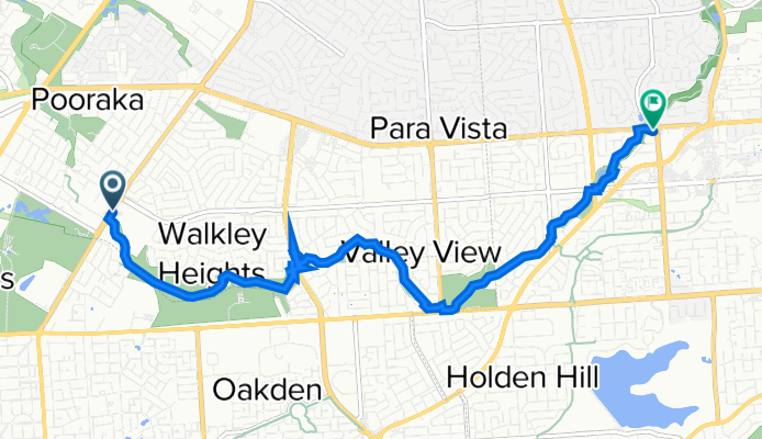
Dry Creek bike & hiking track - Bridge Road, Walkley Heights to TTP Modbury
A cycling route starting in Ingle Farm, South Australia, Australia.
Overview
About this route
- 59 min
- Duration
- 9.7 km
- Distance
- 107 m
- Ascent
- 28 m
- Descent
- 9.8 km/h
- Avg. speed
- ---
- Max. altitude
Route photos


Continue with Bikemap
Use, edit, or download this cycling route
You would like to ride Dry Creek bike & hiking track - Bridge Road, Walkley Heights to TTP Modbury or customize it for your own trip? Here is what you can do with this Bikemap route:
Free features
- Save this route as favorite or in collections
- Copy & plan your own version of this route
- Sync your route with Garmin or Wahoo
Premium features
Free trial for 3 days, or one-time payment. More about Bikemap Premium.
- Navigate this route on iOS & Android
- Export a GPX / KML file of this route
- Create your custom printout (try it for free)
- Download this route for offline navigation
Discover more Premium features.
Get Bikemap PremiumFrom our community
Other popular routes starting in Ingle Farm
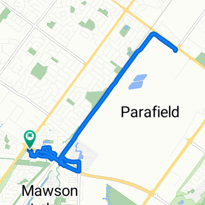
 Montague - Mawson
- Distance
- 6.5 km
- Ascent
- 38 m
- Descent
- 38 m
- Location
- Ingle Farm, South Australia, Australia
 Mawson Lakes Interchange to Parabanks in Salisbury
- Distance
- 7.6 km
- Ascent
- 40 m
- Descent
- 10 m
- Location
- Ingle Farm, South Australia, Australia
 Mawson Lakes to Munno Para Wetlands
- Distance
- 20.6 km
- Ascent
- 75 m
- Descent
- 47 m
- Location
- Ingle Farm, South Australia, Australia
 MLH-One Tree Hill-Gawler-MLH
- Distance
- 72.7 km
- Ascent
- 366 m
- Descent
- 359 m
- Location
- Ingle Farm, South Australia, Australia
 Dry Creek bike & hiking track - Bridge Road, Walkley Heights to TTP Modbury
- Distance
- 9.7 km
- Ascent
- 107 m
- Descent
- 28 m
- Location
- Ingle Farm, South Australia, Australia
 Coventry Street 5, Mawson Lakes to Coventry Street 5, Mawson Lakes
- Distance
- 10.2 km
- Ascent
- 51 m
- Descent
- 47 m
- Location
- Ingle Farm, South Australia, Australia
 31122010 48km
- Distance
- 48 km
- Ascent
- 492 m
- Descent
- 491 m
- Location
- Ingle Farm, South Australia, Australia
 Dry Creek circuit in Mawson Lakes to Valley View area - SA
- Distance
- 32.6 km
- Ascent
- 213 m
- Descent
- 212 m
- Location
- Ingle Farm, South Australia, Australia
Open it in the app