

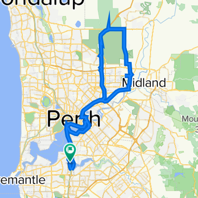
100km by Feb2022 : MtPleasant - Freo - Coogee - Cockburn
A cycling route starting in Manning, Western Australia, Australia.
Overview
About this route
- -:--
- Duration
- 57.7 km
- Distance
- 180 m
- Ascent
- 180 m
- Descent
- ---
- Avg. speed
- 49 m
- Max. altitude

Route quality
Waytypes & surfaces along the route
Waytypes
Cycleway
32.3 km
(56 %)
Road
13.3 km
(23 %)
Surfaces
Paved
45 km
(78 %)
Asphalt
27.7 km
(48 %)
Paved (undefined)
15.6 km
(27 %)
Continue with Bikemap
Use, edit, or download this cycling route
You would like to ride 100km by Feb2022 : MtPleasant - Freo - Coogee - Cockburn or customize it for your own trip? Here is what you can do with this Bikemap route:
Free features
- Save this route as favorite or in collections
- Copy & plan your own version of this route
- Sync your route with Garmin or Wahoo
Premium features
Free trial for 3 days, or one-time payment. More about Bikemap Premium.
- Navigate this route on iOS & Android
- Export a GPX / KML file of this route
- Create your custom printout (try it for free)
- Download this route for offline navigation
Discover more Premium features.
Get Bikemap PremiumFrom our community
Other popular routes starting in Manning
 Hills Ride
- Distance
- 130.6 km
- Ascent
- 987 m
- Descent
- 991 m
- Location
- Manning, Western Australia, Australia
 Swan River/City loop
- Distance
- 62.4 km
- Ascent
- 205 m
- Descent
- 205 m
- Location
- Manning, Western Australia, Australia
 Raffles Como - Shelley Foreshore - South Perth Loop
- Distance
- 28.7 km
- Ascent
- 87 m
- Descent
- 85 m
- Location
- Manning, Western Australia, Australia
 Airport Loop
- Distance
- 76.5 km
- Ascent
- 648 m
- Descent
- 648 m
- Location
- Manning, Western Australia, Australia
 Raffles - Curtin - Vic Park - South Perth
- Distance
- 32.1 km
- Ascent
- 196 m
- Descent
- 198 m
- Location
- Manning, Western Australia, Australia
 Canning Bridge
- Distance
- 10.5 km
- Ascent
- 76 m
- Descent
- 36 m
- Location
- Manning, Western Australia, Australia
 A river loop
- Distance
- 61.2 km
- Ascent
- 480 m
- Descent
- 478 m
- Location
- Manning, Western Australia, Australia
 86 km - Mt Pleasant-Ellenbrook
- Distance
- 85.8 km
- Ascent
- 626 m
- Descent
- 629 m
- Location
- Manning, Western Australia, Australia
Open it in the app