

Mühlviertel Kollerschlag Fahrt
A cycling route starting in Grieskirchen, Upper Austria, Austria.
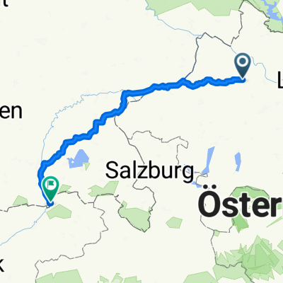
Overview
About this route
- -:--
- Duration
- 98.8 km
- Distance
- 1,268 m
- Ascent
- 1,268 m
- Descent
- ---
- Avg. speed
- ---
- Max. altitude

Route quality
Waytypes & surfaces along the route
Waytypes
Road
23.7 km
(24 %)
Quiet road
11.9 km
(12 %)
Surfaces
Paved
25.7 km
(26 %)
Asphalt
24.7 km
(25 %)
Paved (undefined)
1 km
(1 %)
Undefined
73.1 km
(74 %)
Route highlights
Points of interest along the route
Point of interest after 27.2 km
Fähre
Point of interest after 28.2 km
Continue with Bikemap
Use, edit, or download this cycling route
You would like to ride Mühlviertel Kollerschlag Fahrt or customize it for your own trip? Here is what you can do with this Bikemap route:
Free features
- Save this route as favorite or in collections
- Copy & plan your own version of this route
- Split it into stages to create a multi-day tour
- Sync your route with Garmin or Wahoo
Premium features
Free trial for 3 days, or one-time payment. More about Bikemap Premium.
- Navigate this route on iOS & Android
- Export a GPX / KML file of this route
- Create your custom printout (try it for free)
- Download this route for offline navigation
Discover more Premium features.
Get Bikemap PremiumFrom our community
Other popular routes starting in Grieskirchen
 Grieskirchen - Reichersberg am Inn
- Distance
- 72.5 km
- Ascent
- 425 m
- Descent
- 414 m
- Location
- Grieskirchen, Upper Austria, Austria
 Neumarkt-Haag-St. Marienkirchen-Neumarkt
- Distance
- 48.3 km
- Ascent
- 723 m
- Descent
- 703 m
- Location
- Grieskirchen, Upper Austria, Austria
 Kreuzweg nach Mariazell
- Distance
- 346.8 km
- Ascent
- 1,390 m
- Descent
- 1,377 m
- Location
- Grieskirchen, Upper Austria, Austria
 Mühlviertel Tour zum Ameisberg
- Distance
- 112.2 km
- Ascent
- 1,628 m
- Descent
- 1,628 m
- Location
- Grieskirchen, Upper Austria, Austria
 Willersdorf nach Gießenweg
- Distance
- 214.2 km
- Ascent
- 1,635 m
- Descent
- 1,526 m
- Location
- Grieskirchen, Upper Austria, Austria
 Biciklitura 2024
- Distance
- 183.5 km
- Ascent
- 2,048 m
- Descent
- 2,049 m
- Location
- Grieskirchen, Upper Austria, Austria
 Wien eigen
- Distance
- 239.1 km
- Ascent
- 603 m
- Descent
- 754 m
- Location
- Grieskirchen, Upper Austria, Austria
 Route in Neumarkt im Hausruckkreis
- Distance
- 59.7 km
- Ascent
- 821 m
- Descent
- 820 m
- Location
- Grieskirchen, Upper Austria, Austria
Open it in the app