

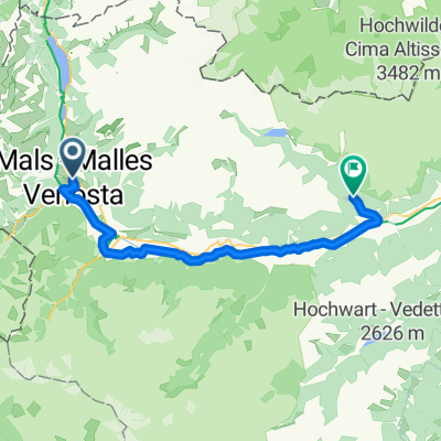
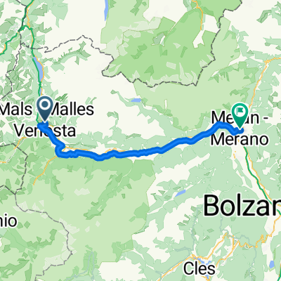
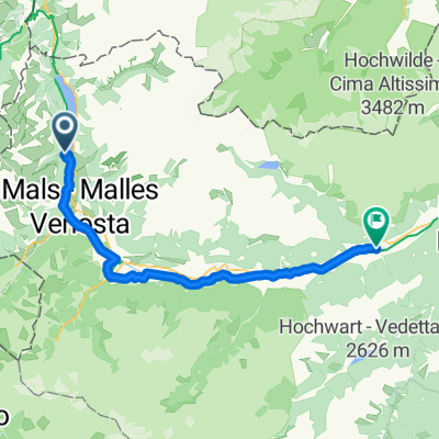
Etsch-Radweg: Burgeis/Malst - Meran CLONED FROM ROUTE 116
A cycling route starting in Mals, Trentino-Alto Adige, Italy.
Overview
About this route
You cycle down the Adige Valley. Glurns charms with its fully preserved town wall, and the mountaineer Reinhold Messner's castle greets from afar. In Merano, you have finally reached the south. Here, a variety of Mediterranean and subtropical plants grow abundantly.
- -:--
- Duration
- 66 km
- Distance
- 126 m
- Ascent
- 1,050 m
- Descent
- ---
- Avg. speed
- ---
- Max. altitude
Route quality
Waytypes & surfaces along the route
Waytypes
Quiet road
26.4 km
(40 %)
Track
17.2 km
(26 %)
Surfaces
Paved
51.5 km
(78 %)
Unpaved
8.6 km
(13 %)
Asphalt
50.8 km
(77 %)
Gravel
3.3 km
(5 %)
Continue with Bikemap
Use, edit, or download this cycling route
You would like to ride Etsch-Radweg: Burgeis/Malst - Meran CLONED FROM ROUTE 116 or customize it for your own trip? Here is what you can do with this Bikemap route:
Free features
- Save this route as favorite or in collections
- Copy & plan your own version of this route
- Sync your route with Garmin or Wahoo
Premium features
Free trial for 3 days, or one-time payment. More about Bikemap Premium.
- Navigate this route on iOS & Android
- Export a GPX / KML file of this route
- Create your custom printout (try it for free)
- Download this route for offline navigation
Discover more Premium features.
Get Bikemap PremiumFrom our community
Other popular routes starting in Mals
 Von Mals bis Bozen
- Distance
- 95.2 km
- Ascent
- 337 m
- Descent
- 1,125 m
- Location
- Mals, Trentino-Alto Adige, Italy
 7 July Malles Venosta to Naturns
- Distance
- 50 km
- Ascent
- 605 m
- Descent
- 809 m
- Location
- Mals, Trentino-Alto Adige, Italy
 Route zu Ortles B And B
- Distance
- 19.2 km
- Ascent
- 637 m
- Descent
- 221 m
- Location
- Mals, Trentino-Alto Adige, Italy
 Bahnhofstraße, Mals nach Laubengasse, Meran
- Distance
- 63.8 km
- Ascent
- 289 m
- Descent
- 1,004 m
- Location
- Mals, Trentino-Alto Adige, Italy
 Nauders - Naturns
- Distance
- 54.4 km
- Ascent
- 294 m
- Descent
- 1,457 m
- Location
- Mals, Trentino-Alto Adige, Italy
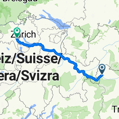 Route nach Zürich
- Distance
- 259 km
- Ascent
- 5,958 m
- Descent
- 6,597 m
- Location
- Mals, Trentino-Alto Adige, Italy
 MTB-Transalp-Nauders_Tag3: Schlinig - Nauders
- Distance
- 27.3 km
- Ascent
- 1,012 m
- Descent
- 1,229 m
- Location
- Mals, Trentino-Alto Adige, Italy
 Von Mals bis Terlan
- Distance
- 79.5 km
- Ascent
- 266 m
- Descent
- 1,059 m
- Location
- Mals, Trentino-Alto Adige, Italy
Open it in the app