
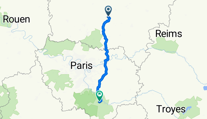
Dag 2 Fatima
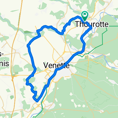
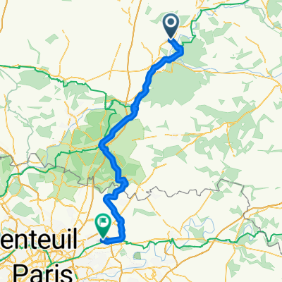
A cycling route starting in Thourotte, Nord-Pas-de-Calais-Picardie, France.
Overview
About this route
Noyon - Fontaine bleu
- -:--
- Duration
- 154 km
- Distance
- 748 m
- Ascent
- 726 m
- Descent
- ---
- Avg. speed
- 136 m
- Max. altitude

Route quality
Waytypes & surfaces along the route
Waytypes
Road
58.4 km
(38 %)
Quiet road
41.8 km
(27 %)
Surfaces
Paved
66.1 km
(43 %)
Unpaved
3.6 km
(2 %)
Asphalt
65.5 km
(43 %)
Gravel
3.2 km
(2 %)
Route highlights
Points of interest along the route
Point of interest after 106.2 km
bevoorrading 2
Continue with Bikemap
Use, edit, or download this cycling route
You would like to ride Dag 2 Fatima or customize it for your own trip? Here is what you can do with this Bikemap route:
Free features
- Save this route as favorite or in collections
- Copy & plan your own version of this route
- Split it into stages to create a multi-day tour
- Sync your route with Garmin or Wahoo
Premium features
Free trial for 3 days, or one-time payment. More about Bikemap Premium.
- Navigate this route on iOS & Android
- Export a GPX / KML file of this route
- Create your custom printout (try it for free)
- Download this route for offline navigation
Discover more Premium features.
Get Bikemap PremiumFrom our community
Other popular routes starting in Thourotte
 162 bis Rue du Moulin, Mélicocq à D 935, Mortemer
- Distance
- 21.7 km
- Ascent
- 165 m
- Descent
- 109 m
- Location
- Thourotte, Nord-Pas-de-Calais-Picardie, France
 22222
22222- Distance
- 4.3 km
- Ascent
- 16 m
- Descent
- 24 m
- Location
- Thourotte, Nord-Pas-de-Calais-Picardie, France
 Compiegne 5
- Distance
- 46.2 km
- Ascent
- 226 m
- Descent
- 226 m
- Location
- Thourotte, Nord-Pas-de-Calais-Picardie, France
 De 41 Rue du Haut Saule, Mélicocq à 1bis Boulevard Mony, Noyon
- Distance
- 18.5 km
- Ascent
- 82 m
- Descent
- 72 m
- Location
- Thourotte, Nord-Pas-de-Calais-Picardie, France
 De 41 Rue du Haut Saule, Mélicocq à 1–7 Rue des Pâtissiers, Compiègne
- Distance
- 12.3 km
- Ascent
- 82 m
- Descent
- 81 m
- Location
- Thourotte, Nord-Pas-de-Calais-Picardie, France
 De 54 Rue de la République, Thourotte à 1 Clos Châtelaine, Saint-Vaast-de-Longmont
- Distance
- 26.2 km
- Ascent
- 87 m
- Descent
- 98 m
- Location
- Thourotte, Nord-Pas-de-Calais-Picardie, France
 MitryMory
- Distance
- 93.5 km
- Ascent
- 229 m
- Descent
- 228 m
- Location
- Thourotte, Nord-Pas-de-Calais-Picardie, France
 De Chemin de Halage 49, Thourotte à Rue de Janville 36, Longueil-Annel
- Distance
- 4.2 km
- Ascent
- 6 m
- Descent
- 3 m
- Location
- Thourotte, Nord-Pas-de-Calais-Picardie, France
Open it in the app