

Etapa 007C (Segovia - Valladolid)
A cycling route starting in Palazuelos de Eresma, Castille and León, Spain.
Overview
About this route
Vuelta a Europa occidental. Etapa 7
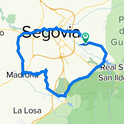
Segovia - Valseca - Los Huertos - Santa María la Real de Nieva - Nieva - Nava de la Asunción - Coca - Villeguillo - Alcazarén - Valdestillas - Puente Duero - Valladolid
124.0 km
730 m desnivel acumulado positivo
- -:--
- Duration
- 124 km
- Distance
- 728 m
- Ascent
- 1,097 m
- Descent
- ---
- Avg. speed
- 1,085 m
- Max. altitude

Route quality
Waytypes & surfaces along the route
Waytypes
Track
54.3 km
(44 %)
Road
26.1 km
(21 %)
Surfaces
Paved
50.6 km
(41 %)
Unpaved
55.4 km
(45 %)
Asphalt
46.3 km
(37 %)
Gravel
36.4 km
(29 %)
Route highlights
Points of interest along the route
Point of interest after 3.5 km
Acueducto de Segovia
Point of interest after 4.2 km
Plaza Mayor
Point of interest after 4.3 km
Catedral
Point of interest after 6 km
Mirador de la Pradera de San Marcos
Point of interest after 58.7 km
Puerta de la Villa
Point of interest after 59.1 km
Castillo de Coca
Point of interest after 119.8 km
Puente Colgante
Point of interest after 121.5 km
Academia de Caballería
Point of interest after 121.6 km
Plaza de Zorrilla
Point of interest after 122 km
Plaza Mayor
Point of interest after 122.7 km
Catedral
Point of interest after 123.5 km
Plaza e Iglesia de San Pablo
Continue with Bikemap
Use, edit, or download this cycling route
You would like to ride Etapa 007C (Segovia - Valladolid) or customize it for your own trip? Here is what you can do with this Bikemap route:
Free features
- Save this route as favorite or in collections
- Copy & plan your own version of this route
- Split it into stages to create a multi-day tour
- Sync your route with Garmin or Wahoo
Premium features
Free trial for 3 days, or one-time payment. More about Bikemap Premium.
- Navigate this route on iOS & Android
- Export a GPX / KML file of this route
- Create your custom printout (try it for free)
- Download this route for offline navigation
Discover more Premium features.
Get Bikemap PremiumFrom our community
Other popular routes starting in Palazuelos de Eresma
 casa, La higuera, Brieva, Torrecaballeros, Trescasas, Casa
- Distance
- 32.4 km
- Ascent
- 368 m
- Descent
- 373 m
- Location
- Palazuelos de Eresma, Castille and León, Spain
 De Carretera Segovia 30A, Palazuelos de Eresma a Carretera Segovia 30A, Palazuelos de Eresma
- Distance
- 32.4 km
- Ascent
- 368 m
- Descent
- 368 m
- Location
- Palazuelos de Eresma, Castille and León, Spain
 Cada, Segovia, Casino Juan Bravo, Madrona, Revenga, Tabanera,
- Distance
- 40.8 km
- Ascent
- 84 m
- Descent
- 272 m
- Location
- Palazuelos de Eresma, Castille and León, Spain
 Tabanera, Segovia, panorámico
- Distance
- 45.5 km
- Ascent
- 605 m
- Descent
- 605 m
- Location
- Palazuelos de Eresma, Castille and León, Spain
 La Granja Navacerrada Rascafría Cotos La Granja
- Distance
- 87.7 km
- Ascent
- 1,492 m
- Descent
- 1,491 m
- Location
- Palazuelos de Eresma, Castille and León, Spain
 Etapa 007C (Segovia - Valladolid)
- Distance
- 124 km
- Ascent
- 728 m
- Descent
- 1,097 m
- Location
- Palazuelos de Eresma, Castille and León, Spain
 Vía Verde del Eresma
- Distance
- 125.4 km
- Ascent
- 585 m
- Descent
- 923 m
- Location
- Palazuelos de Eresma, Castille and León, Spain
 Stage 25: Bird's Eye View of Madrid
- Distance
- 179.8 km
- Ascent
- 3,726 m
- Descent
- 2,553 m
- Location
- Palazuelos de Eresma, Castille and León, Spain
Open it in the app